A year or two ago, while in Australia visiting kids and grandkids, we read somewhere an article promoting “Field of Lights” at Uluru (Ayers Rock), an installation of British artist Bruce Munro … , on till December 2020 … so for travelers from abroad … limited opportunities.
(Note: when we eventually arrived at Field of Lights our guide/host told us that the light installation would be there indefinitely … so much for our rush)
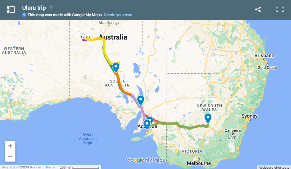
So … it was on our bucket list. Due to circumstances beyond our control (late arrival of grandchild nr 5 earlier in the year) our first opportunity came along at year end of 2019. With Stefaan now properly retired we didn’t have the same time restrictions as before and planned for a 7 week holiday to Oz, allowing for a week long break to drive to Uluru to see the lights. And travelling from where the kids live (Griffith NSW) that’s about 2250 km … about 23 hours drive at the general 110 km per hour speed limits.
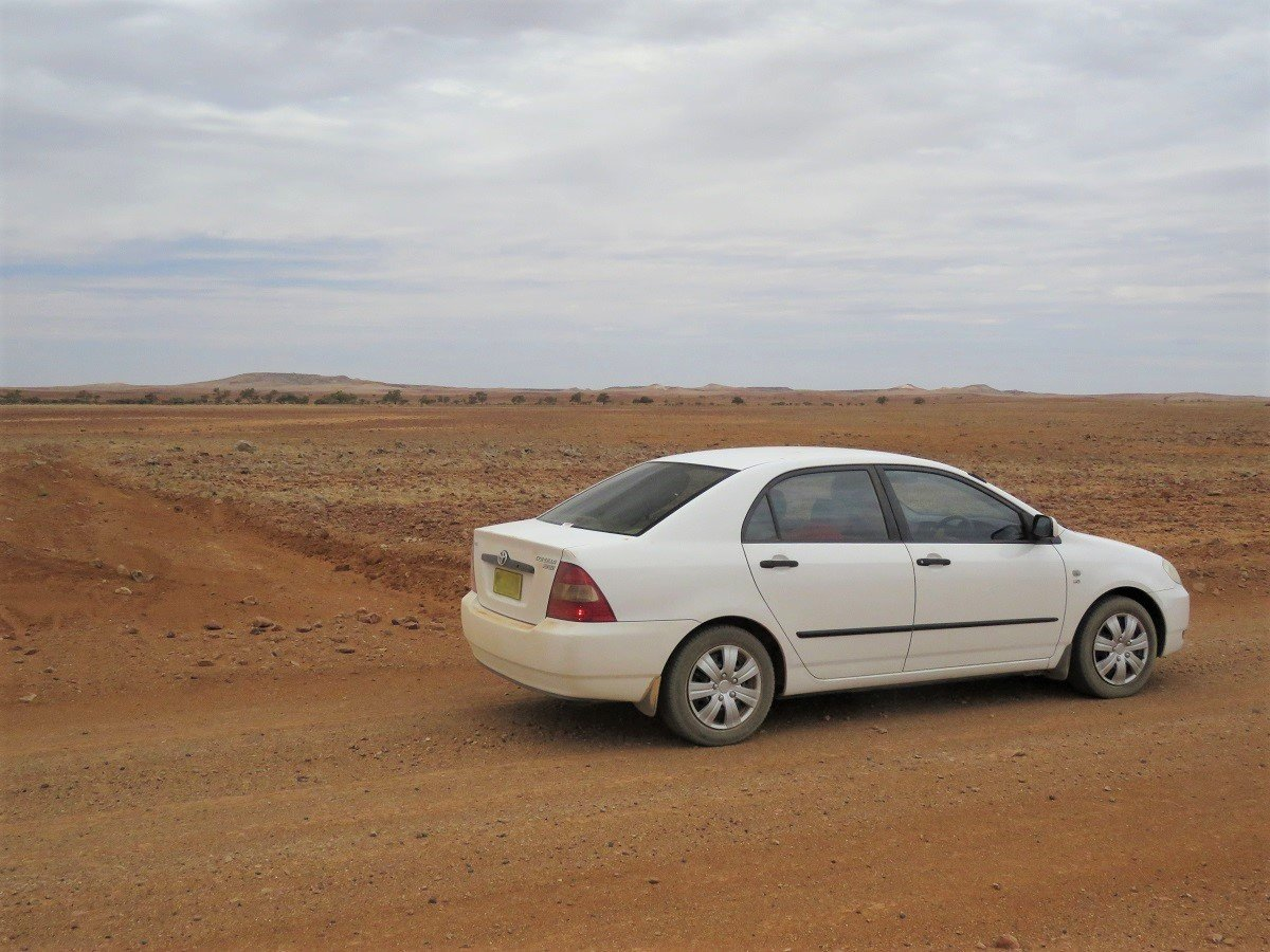
After a week or 2 with kids and grandkids, we hit the road – in a 16 year old Toyota Corolla borrowed from our daughter-in-law. We decided to “rush” to our destination (Uluru) and travel back at a more leisurely pace.
And man … was that a road trip!
Side note: this was a whirlwind trip into the Outback and we definitely will be back to take our time to enjoy it all at a leisurely pace! There were so many places that we would have loved to either include in the trip or spend more time there, but couldn’t due to time restraints.
Day 1 and 2: Griffith to Uluru & Kata Tutja.
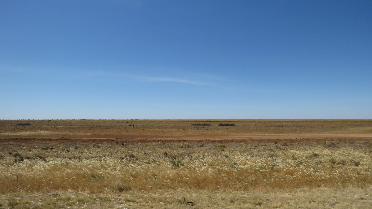
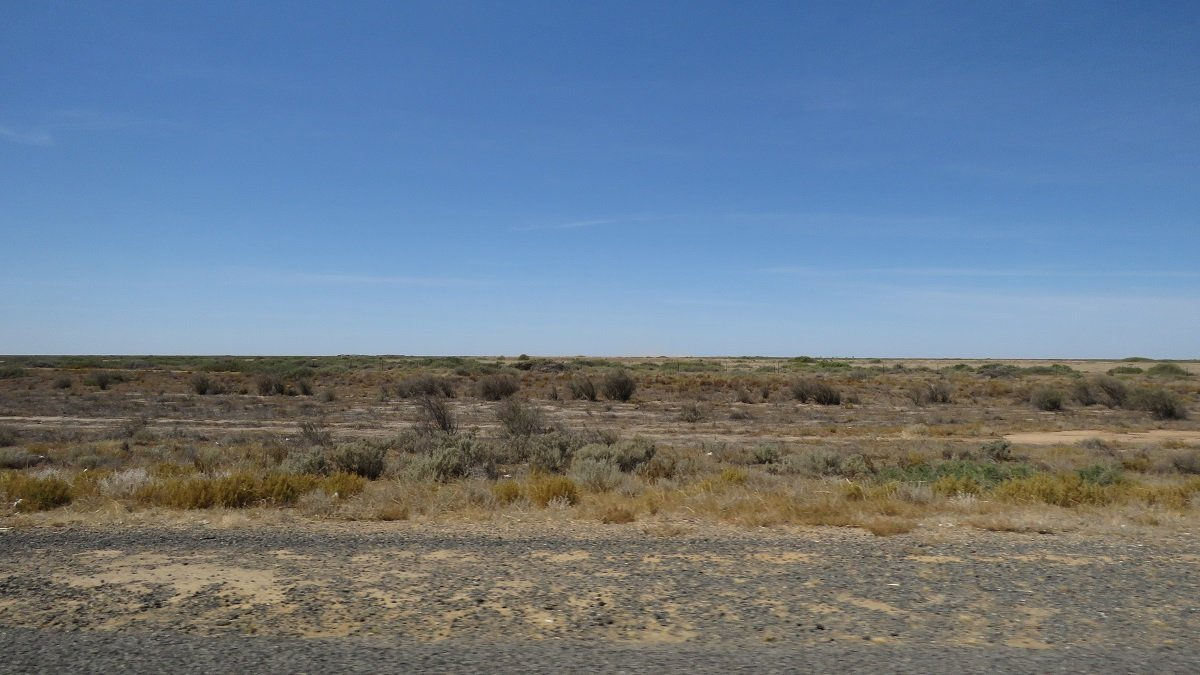
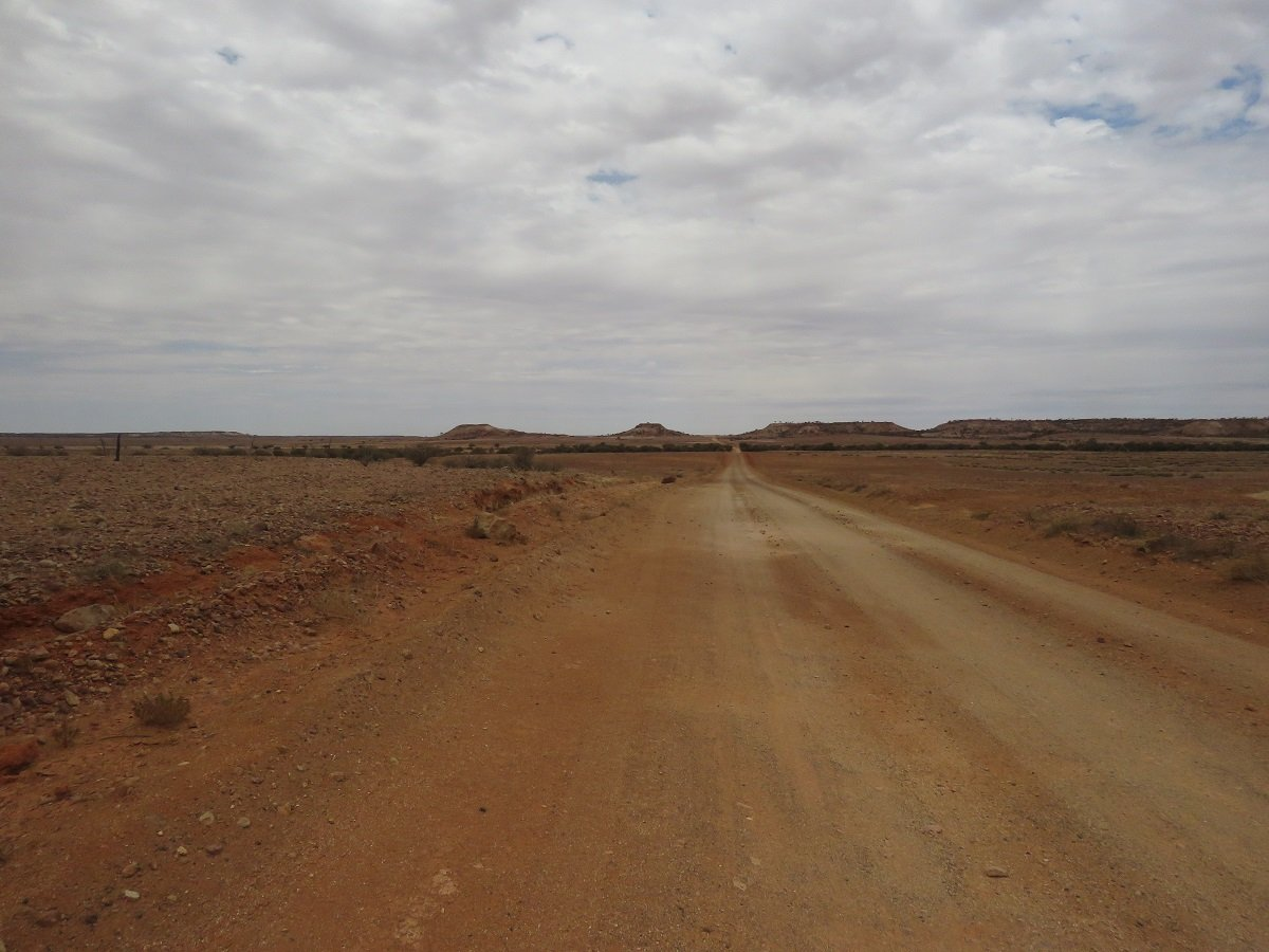
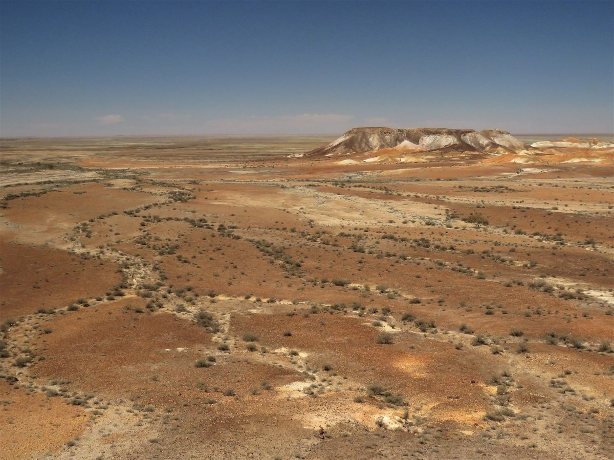
Traveling to the Outback makes you realise – even when being used to the distances in South Africa (compared to Belgium/Europe) – that the landscape is truly endless. They call it the Red Centre: for some it means only red dirt and flies... for others solitude, endless vista's and rich aboriginal culture.
Some side notes :
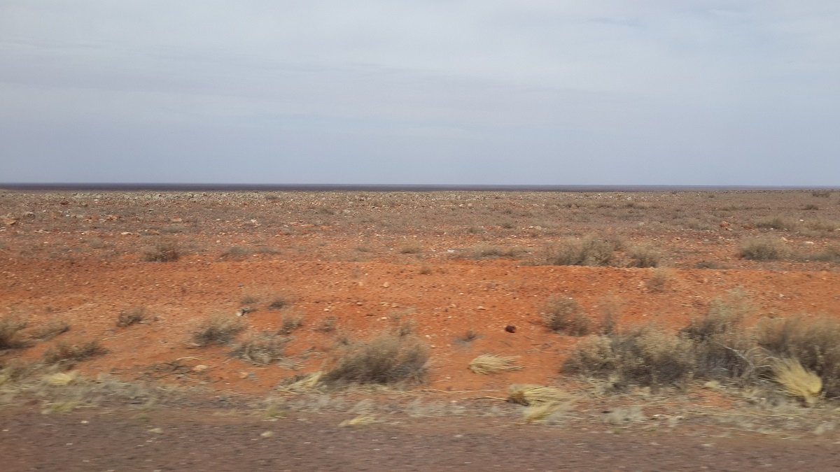
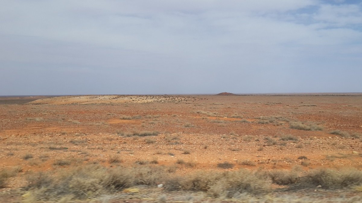
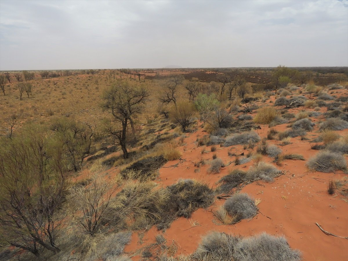
- Flat, flat and more flat as far as you can see. Closer to our point of departure (Griffith NSW) it was predominantly farmlands – flatter than Holland! (the South Australian farmlands in the Adelaide region are a bit more hilly). In the Outback: rocky deserts as far as you can see.
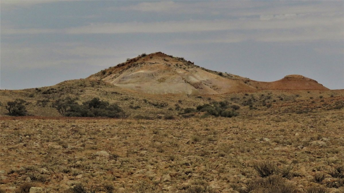
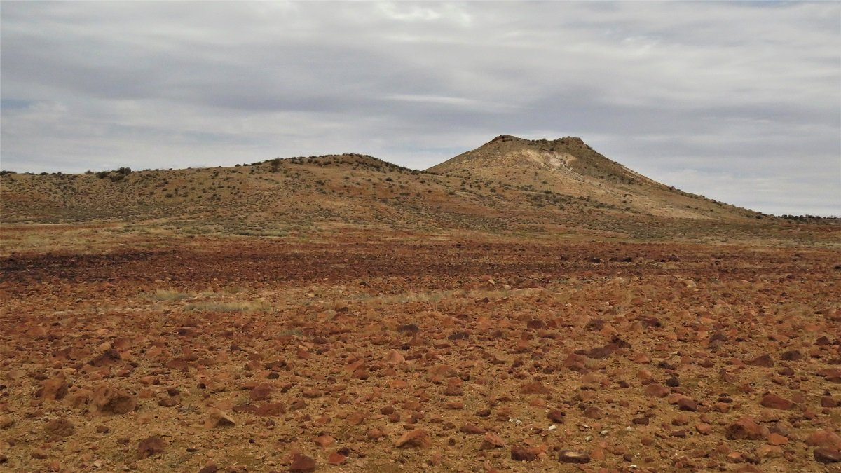
- Yeah … there are some mountains and hills in the Outback desert, but sometimes they look like fata morganas floating and shimmering on the horizon due to the heat rising from the desert floor.
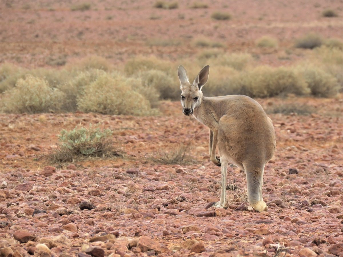
- Dead kangaroos everywhere – every few 100m. For normal sedans a hit can be fatal – we saw several car wrecks along the roadside – but in an encounter with a road train, the kangaroo comes off second best. We think that the road trains barely feel it when they hit a kangaroo.
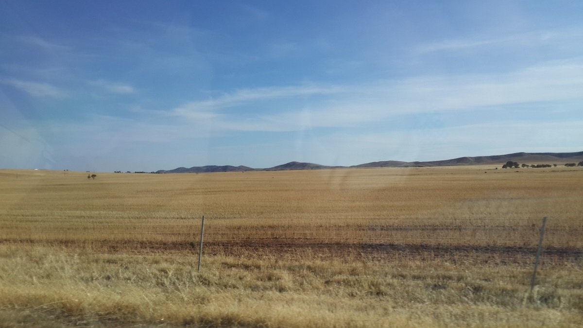
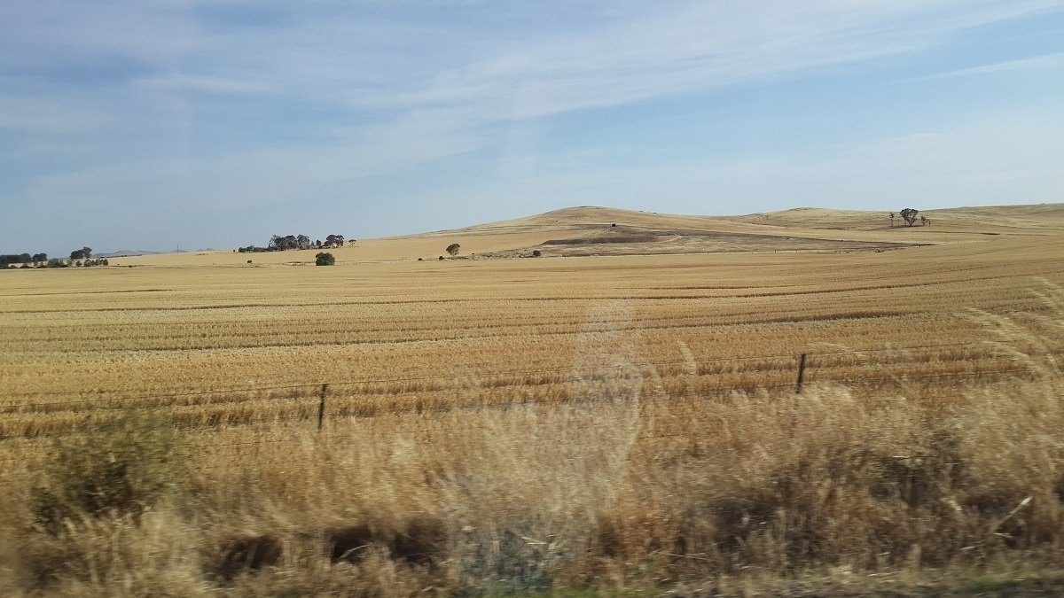
As said … we ate our km’s in those first 2 days. We traveled from the flat plains of NSW, via a short corner through the fruit lands of Victoria, to the green vineyards and yellow hay fields of South Australia, with our first night stopover in Port Augusta.
Australia's biosecurity is very strict : the crossing of state borders with fruit and vegetables (which varies from state to state) to curb the spread of various pests and protect the crops. Every single car gets stopped. No one escapes their scrutiny!
The next morning we set out early … just under 1300km to cover before reaching Uluru!
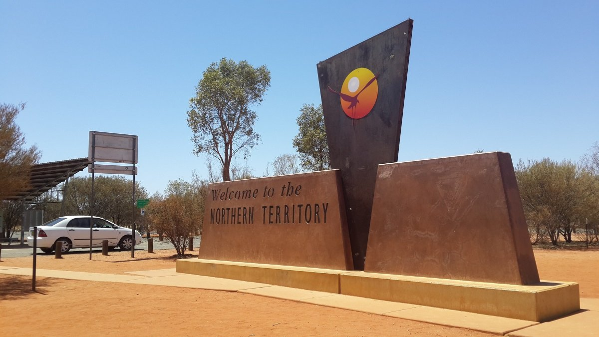
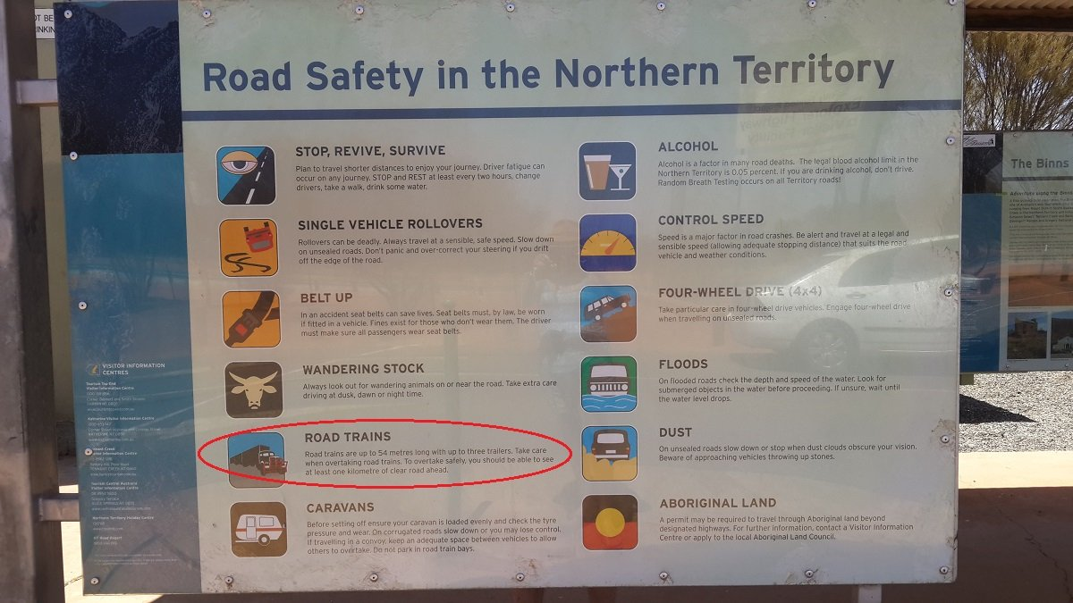
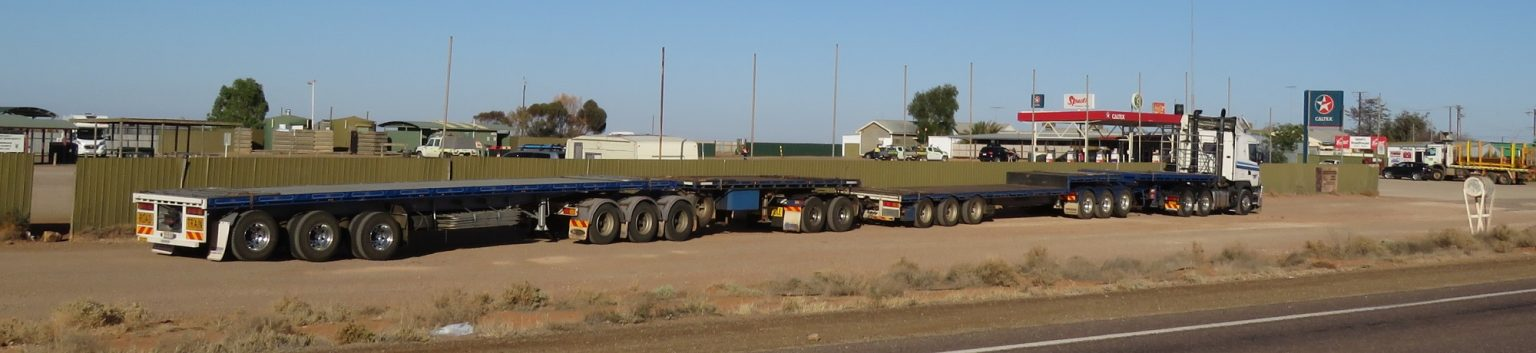
Leaving the lush agricultural lands behind us, we soon enough got our first taste of The Outback: vast plains with hilltops silhouetted in the far distance. We passed the border into the Northern Territory and were reminded of road safety rules. Especially the info on the road trains was fascinating, because that’s something we don’t know in South Africa. And we figured out soon enough … there are more road trains in the Outback than cars!
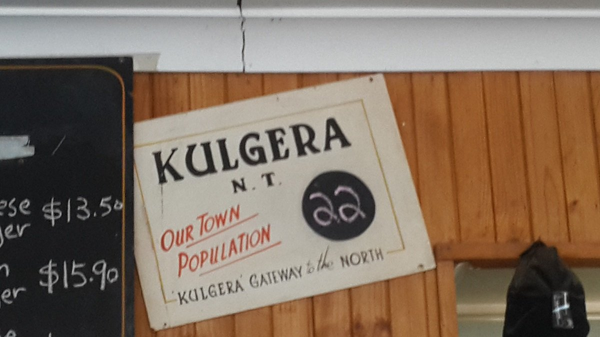
We had lunch at Kulgera Roadhouse – a tiny hamlet somewhere in the middle of nowhere …. literally! Population:22! We had a cup of really good coffee and browsed around in their cultural exhibition room with a variety of aboriginal artwork.
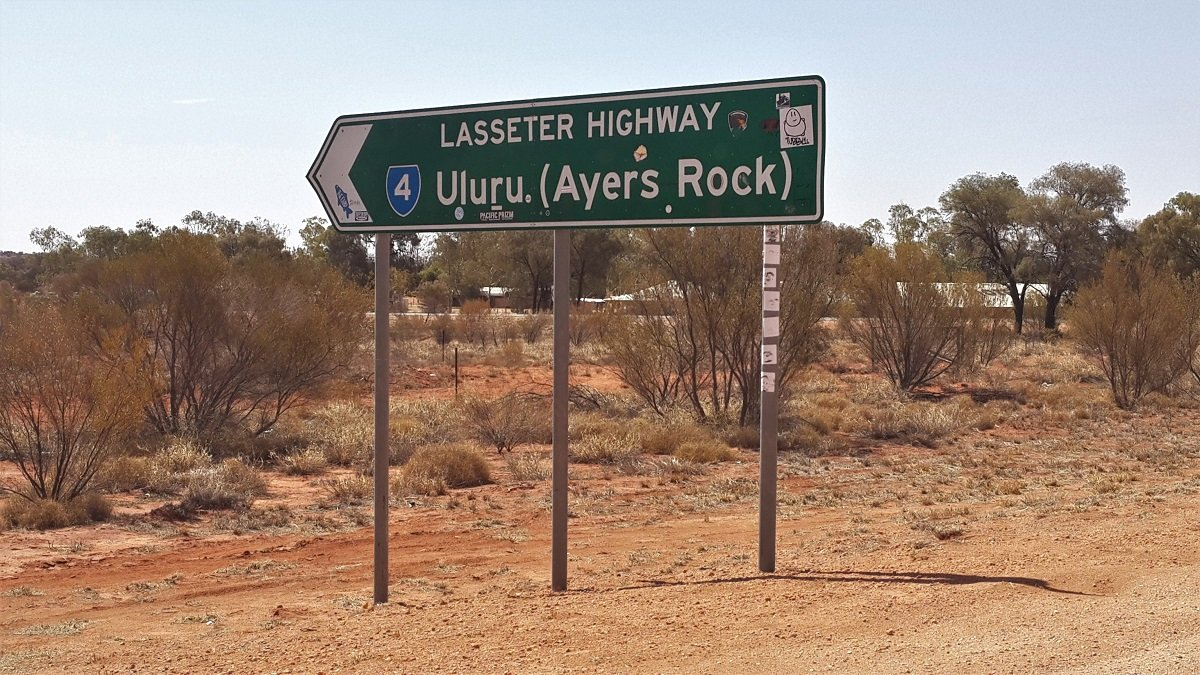
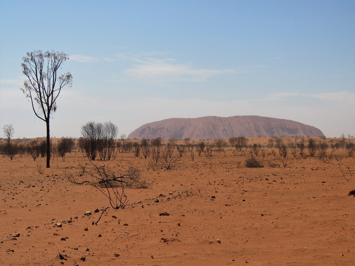
Eventually we came at the signpost that indicated our last 250 km to Uluru!
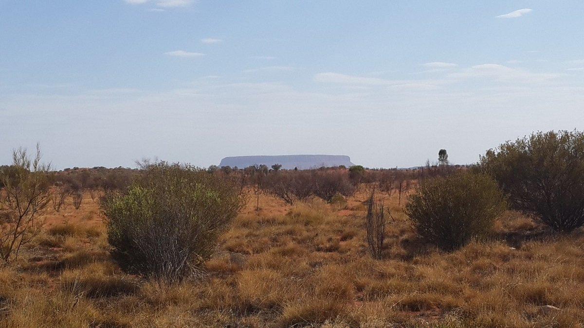
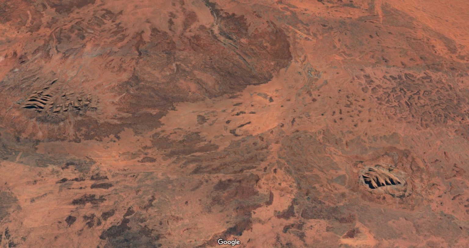
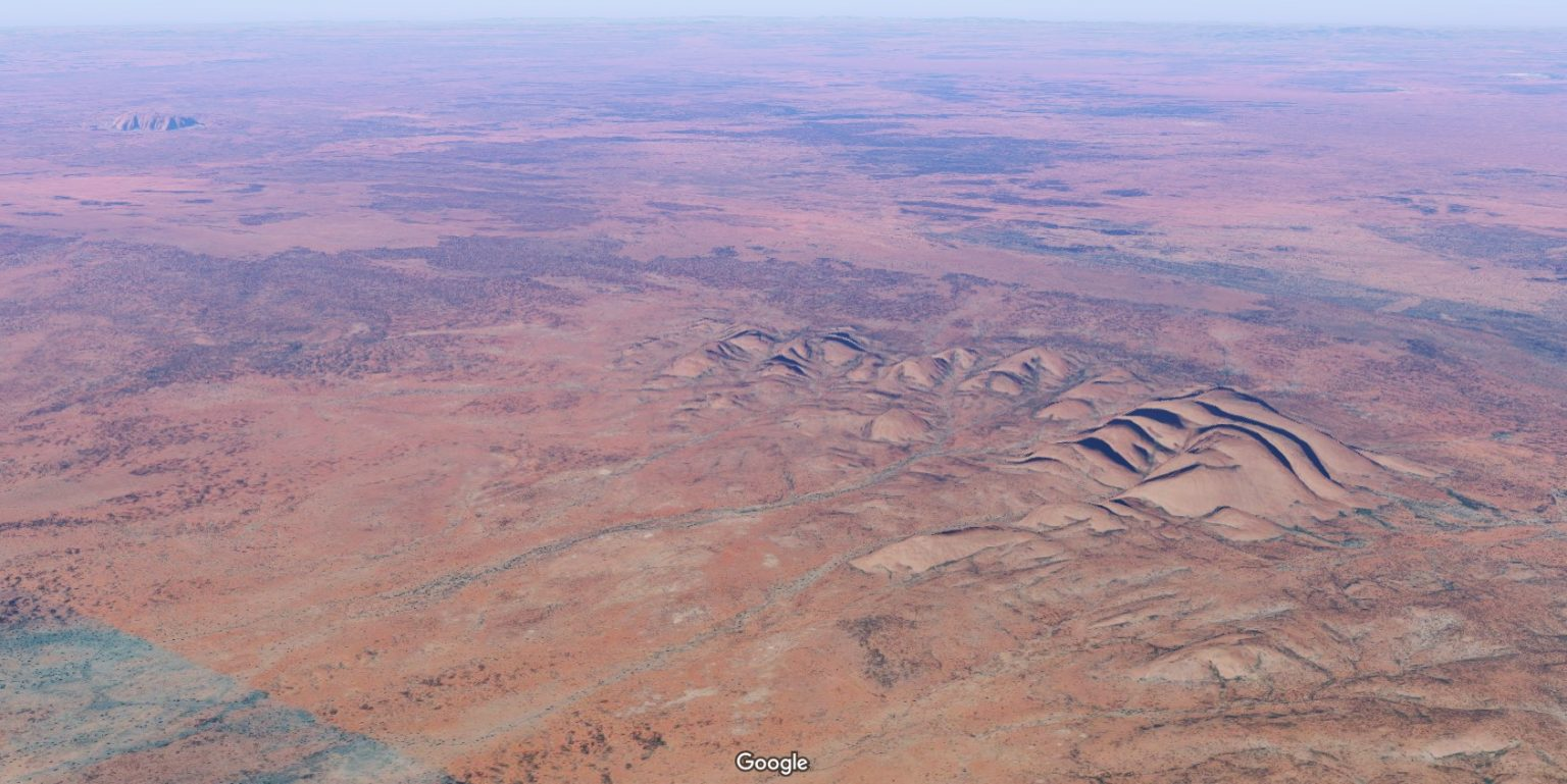
Coming from the east towards Uluru, it was quite interesting that you only see “The Rock” (bottom right) on the very last 20km or so, unlike other mountains and ranges you can see from quite a distance. Initially we were so excited to see a grey hump rising from the bush, but much to our disappointment it was Mount Conner (bottom left – still about 150 km to go … imagination runs away with you when you’re excited).
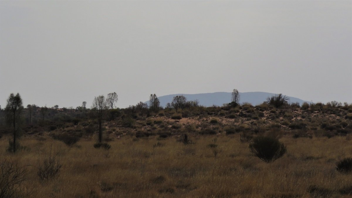
But our patience was rewarded.
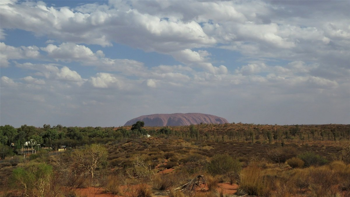
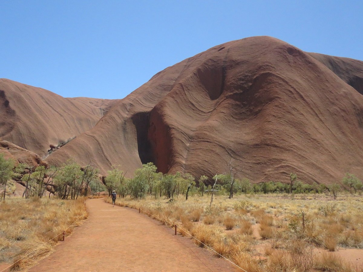
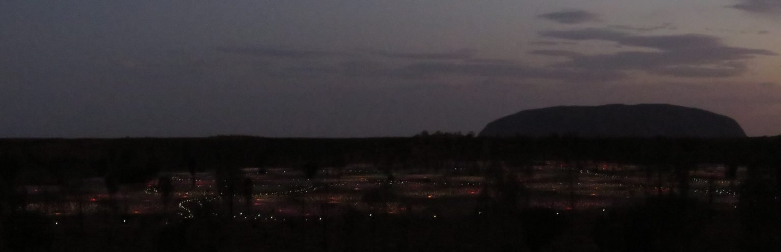
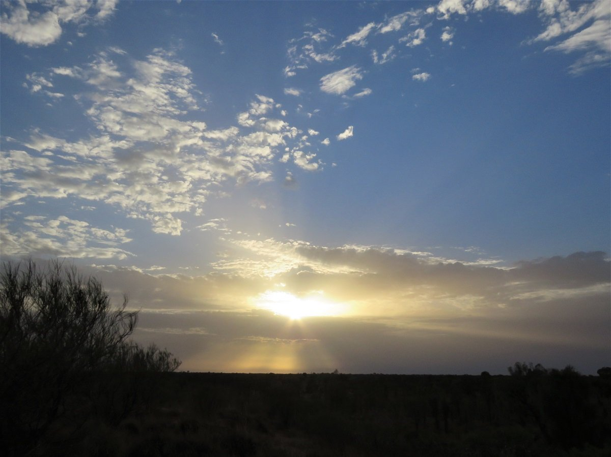
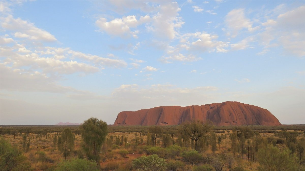
Eventually there she was … Uluru … in all her solitary majesty!
A grey shape on the horizon in the late, overcast afternoon, with a bit more clearer view from the central lookout point at the Ayers Rock Resort.
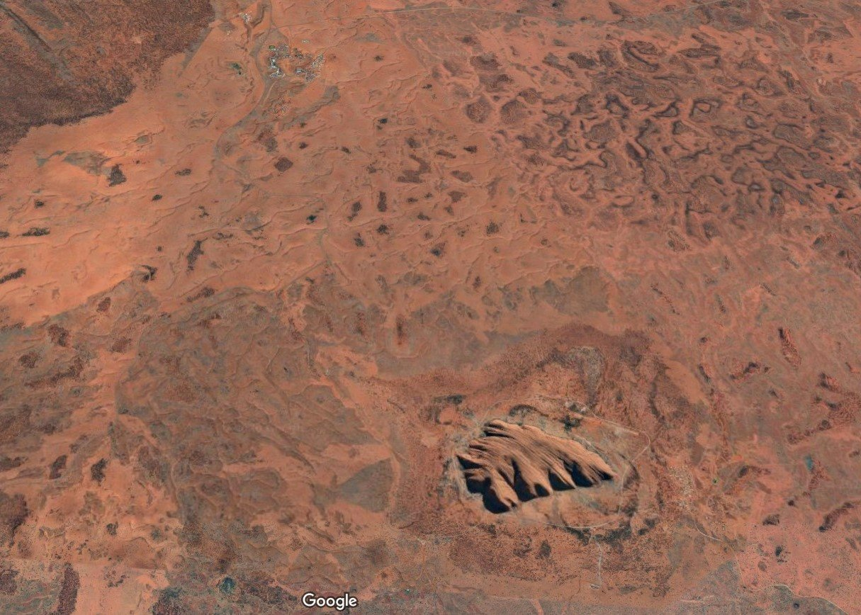
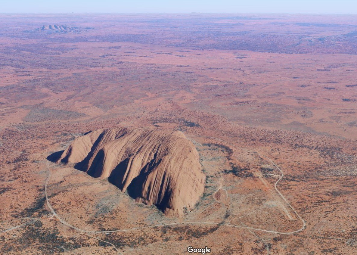
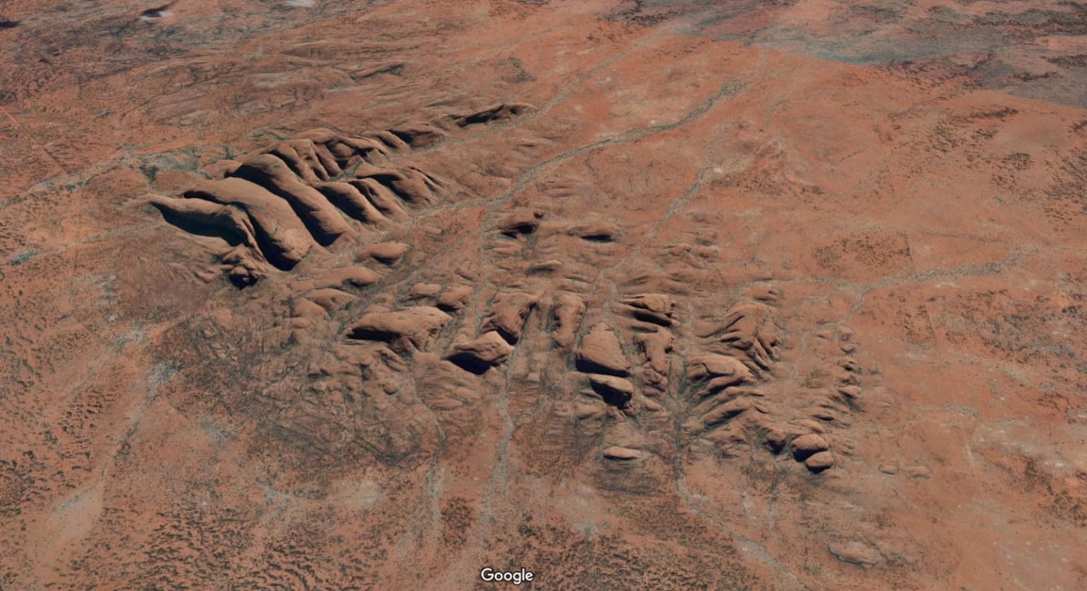
Seeing we don’t have a drone (yet), we rely a lot on the amazing imagery of Google Maps for aerial shots where we can’t get any ourselves. These are some more images from Google Maps to give you a very good idea of this rock’s majesty and solitude in the landscape.
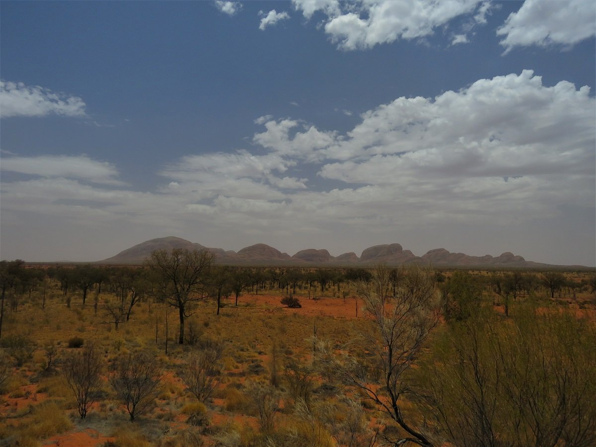
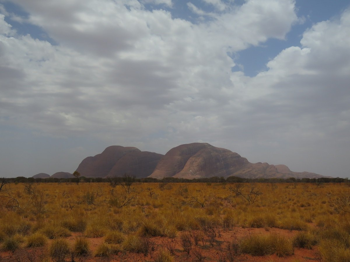
Some 50 km away from Uluru is another isolated rock formation in this red desert landscape: Kata Tutja – previously known as The Olga’s.
Looking at the Google images it’s fascinating to see how these two rock formations stand out like giant pimples in this otherwise fairly flat landscape. The Aboriginal name Uluru means "Great Pebble". Kata Tutja means "Many Heads", and they form one of Australia's World Heritage Sites.
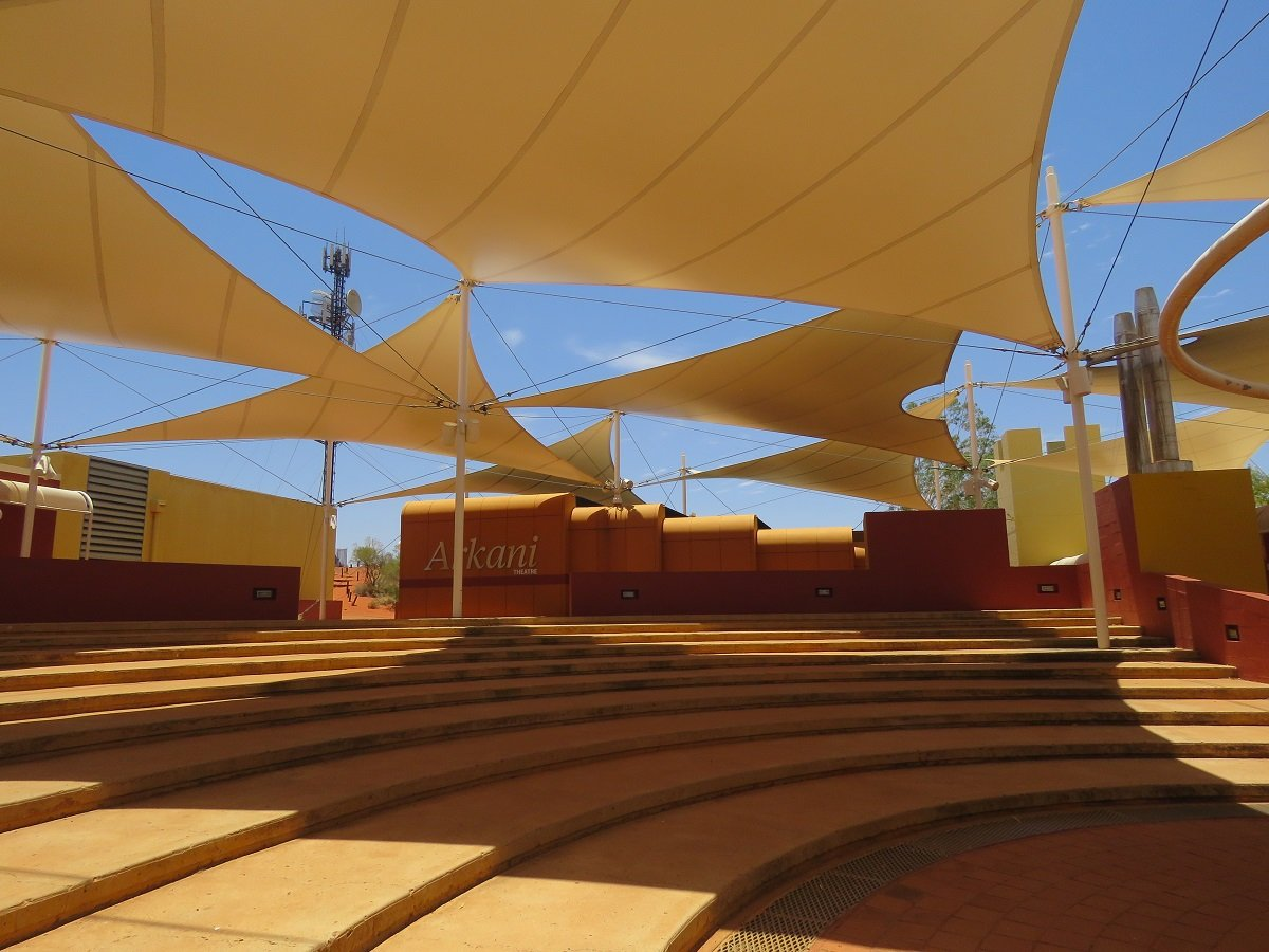
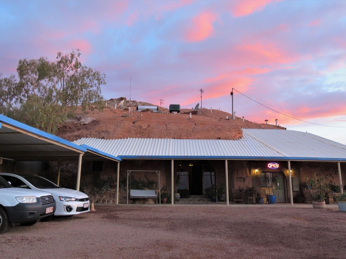
We had anticipated to spend some time in the little village at arrival, until we realised that there is no real village. All the accommodation, coffee and other shops, museum and theatre complex are combined in a resort style complex that’s especially built as the sole Uluru tourist destination.
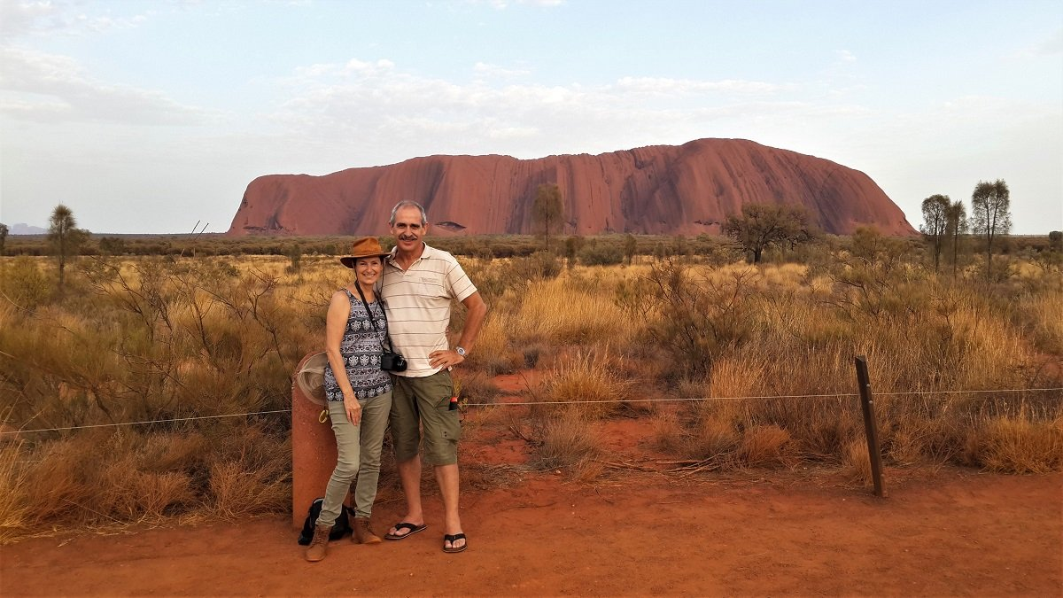
The same late afternoon when we arrived we decided (seeing there was not really a village to hang around in) to drive into the national park to buy our 3 day pass. That would make entry in the park easier for the next few days, as we would be able to skip queues. Queues however didn’t seem to be a problem, because the park was reasonable quiet. Seems in summer everybody avoids Uluru’s heat like the pest and rather heads for the coast. We had a quick drive-around the rock for the very first time and headed home again to set up camp.
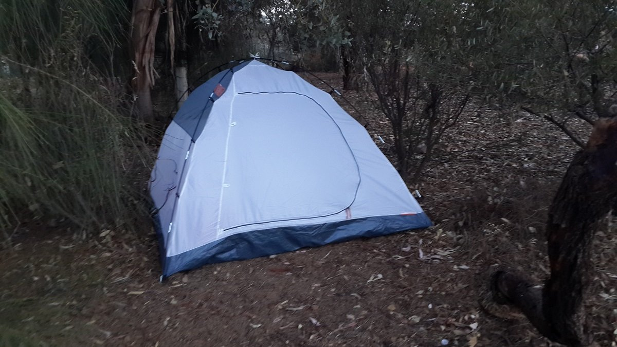
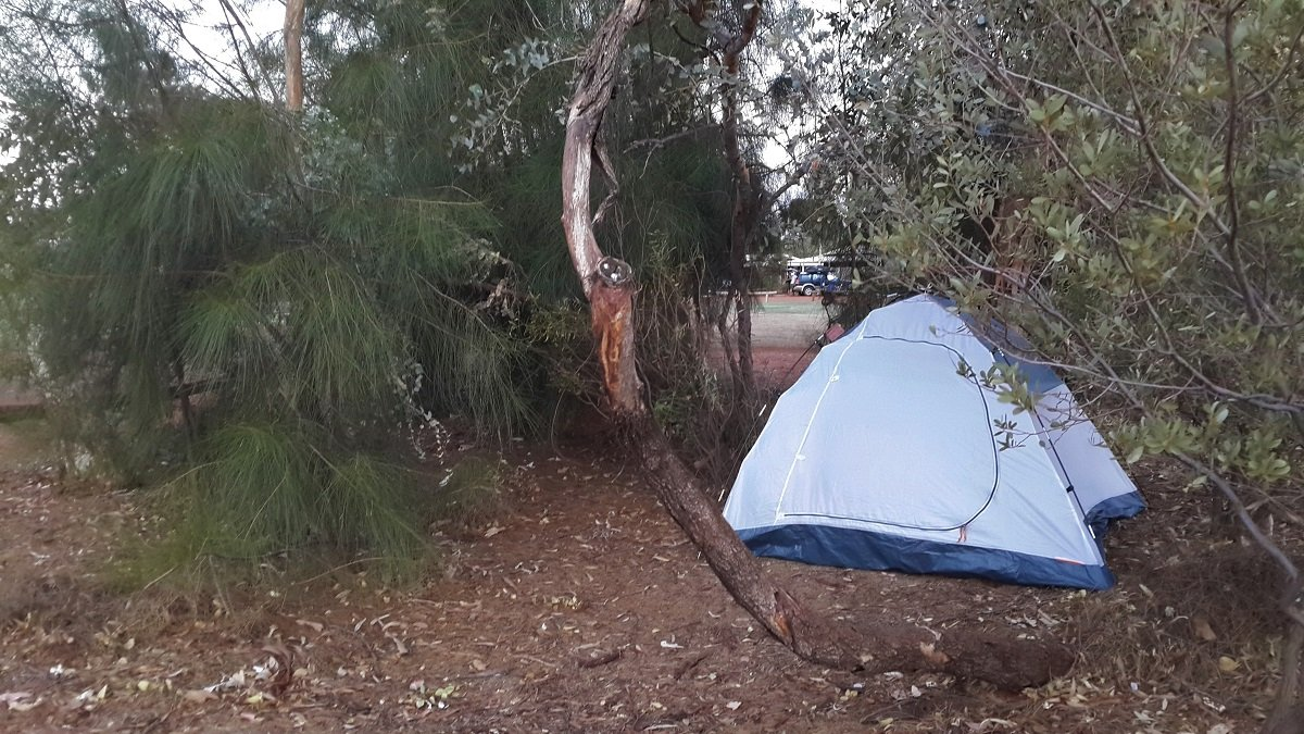
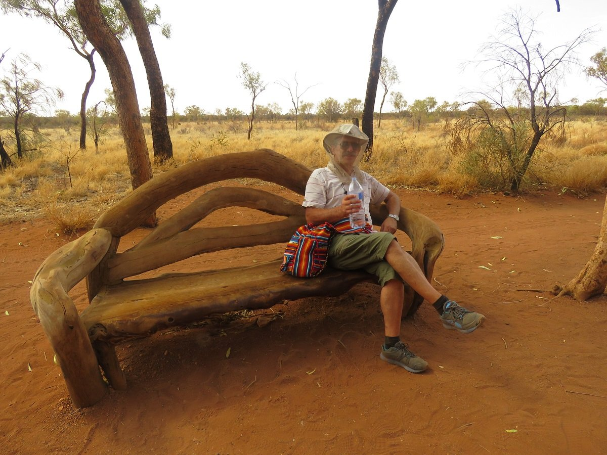
Due to fairly horrific prices in the hotels/apartments (for South Africans, starting from about A$ 180 per night for a self-catering cabin is stiff) we had decided to camp in a tent … in a smallish two man tent. That was a real test how to cope with heat: no air-con and 9pm night temperatures of about 38-41 degrees Celsius. We were quite amazed though – when sitting in the communal kitchen charging our technology at night – to see NO bugs or moths whatsoever buzzing around the light. And we had virtually no problems with mosquito’s.
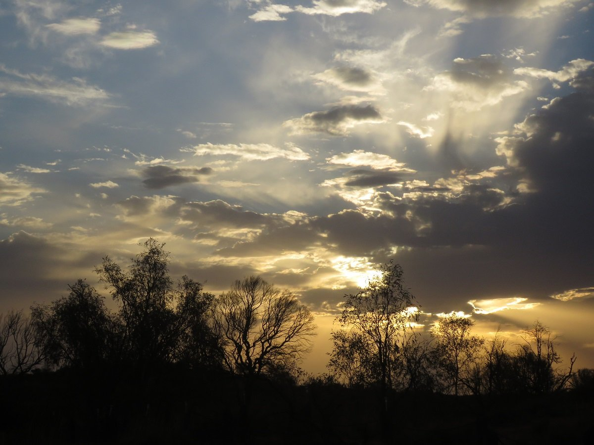
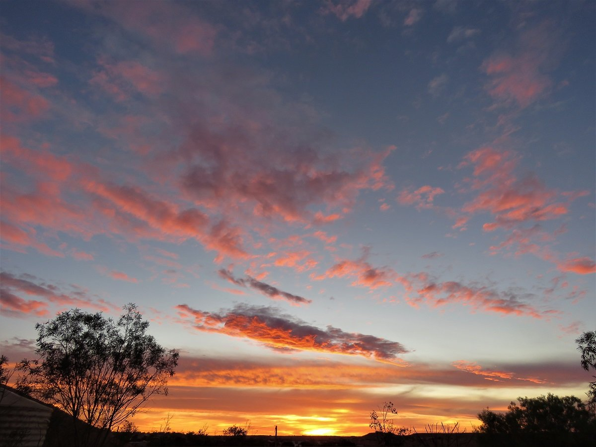
And be honest … with a sunset like this who would mind a few bugs anyway!
Day 3: Getting to know Uluru and its Aboriginal background.
And the lights of course.
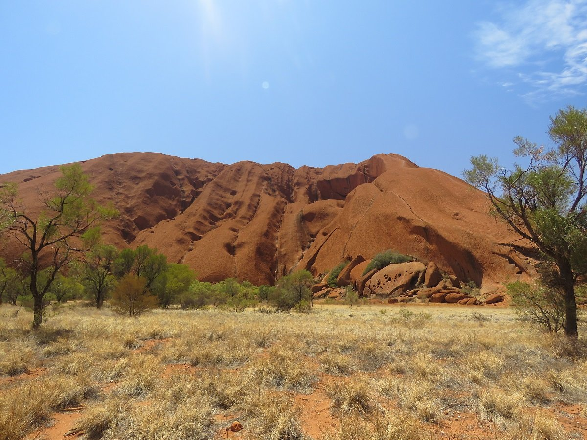
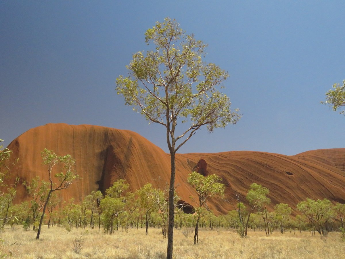
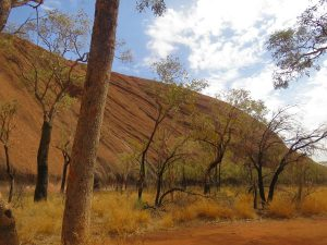
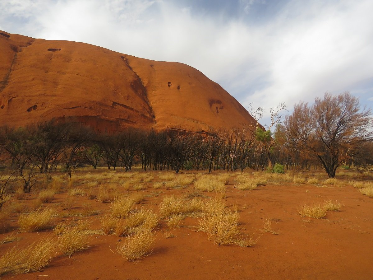
After a bit of a lie in the next morning, we went for a drive around Uluru to see the rock up close. We were planning a walk around the base of the rock the following day so this was our first (shortish) acquaintance. It’s amazing to realize this one solid block of rock has popped out of the otherwise flat plains of the Red Centre , aeons ago.
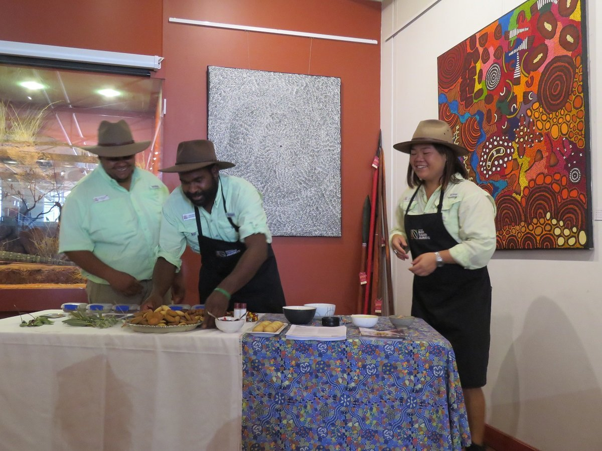
In an attempt to understand more about the context of Uluru we decided to attend some cultural and historical activities organised by the local Wintjiri Arts and Museum.
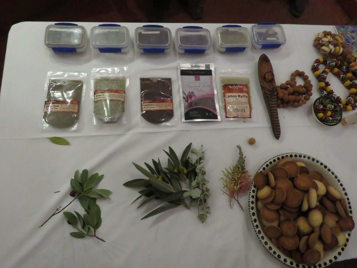
The Bush Tucker’s Journey‘s presentation about local bush fare made us intrigued enough to book at one of the local restaurants to try it out! The museum guide also took us through the flora and fauna aspect of Australia and the Uluru National Park. His rundown of Uluru’s geological and historical (aboriginal and colonial) background gave us a much better idea about the place, and a better understanding why Uluru is sacred to the Pitjantjatjara Anangu, the local people of the area.
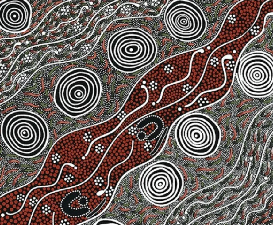
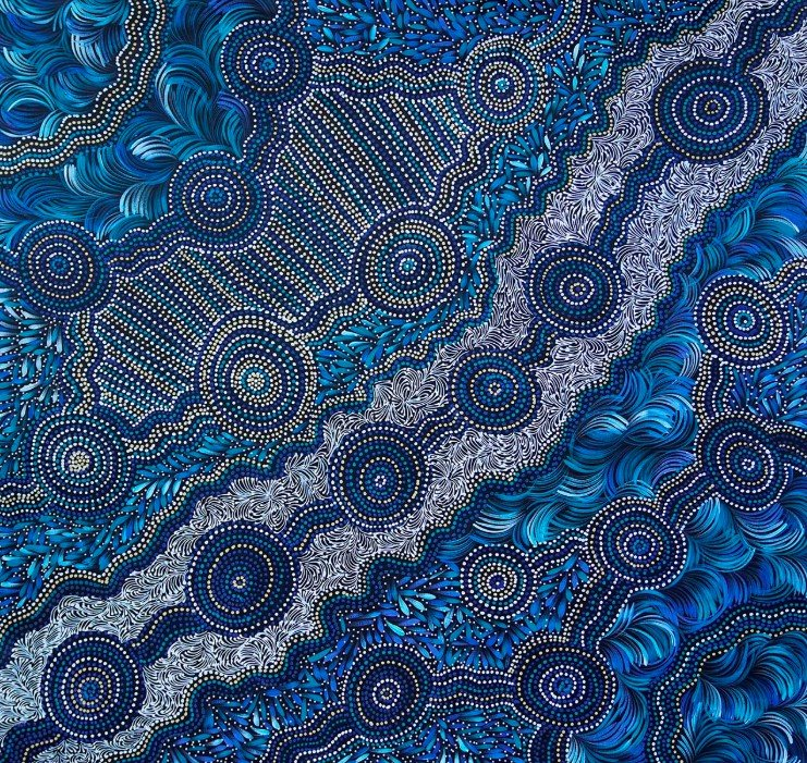
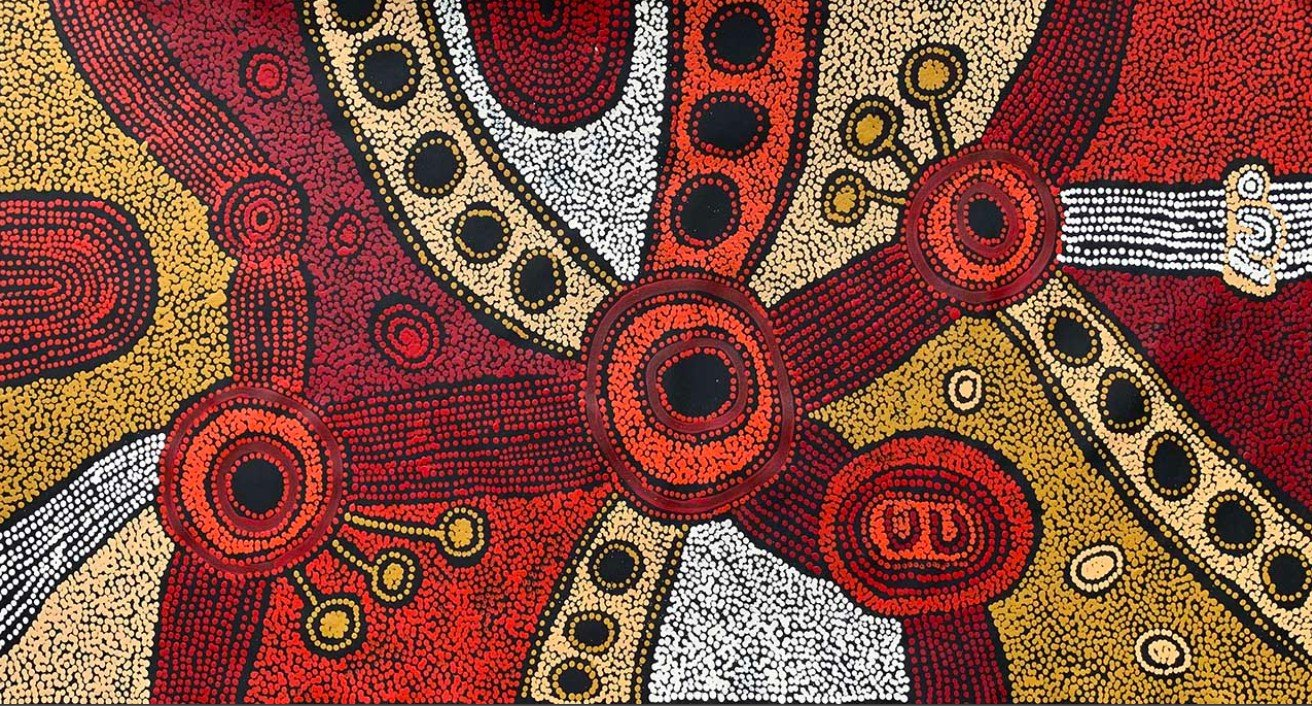
The museum also runs a program where local aboriginal artists can show off their work. Beauty is in the eye of the beholder so yes … some of the typical Aboriginal “dot” art is really beautiful, some give the impression of haphazardly slapping something together.
The 3 examples of the Dreamtime art below are in a style that I like. Left : Audrey Martin Napanangka (M&S Textiles), Clarise Tunkin (japinkaaboriginal art). Lanita Numina Napanangka (japingkaaboriginalart), Note : these are NOT images from the local gallery. The art at the gallery was not as refined as the images below)
For the rest of the afternoon we dawdled around in the little shops for the inevitable souvenir. Seeing we were going to walk around Uluru the following day and we had been slapping our faces and necks for the better part of that day, we decide to invest in the very unfashionable fly nets. Better be prepared.
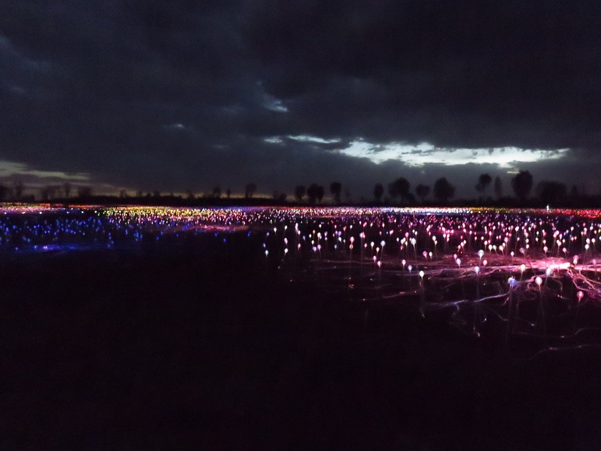
Early evening we were picked up by a tour bus for the much anticipated “Field of Lights” experience. The exhibition, aptly named Tili Wiru Tjuta Nyakutjaku (looking at lots of beautiful lights in local Pitjantjatjara language) is Munro's largest work to date (at date of visit).
We were hosted by a local guide who told us some more about the art installation and were treated to Australian beer and sparkling wines and some snacks prepared with local ingredients. With dusk getting darker and darker we could see the shape of Ulury subtly disappearing into the black velvet of the night. By then the lights had come on and we were allowed to walk down to the Field.
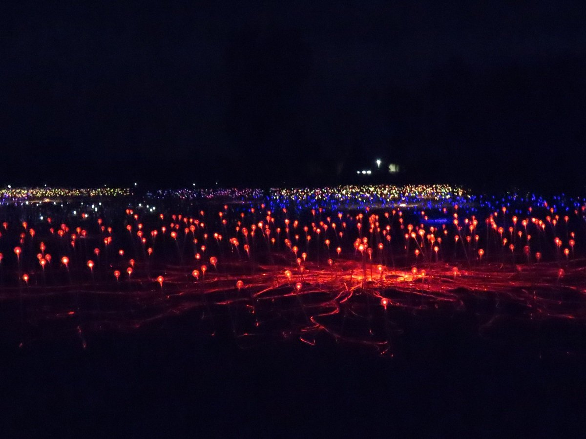
It was beautiful and magical and the ever changing colours lent it a fairy-like atmosphere. Unfortunately you’re not allowed to use a tripod so my photos of the Field didn’t turn out so great.
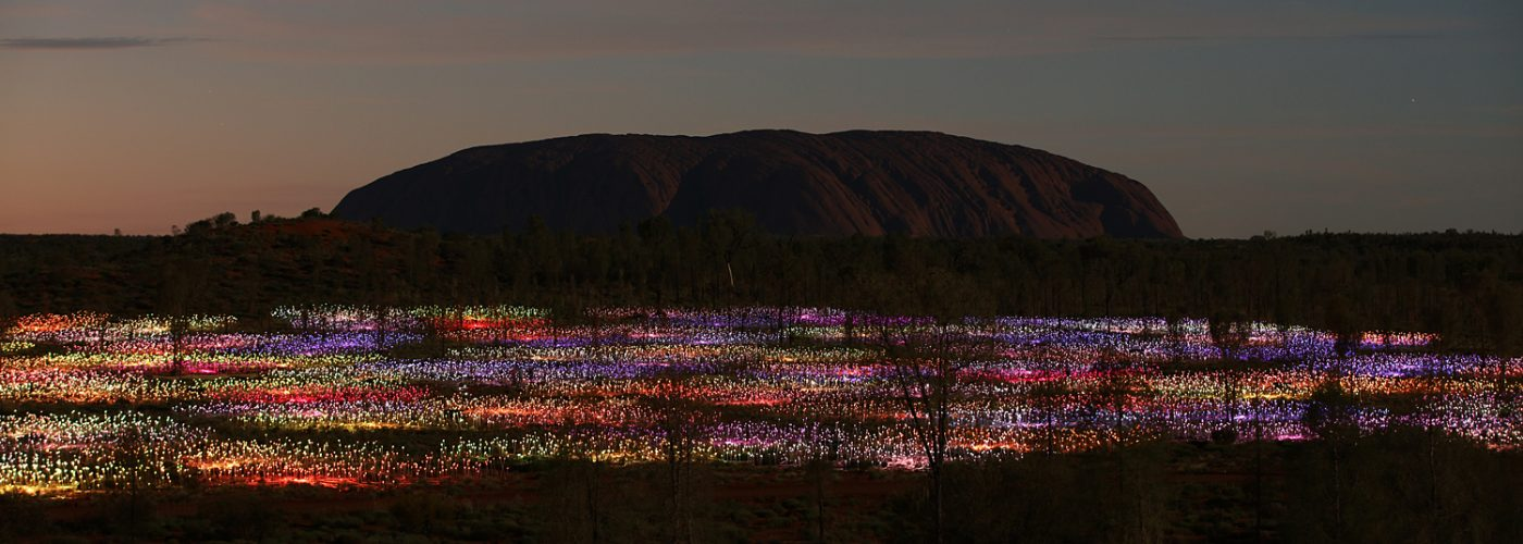
(Just for an idea of the “real” experience … last picture is by Mark Pickthall and additional the promotional video from the Ayers Rock resort.)
Some notes:
- We chose the Field of Light Star Pass at A$ 95 per adult – which (for a South African ) is not really cheap for a 2 hr event.
- Maybe our imagination goes wild, but even though we were presented by canapes, sparkling wine and Australian beers and other drinks (as indeed described in the brochure), it felt a bit “cheap” – if that would be the right word to describe it. In view of this installation being at Uluru since 2016 to March 2018 (with first extension to December 2020 and now further extension indefinitely) we kind of expected that the dune top – where the reception took place before descending to the lights – would be dressed up or furnished- be it with only temporary structures- e.g. a deck, a “proper” bar or tables with the choices of things to eat, a display to read more about the cultural and aboriginal context of Uluru and the inspiration of Bruce Munro. As it turned out the drinks were served on a fold out table from a few big cooler boxes. For the snacks: one or two hostesses came around with plates of canapes to choose from. I think we each had 5 or 6 canapes and then it was time to walk to the Lights. For the kind of money this cost, it was a bit underwhelming – the reception on the dunetop, I mean. (Just as a question thrown out there: at the kind of money Field of Lights has brought in for Uluru, would it have been too much to ask to spend some money to “dress up” the reception space to enhance the tourist experience?)
- Maybe the weather played a role but we never came close to seeing the amazing images you see on Google (Uluru against a sky, coloured by a pink sunset, while at the same time, Field of Lights in full colour blaze.) Granted, mine are very amateurish photo’s but just compare my image with Mark Pickthard’s image. Uluru was virtually only a phantom in a black sky when the lights started coming on. By the time the Field was fully lighted up, there was no Uluru to be seen. Photo manipulation? Those few professionals who were allowed to use the right equipment like tripods, which we were NOT allowed to use?
- Down in the Field, we got our instructions from the guide and could choose between the long and the shorter walk. We chose the longer one which took us about 45 minutes. After that we were herded back to the bus to go home. There was no opportunity to do the walk again or really take your time to perhaps sit down and immerse yourself in the experience.
- So yes – mixed feelings. Loved the installation and the magical colours ever changing in a fairy wonderland. Didn’t like so much the “staging”.
Day 4: A sunrise and a walk
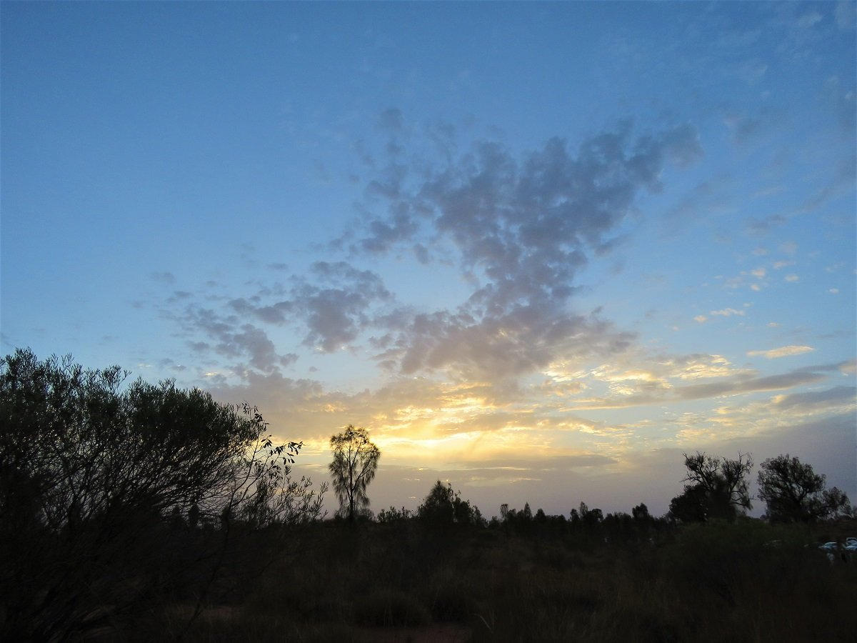
The next morning we went out very early to see the sun rise over Uluru. Unfortunately, the skies were not in our favour and by the time the sun appeared from behind the clouds, it was bright white and we didn’t see Uluru in all its red morning glory. Granted … it was still a beautiful sunrise!
Sunrise was supposed to be at 5:45 so by 5:00 heaps of people were gathering at the lookout point. The sun hiding behind clouds resulted in her only showing face, way after proper sunrise time. Some tour buses (obviously on strict schedules) started herding their passengers back to the bus before the sun had appeared behind the clouds and one guy was very adamant he would hang around till he saw the sun shining on Uluru … that was what he signed up for. Of course this only happened like almost an hour later. As we were on our own, we luckily could hang around for as long as we wanted.
(last photo on top: Uluru at sunrise, with a faint outline of Kata Tutja in the background, just to the left of Uluru)
Side note: Although there are special vantage points for watching sunrise and sunset on the rock, during our few days there was a lot of overcast weather and the glorious red sun peeping over or dipping beyond the horizon to colour the rock a fiery red, just didn’t happen for us. We will be back... to sit around and wait for the perfect sunrise and sunset on Uluru!
After sunrise, we set off to one off the parking area’s to get an early start on our walk around the rock.
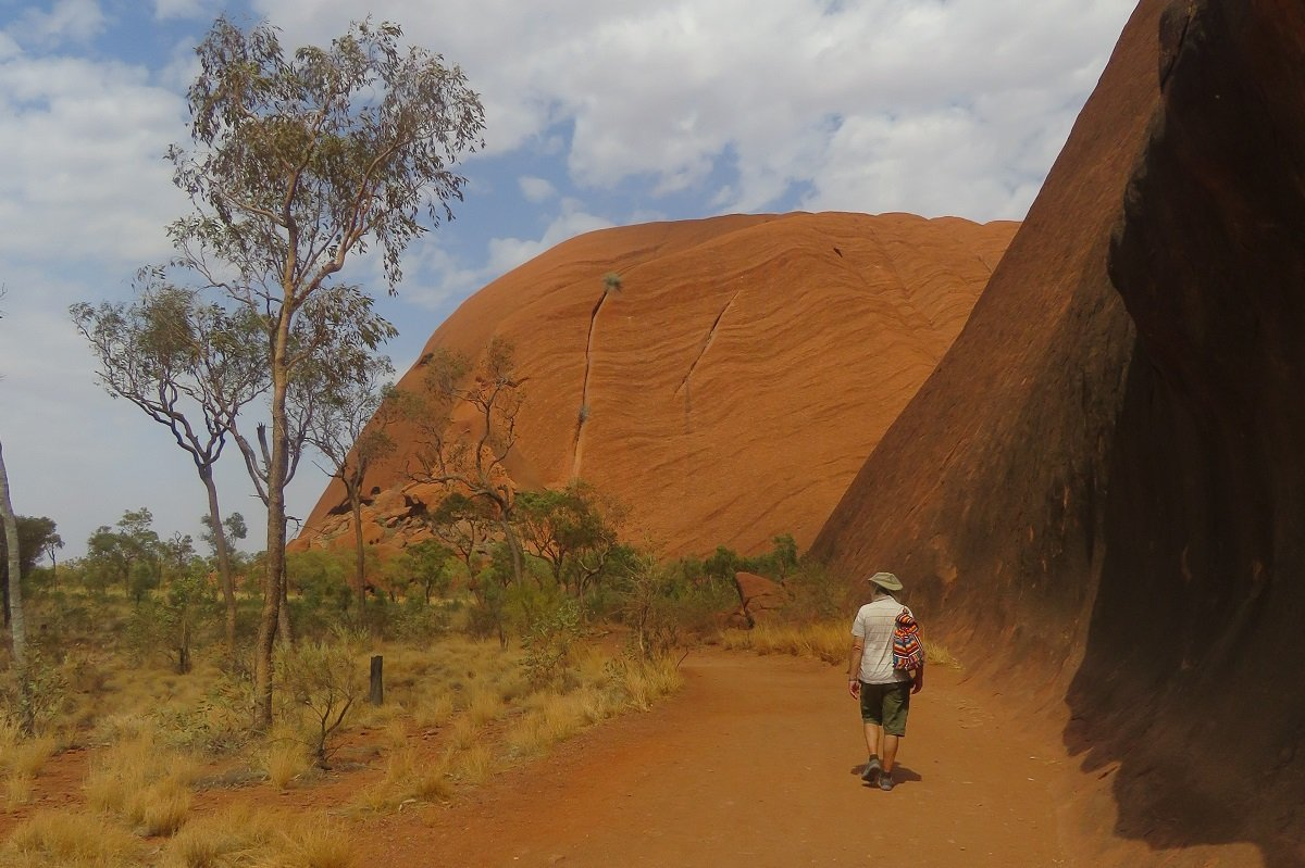
It was a long and hot 3.5 hrs walk!
Some notes:
- Along the walk, we saw other tourists swatting as if their lives depended on it and we were very grateful for our flynets.
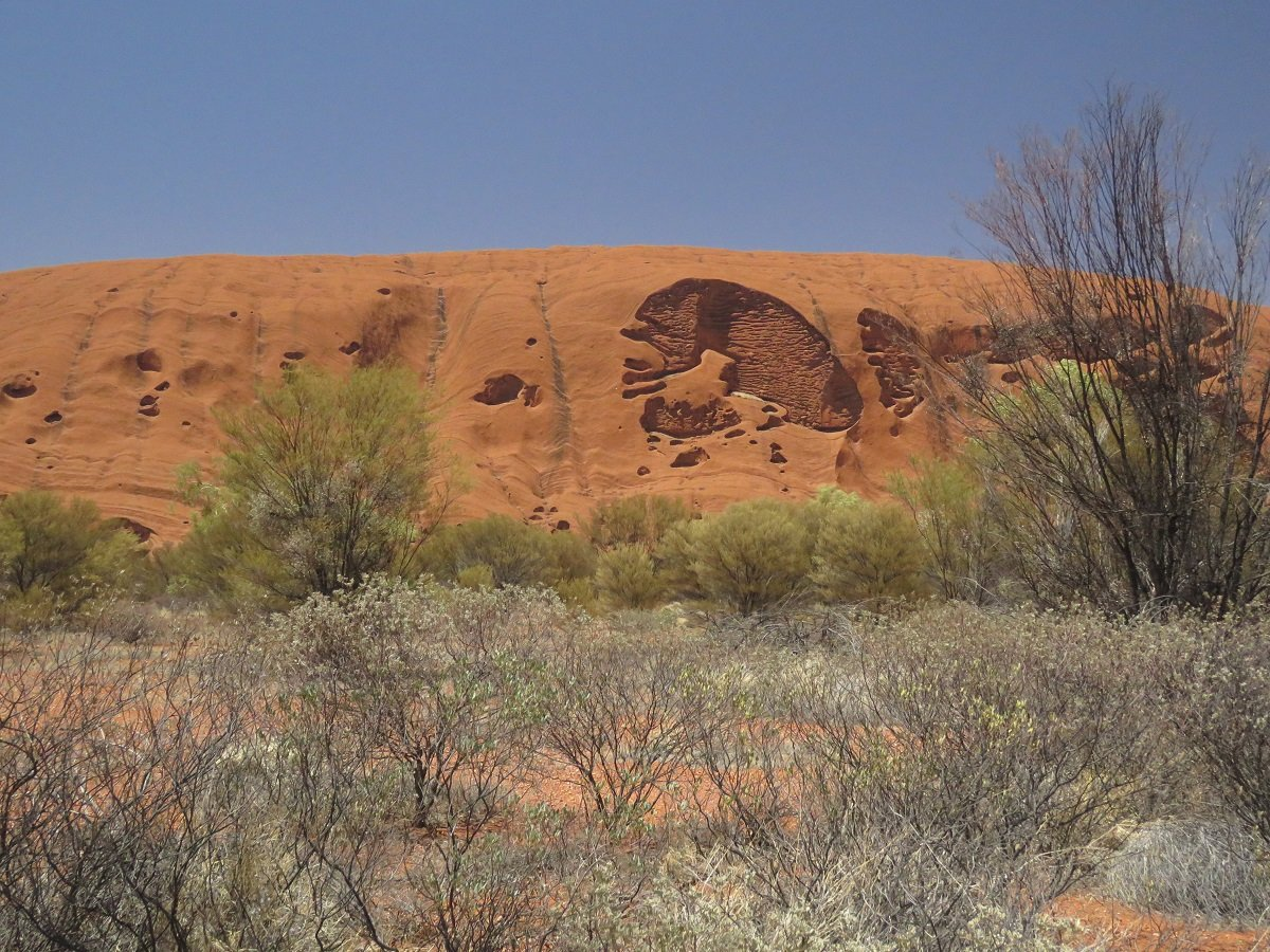
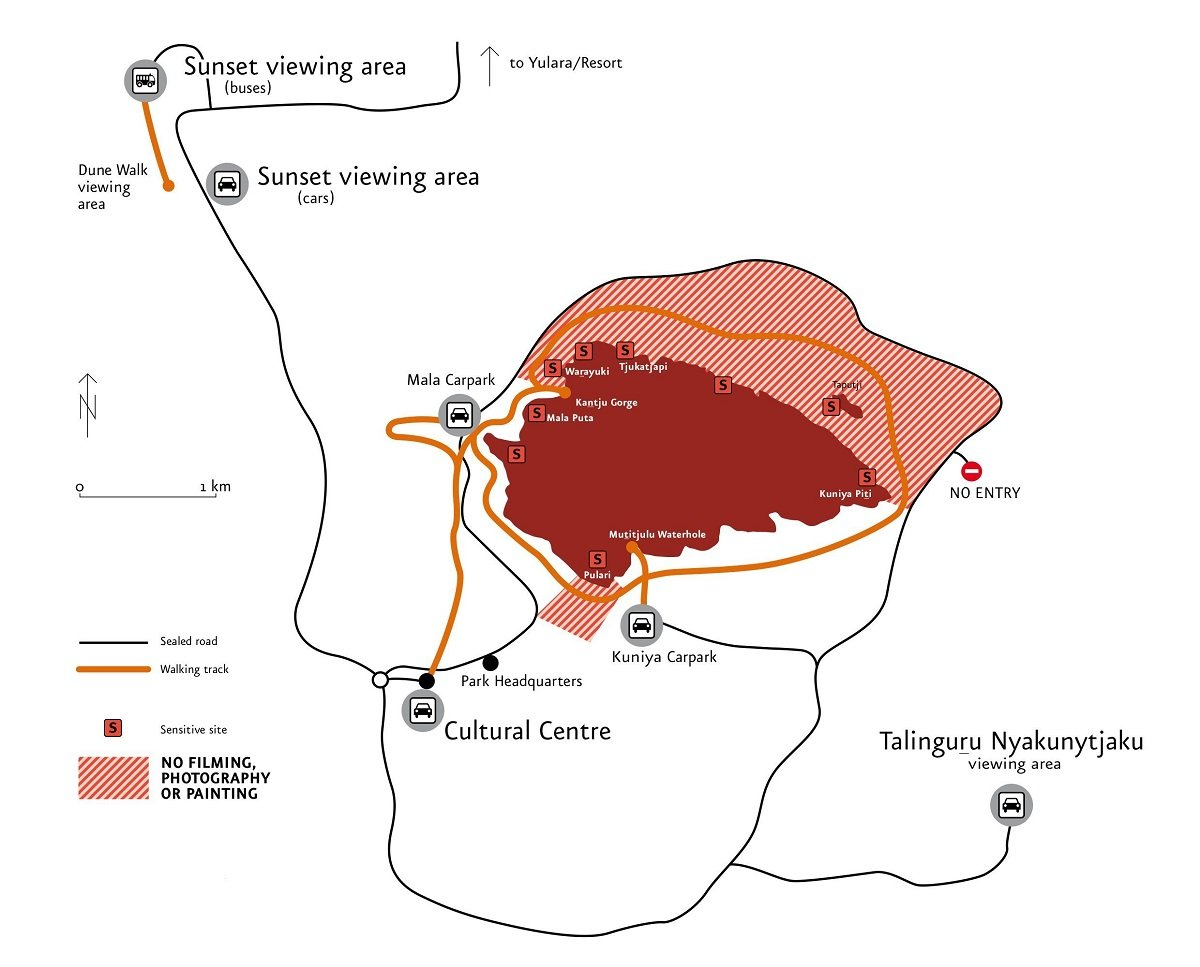
- Some portions of the walk were very nice, but the part on the northern side was quite long and more monotonous than the other side. (Looking at the image below you can see that the path veers away from the rock substantially … we presume it has to do with the sensitive areas.)
- There are shorter walks indicated on the plan and it may be nicer to drive around from one point to another than to attempt the full walk around.
- Most paths have notices for closing times. Walking in 35-40 degrees Celsius we could understand why it’s smart to walk first thing in the morning. By the time paths close at 11am or 2pm it is HOT!
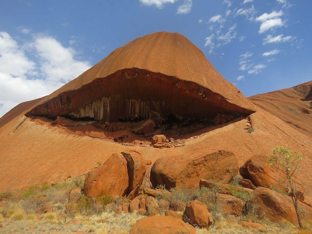
- On the walk various notes request not taking photo or video out of respect of the traditional sacred areas. On the other hand … if you would be driving around with your car and take photos or video with tele lens (without being aware of the warnings) – you could take images of those same portions of the rockfaces. (we weren’t aware of these “sensitive” zones as indicated on the image and we only figured it out once we were on the walk. Of the various pamphlets, brochures and maps you get at the resort or at the entrance of the park NOT ONE mentioned anything about the prohibition of taking photos/videos. There are general safety and health warnings re heat exhaustion, but nothing about the sensitivity of taking images.) The sensitive areas are NOT over this full distance as shown on the image but signposts indicate if a sensitive area is to the right, left or both sides.
- Because we were only able to visit Uluru in December 2019, we were not able to climb it any more (Uluru climbing stopped for good in November 2019).
Our air-conditioned car was the most welcome feeling after a 3.5 hr walk in the baking sun (luckily we had our flynets to at least enjoy a slap-free walk). We hopped in the car and stopped for lunch at the Uluru-Kata Tutja National Park’s Cultural Centre. To reach the little restaurant, you walk through an educational museum / passage – if you can call it that way – with exhibits, stories and images that explain more about the aboriginal heritage and history of Uluru and Kata Tutja. We also sat and watched a video that showed and voiced the story how Uluru is now returned to the original guardians of the land, be it now in collaboration with the government to run it as a National Park / Tourist destination. An interesting thing that we experienced there and have experienced later again and again is that traditional viewers or listeners are warned that sections of videos or audio could contain voices and /or images of ancestors.
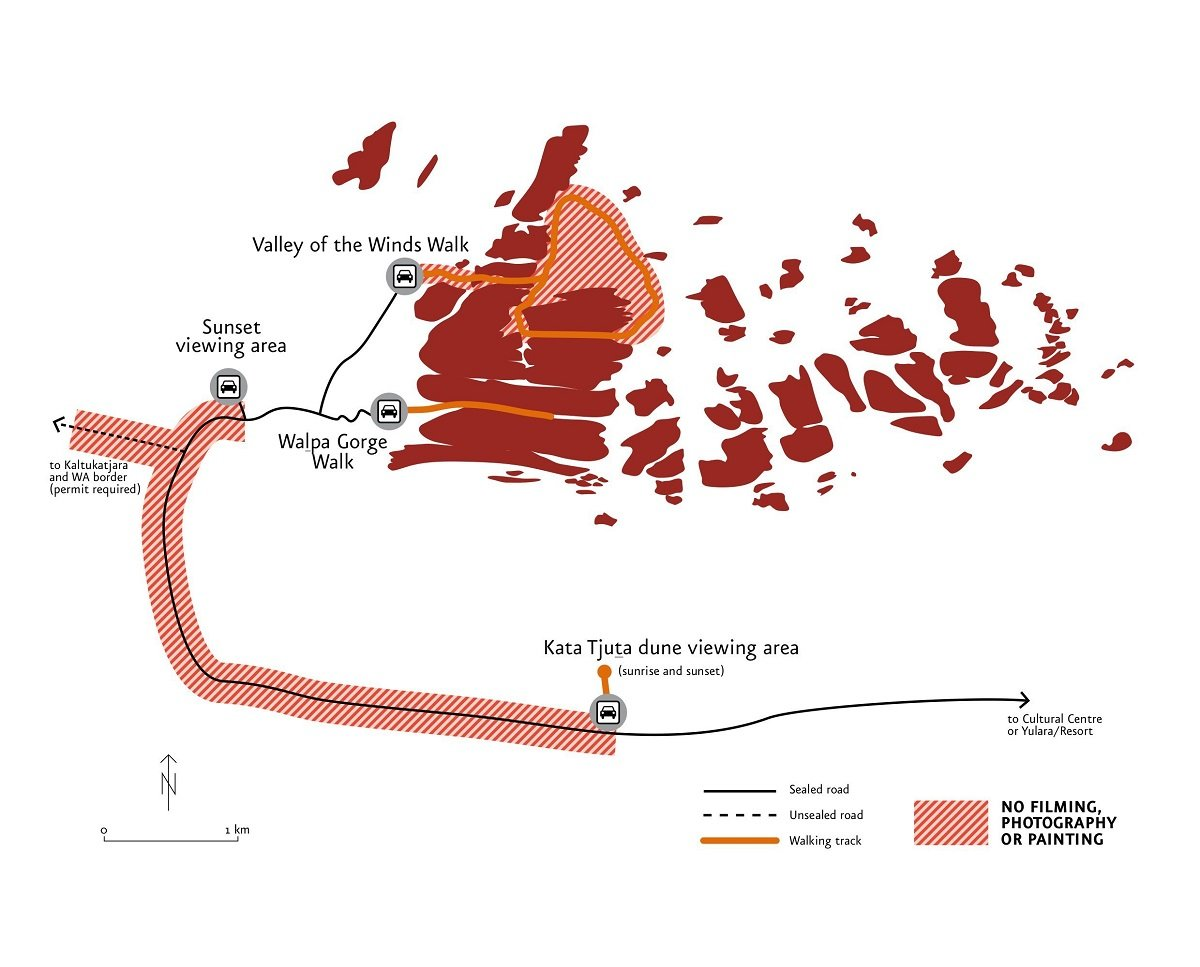
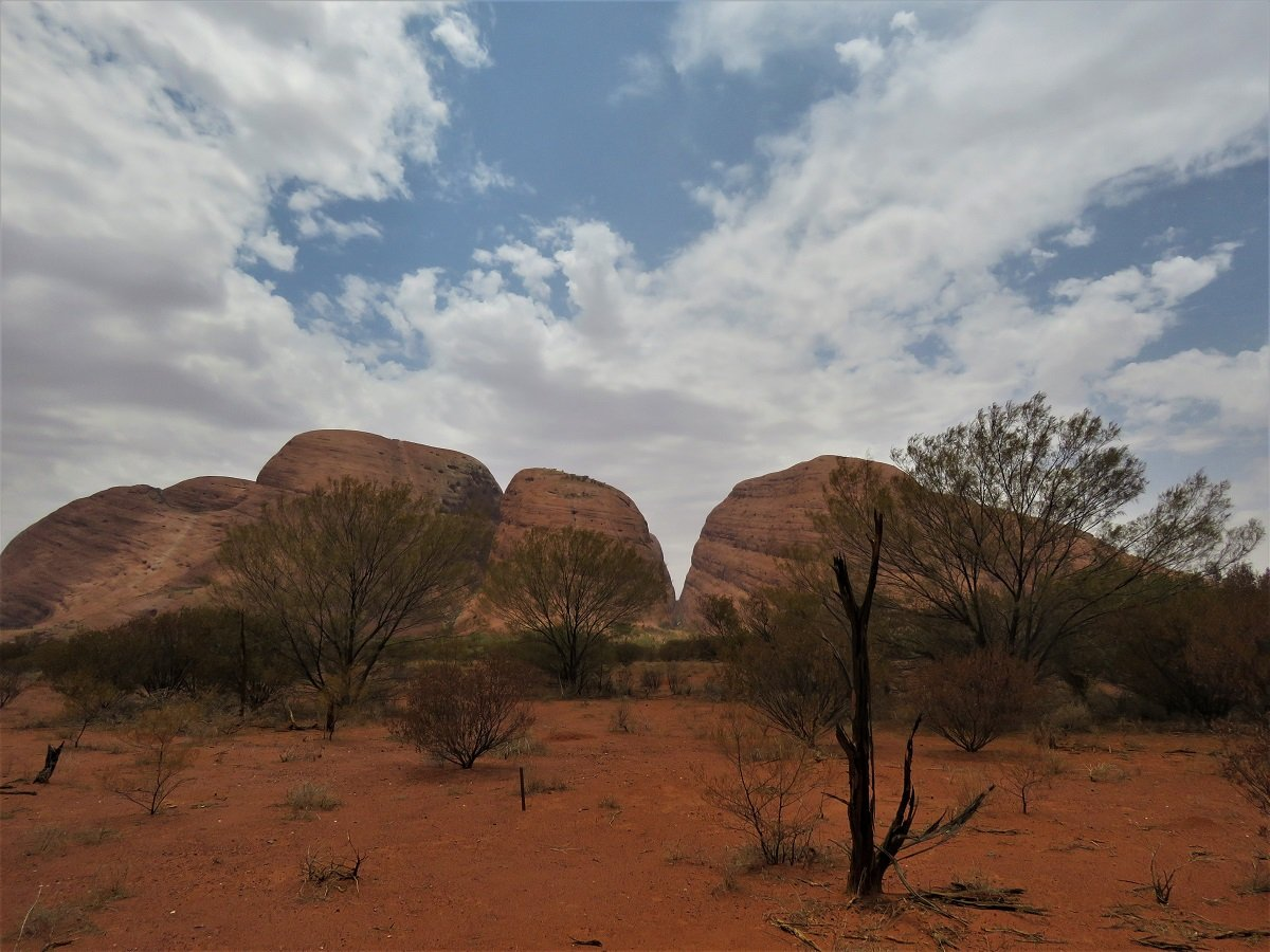
After lunch we set out towards Kata Tutja (or The Olga’s as known previously).
We spend the rest of the afternoon in the national park. You figure out soon enough that Uluru is the star of the park. Kata Tutja makes way less effort for the tourists: there are 2 or 3 viewing points and a walk or 2, but you cannot drive around Kata Tjuta like you can drive around Uluru. A pity, because it could possibly be a nice drive.
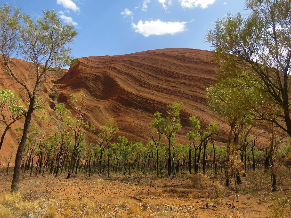
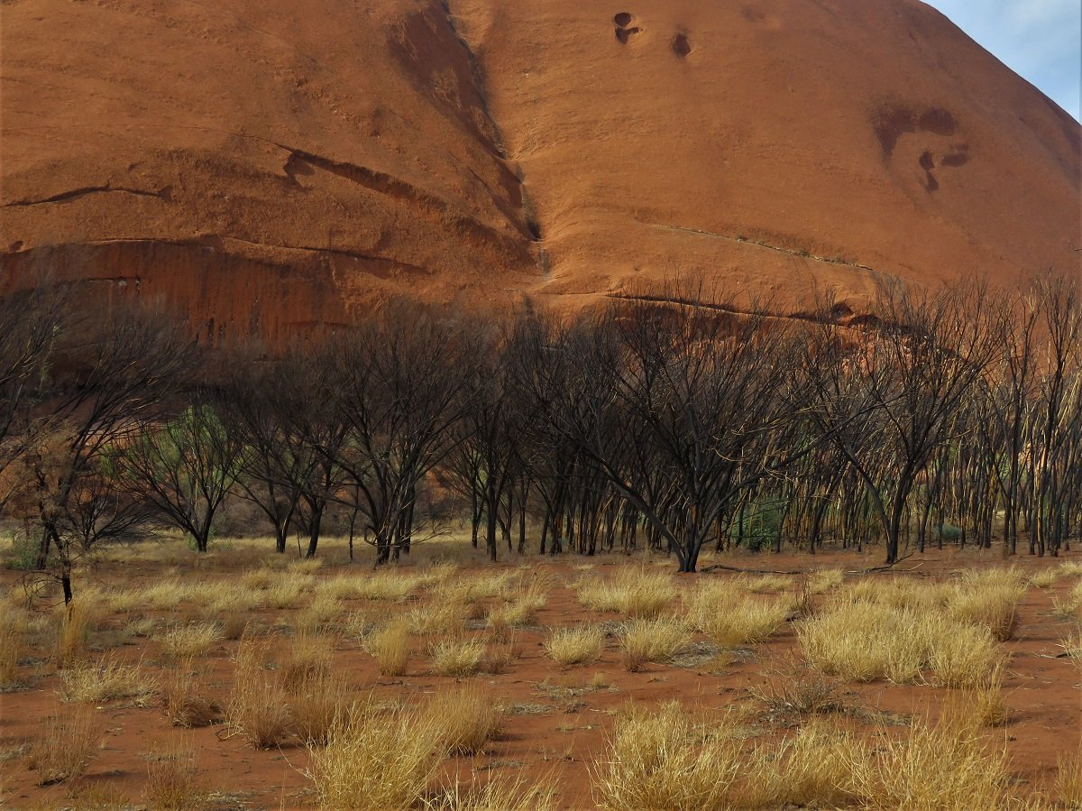
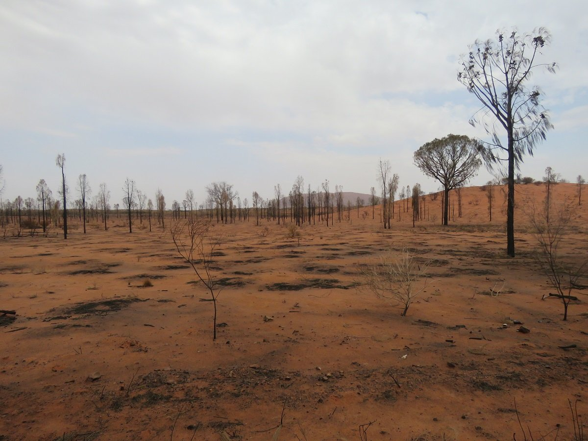
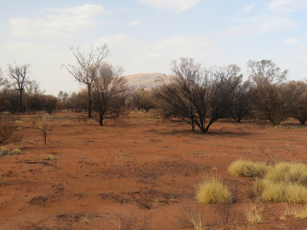
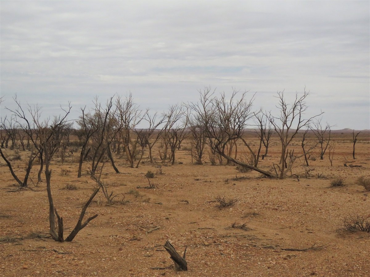
The fascinating thing about driving in the National Park is seeing the differences between the various patches of vegetation. We understood from the guide at the Museum Complex that the Aboriginal community, in collaboration with the government, applies strict methods for back burning to maintain the land and its vegetation. You can see areas where the back burning only happened recently: the skeletons of burned trees etched against a background of red soil and blue sky. The areas where the back burning happened earlier, land and trees are covered in new, luminous green foliage. (see one of the images from our Uluru basewalk)
Looking at the shadow play on the two rocks in an otherwise fairly flat landscape (on the Google images), on ground level it’s fascinating to look out over the expanse of the park and try find the other rock: a very faint shape on the horizon (photo bottom left).
We drove back to enjoy an early evening dinner at the Arnguli Grill & Restaurant for typical Australian Bush Fare. On the menu: kangaroo and wallaby meat, indigenous nuts mousse and other local delicacies. It was really nice!
Arnguli, the Pitjantjatjara word for bush plum, is a fitting name for a restaurant that successfully blends quality Australian produce with local Indigenous flavours using native ingredients from the bush.
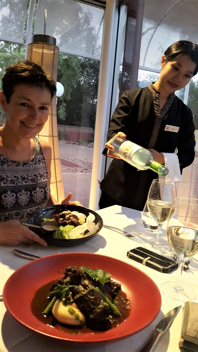
Just a side note: even though the restaurant boasts the authentic Australian bush / indigenous angle, the full floor staff was Asian. I saw some more Caucasian/Australian staff in the open kitchen (no indigenous people), but front of house was Asian.
Day 5: Last goodbye to Uluru and on the road to Coober Pedy
When we left Uluru we took a last drive to The Rock, before leaving for Coober Pedy (still a 7hr drive away). We had bought a map book before we left and between reading the map half assed and Stefaans certain opinion to have seen petrol stations where he thought he’d seen them … we eventually hit the big “E”, possibly about 80km away from the next (certain) petrol stop.
Out of experience we know that when the little orange petrol pump lights up, you can possibly still have about 50 to 60 km in the tank. We were a little bit over so I was worried. While he kept reassuring me that “everything is ok” … I saw him systematically dropping from the allowed 110km per hour to about 80km per hour. I’m dumb but not that dumb and on my question if he was worried running out of petrol before the next pit stop, he had the grace to grin as if caught out! He was careful (worried?) too! I think we made it on fumes to the next available petrol station. We vowed (for as long as that’s gonna stick!) that in future we would fill up (even when not in need) at any next petrol station.
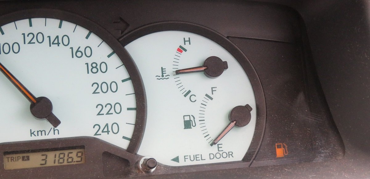
When we filled up in Marla (and my heart stopped racing) we continued towards Coober Pedy.
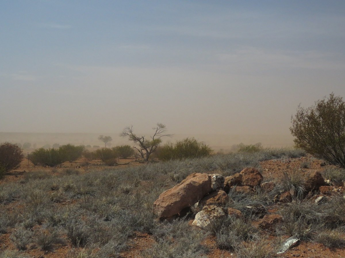
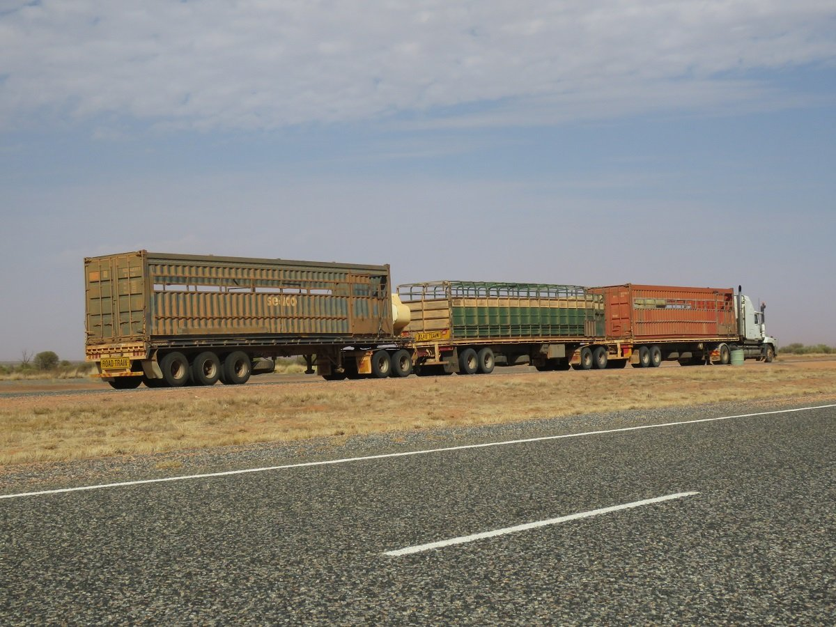
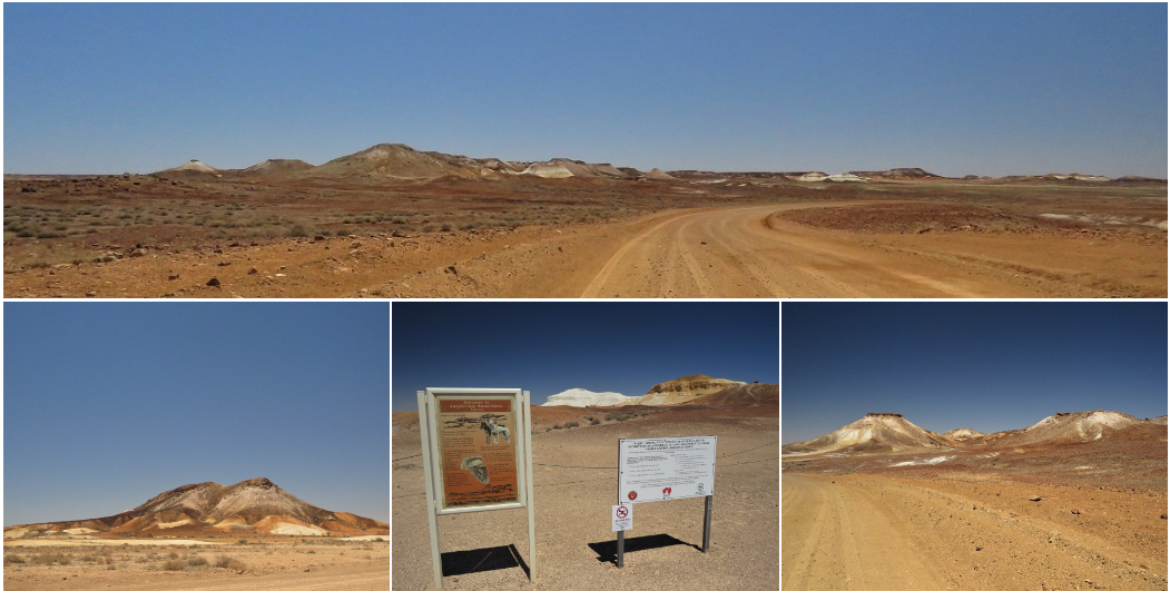
We had a little dust storm along the road and I was able to photograph my first (parked) Road Train. Normally they chase through the Outback at 110 km per hour.
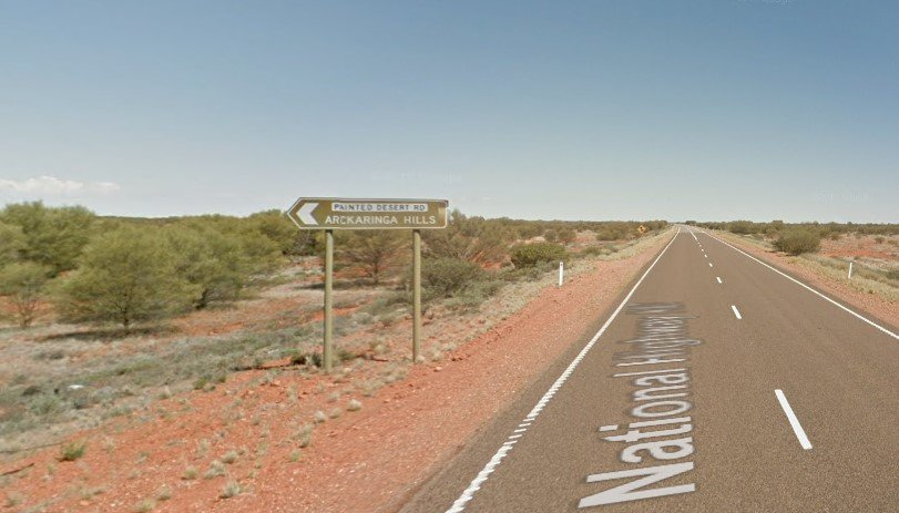
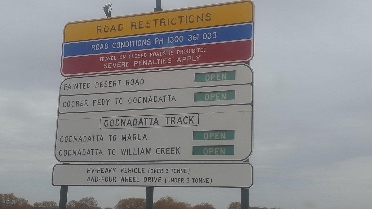
Just past the Cadney Homestead truck stop / roadhouse we passed signage of The Painted Desert. Even though the roads seemed to be open, the indications for heavy and 4wd drive vehicles confused us. Knowing in the meantime how Australians happily apply the law and hand out fines, we decided to return to the road house to make sure.
We got the go ahead and decided to test the Toyota on a trip through The Painted Desert … and she did a brilliant job. Ok … in SA we’re also used to 100’s of km’s of gravel road so that wasn’t a big deal. (maybe for Europeans gravel roads are not such a normal occurrence).
A detour of between 200 and 250 km … but we were up for that.
An interesting fact when we looked at the road sign. The sign mentions Williams Creek. Williams Creek is a small township that is surrounded by the lands of Anna Creek Cattle station, which used to belong to the Kidman family. To put size in perspective: Anna Creek is over seven times the size of the United States' biggest ranch, King Ranch in Texas and for us, coming from Belgium... it's almost the size of Belgium. I can guarantee that not one person living in Belgium could wrap his/her mind around the idea that the whole of Belgium would be one big cattle farm!
And it was worth it, be it that sometimes the mountains were quite far in the distance.
Some notes:
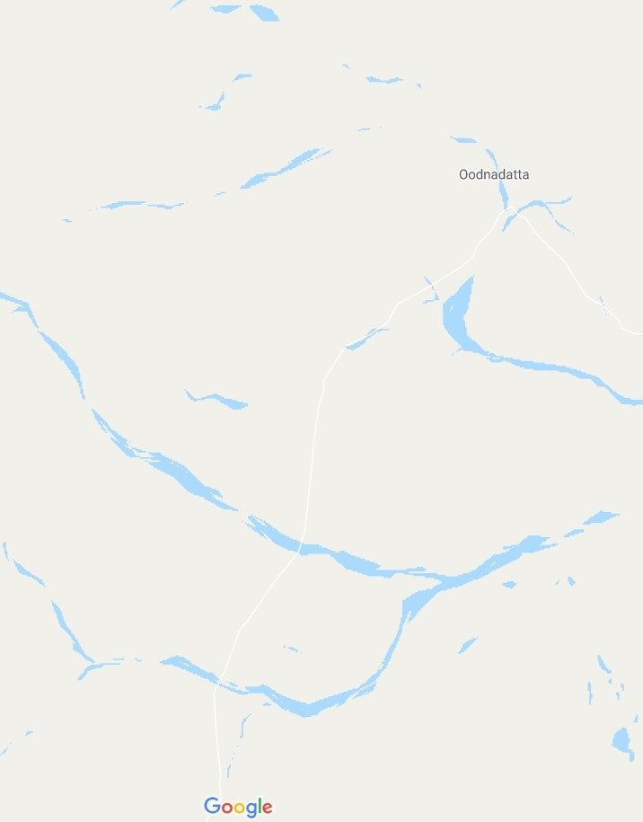
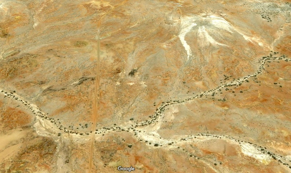
- Although Google Maps shows a reasonable amount of blue water ways, they’re all dry river beds, with gnarled trees hanging on for dear life.
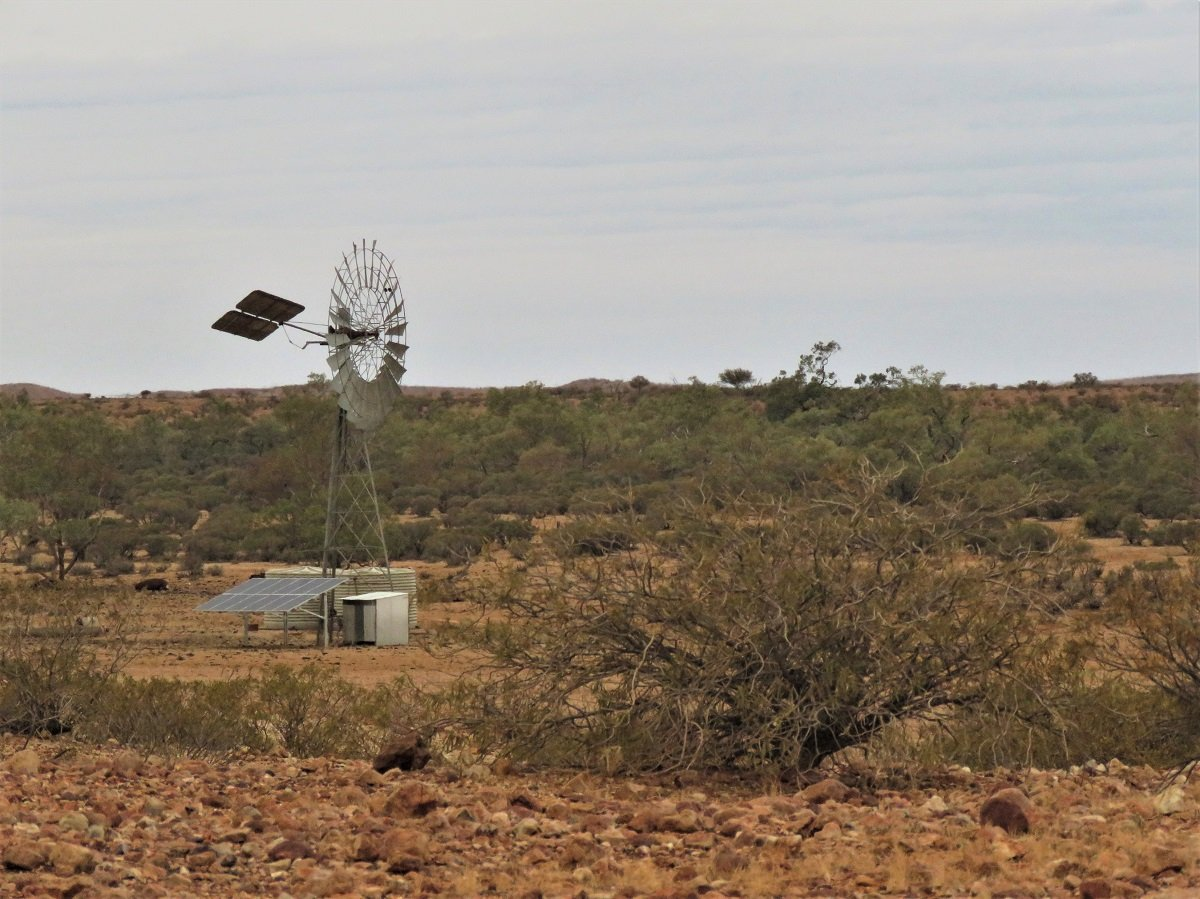
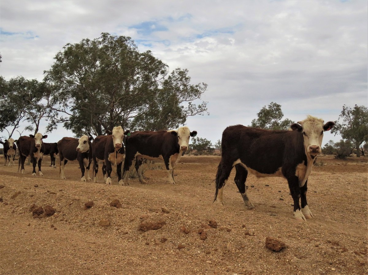
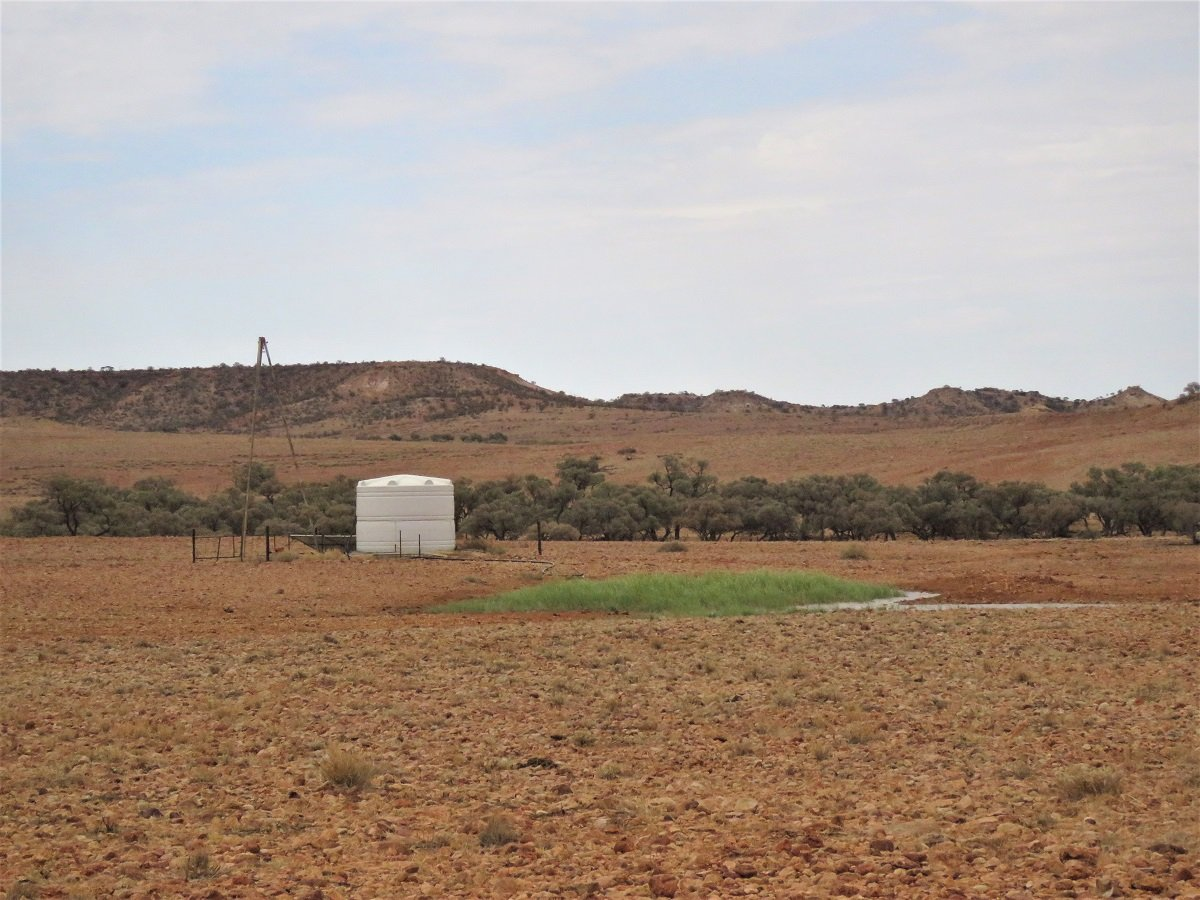
- There is life in the desert: farms, groves, cattle and of course the iconic kangaroo. The occasional wind pump almost made us believe we were traveling through the semi desert Karoo in South Africa.
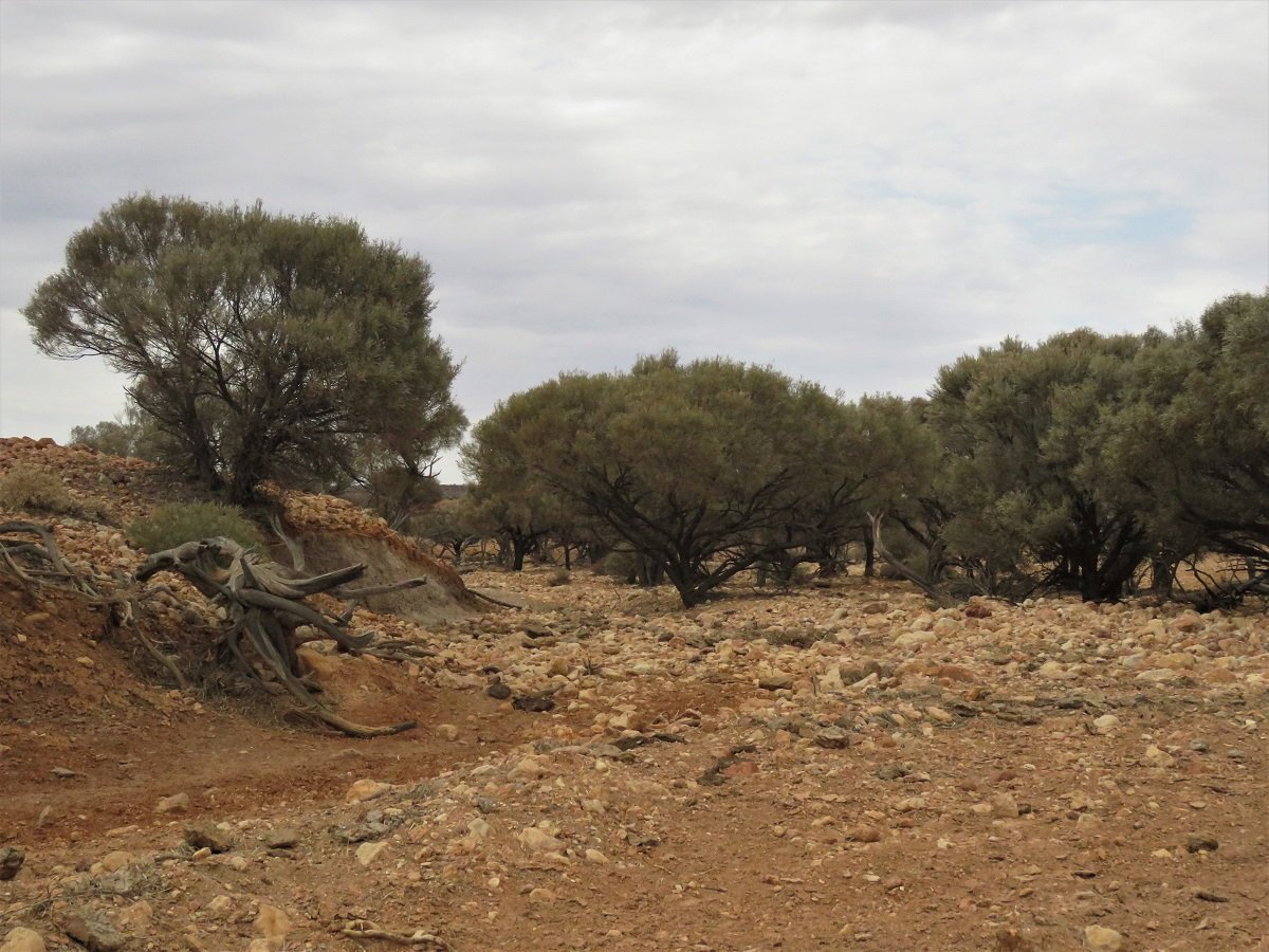
- The desert floor is a carpet of shrubs, small trees and rock, rock and more rock.
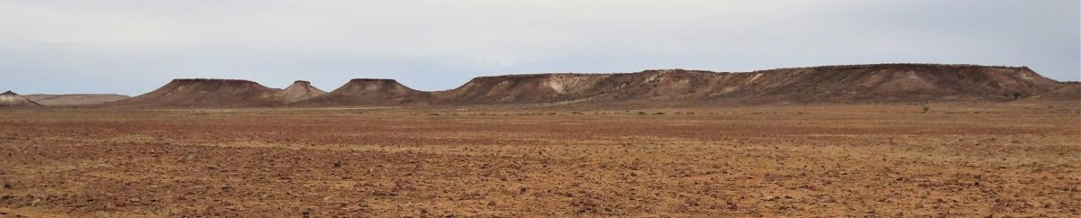
- The layered mountains and mesa, rising from the flat rocky desert floor, are beautiful with all sorts of shades or oranges, yellows, browns with white, mica tops shimmering in the sun.
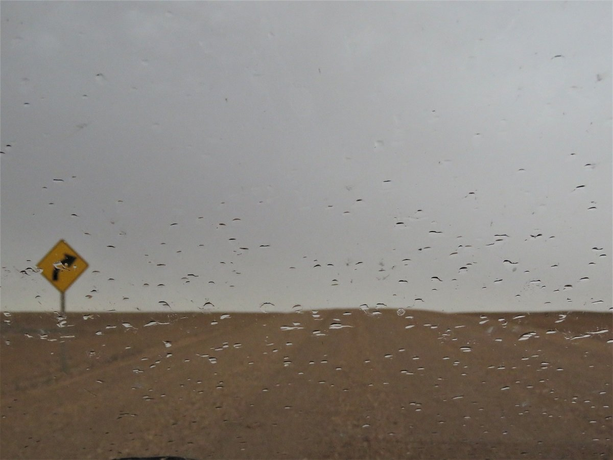
- And yes … we HAD rain in the desert.
Side note: it was an overcast day so the brilliant colours that we had anticipated to see, were not present. To have an inkling of what it could have been … here are some Google images.
(Our trip the following day to The Breakaways, just outside Coober Pedy, brought us much closer to very similar coloured mountains and it was S P E C T A C U L A R!!! (see more about that just a bit further down)
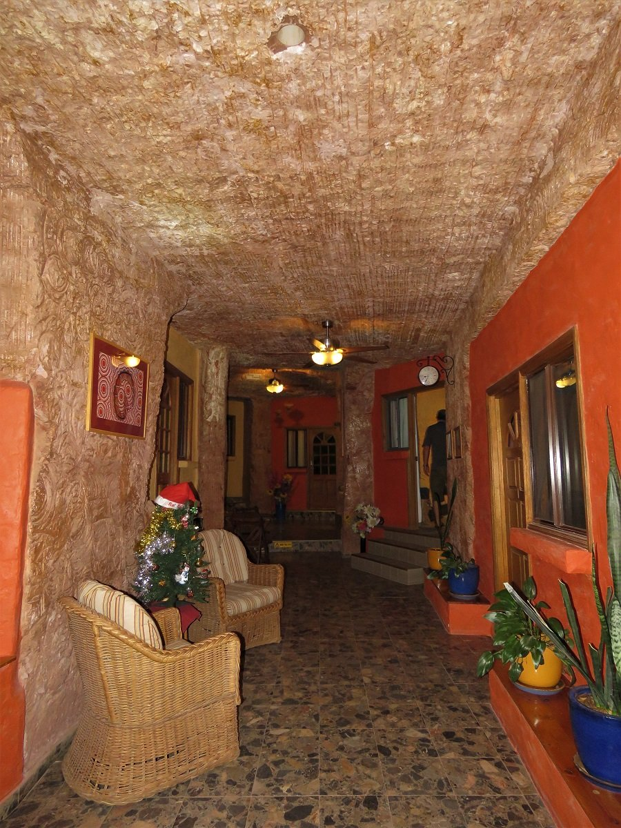
We arrived in Coober Pedy just in time for an orange and purple sunset above out dug out motel, where we holed up for the night with pizza and a book. It’s weird to see that most of the town is built in dug-outs (spaces cut out of the rocky hill side). It’s funny because it makes night time in the room really pitch-black. Having no sunrise peeping through the window, we slept till 9am.
Day 6: Opal Country, Dog Fence and The Breakaways
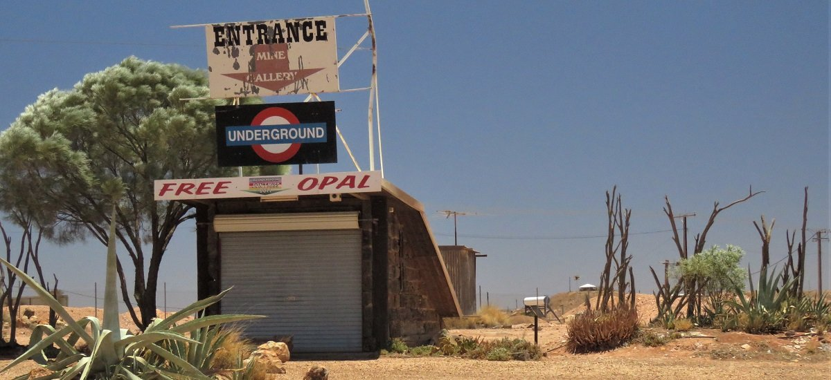
Being in Opal country we did the proper touristy bits: visiting an underground opal mine and the opal museum.
The old granny at Tom’s Working Mine was lovely and chatty about her and her family’s life in the opal business. We were fascinated – when down in the mine – how easy it is to spot the opal in the walls with a small UV torch. The dangerous shafts (where the miners go up and down in their mines) are unprotected … they’re just open holes in the ground. Signage warning NOT to walk backwards (e.g. when taking photographs) are placed all over the show, but the shafts are still open holes.
(So much for the Australian Health and Safety Standards )
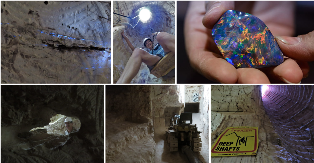
When we came back up from our underground tour, she kept on telling all sorts of stories of opal country: how individuals are still able / allowed to mine (no big conglomerates) and how some people – her own grandson included – still make a living from noodling (a practice where people go to discarded mounds – at night with the uv light – to find still reasonable sized opal leftovers.)
Chatting with her made us realise …. maybe one day we’ll come back to Coober Pedy, buy a claim – they seem to be reasonably priced – and start digging away. Wouldn’t that be fun!
‘Mysterious opals contain the wonders of the skies – sparkling rainbows, fireworks, and lightning, shifting and moving in their depths.’ – Author Unknown
The young lady at the Umoona opal museum was very knowledgeable and enthusiastic and she just loved talking about the opals. Her granny had lived here and visiting her all the time made her fall in love with opals and return to her roots in Coober Pedy.
(top l to r : Umoona Museum, Wikimedia commons, Geology.com)
(bottom l to r: ausieopalsdirect, secrethistories, amazing geologist, australian musem)
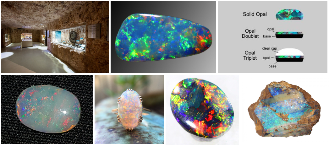
We learned something more about Australia’s prominence on the opal world stage (more than 95% of the market), the different sort of opals from different areas, the various values of colour, cut (solid, doublet, triplet) , etc. She also explained the difference opal areas in Australia and the different sort of opals typical to each area: (bottom row l to r) white opal from the Coober Pedy, Mintabie, Andamooka and White Cliffs areas, chrystal opals from South Australia, black opal predominantly from Lightning Ridge in NSW and boulder opal – with layers of opal surrounded by ironstone – from the inland Queensland fields. We couldn’t resist buying some jewellery for me and the other ladies in our family – unfortunately not solid opals. (And the mine for “free opal” was closed)
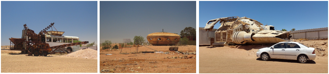
We drove around town to see the derelict cars, trucks and contraptions filling up this little town. Some are discarded skeletons from the opal mining, some are memorabilia from movies, and then there is the local space ship of course.
Besides a comprehensive listing of all things to see and do in and around Coober Pedy, page 21 of the tourist brochure shows an impressive list of more than 30 movies that were made in and around Coober Pedy: Mad Max, Pitch Black (see pic on the right), Priscilla, The red Planet to name but a few.
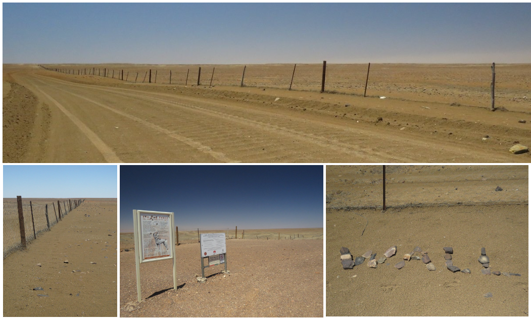
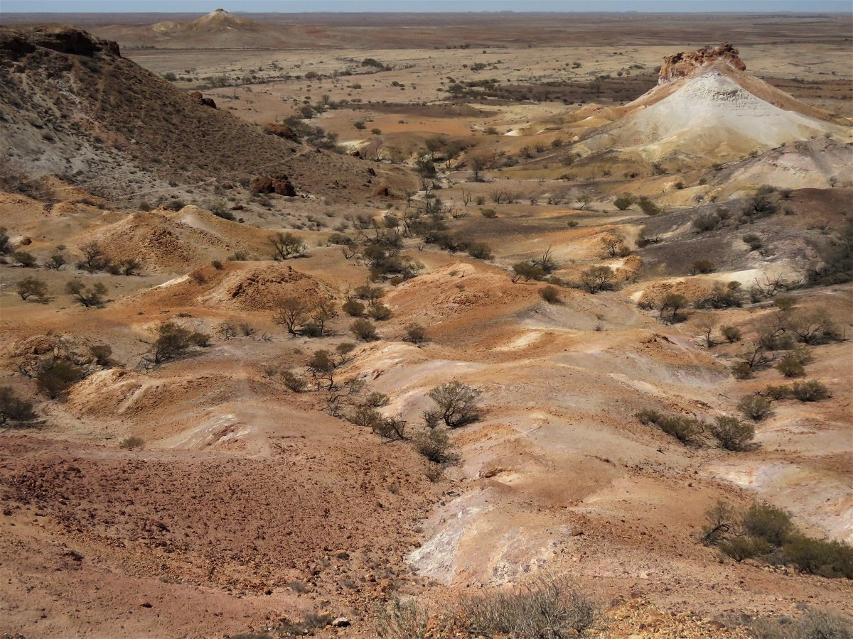
After a quick bite to eat, we took the road out of Coober Pedy to drive to the Kanku Breakaway Mountains and the Dog Fence. As mentioned before: just beautiful. The photo’s speak for themselves.
The Dog Fence is the longest fence in the world and it’s meant to keep the dingo’s out of the farmlands in the south-east part of Australia and protect the sheep of southern Queensland. Made mainly of diamond wire mesh, it was built around 1880 to 1885, and is still constantly maintained. It is one of the longest structures in the world. It stretches just more than 5,600 km. The desert-like moonscape along the fence, with its fossilized shells, grey, soft clay dirt and cracks that appear to be bottomless, has been nicknamed the ‘moon plain’.
The got the name ‘The Breakaways’ because the mesas and low hills give the impression of having “broken away” from the higher ground of the escarpment. ‘Kanku’ (added to the name in 2015) means ‘shelter’ in the traditional language, a place that has provided shelter from the scorching conditions to animals, plants and people for thousands of years.
The ride trough the park was beautiful. The sun was on our side this time and enhanced the ever changing colours of the landscape: a million shades from white to ochre to brown and black interspersed with spider webs of dry river beds sporting clumps of trees and bush.
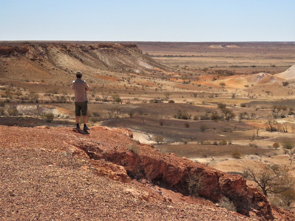
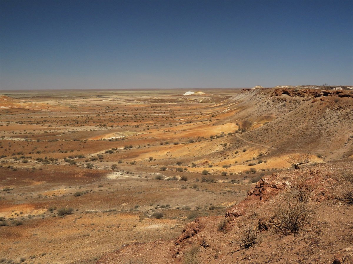
We were pushed for time and had to leave the Kanku Breakaways, much to our disappointment. We came out of the desert, onto the Stuart Highway, just north of Coober Pedy.
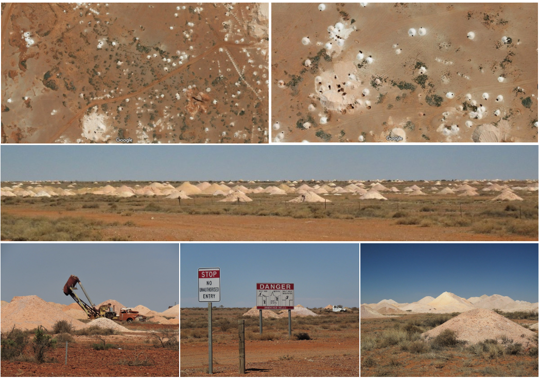
On our way past, going south towards Adelaide, we had a last chance of being fascinated by the “mole hill” landscape of Coober Pedy. Looking at aerial images from Google Maps, it’s amazing how these opal mounds have pockmarked the landscape around Coober Pedy. The open and unprotected shafts are visible all over.
Leaving Coober Pedy behind, we cruised south towards Port Augusta and Adelaide. We were not sure if we would reach Port Augusta by nightfall but any truck stop or motel along the way would do.
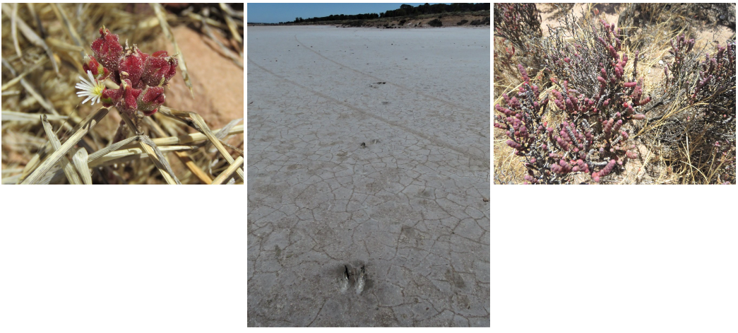
We passed a salt lake in the distance. And on the edge was a sign indicating this was Kokatha country. These Aboriginal signs are put up on various places in South Australia.

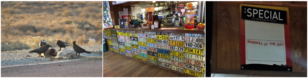
We eventually made it to Spud’s Roadhouse in Pimba for a good outback burger and a bed to sleep, after passing yet another dead kangaroo, now providing food for a murder of crows.
Was the ‘special of the day’ a coincidence?
Day 7: Adelaide
The following morning I had yet another chance to photograph a road train. They still fascinate me.
Just as we reached the Stuart Highway again, we saw that there was still a lot of activity around the dead kangaroo and we returned to the scene of the crime for some more action pics.
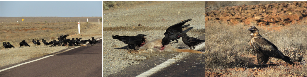
Leaving the crows and eagle to their fight for survival, we turned south and continued towards Adelaide.
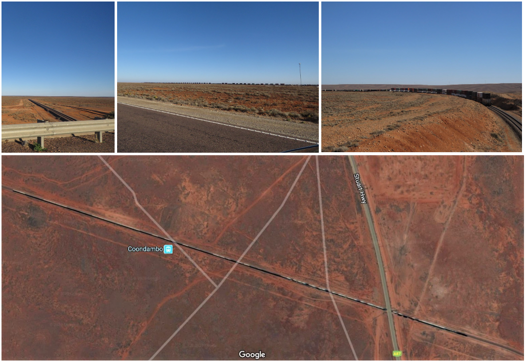
We had crossed a bridge over the railway line at Coondambo the previous day and now, just North of Mason Creek, we passed again over the same railway line. It reminded me a bit of the Sishen-Saldanha railway which seems to have the record of the longest (freight/ore) train in the world. We presume that the railway line we crossed is the one where The Ghan travels from Adelaide via Alice Springs to Darwin.
Going south, the area between Glendambo and Port Augusta is dotted with salt lakes. Once again Google maps shows a lot of great blue expanses, but they’re mostly dry.
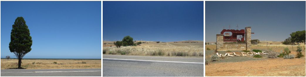
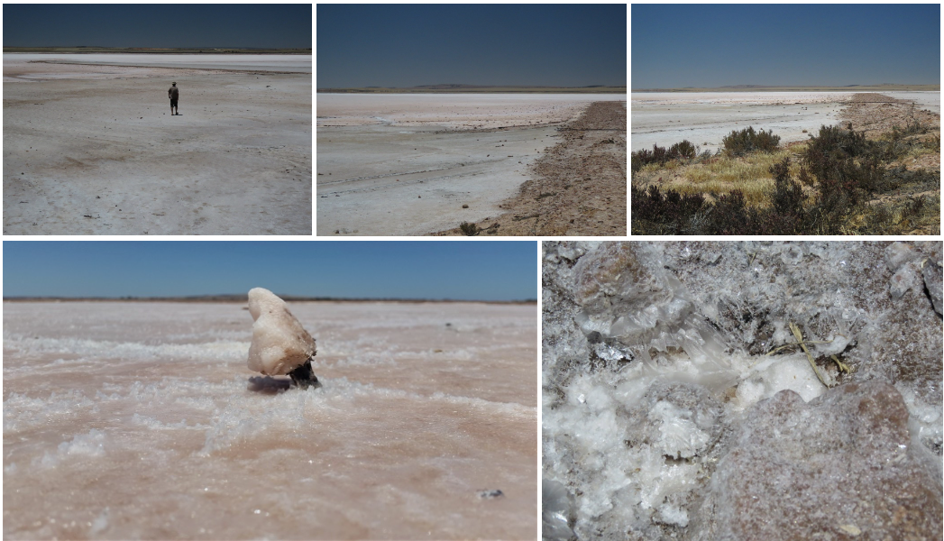
We didn’t really have the time to go off road to get closer to the salt lakes until we were more south, had our first (far away) views of the Spencer Gulf, were back in hay and windmill country and passed infamous Snowtown. Just past Snowtown we saw and fell in love with Bumbunga Lake. That was really beautiful.
Although there was no water and we missed out on the glorious red/pink colour, we were still amazed at the expanse of pinkish white salt cover with the salt crystals shimmering in the mud.
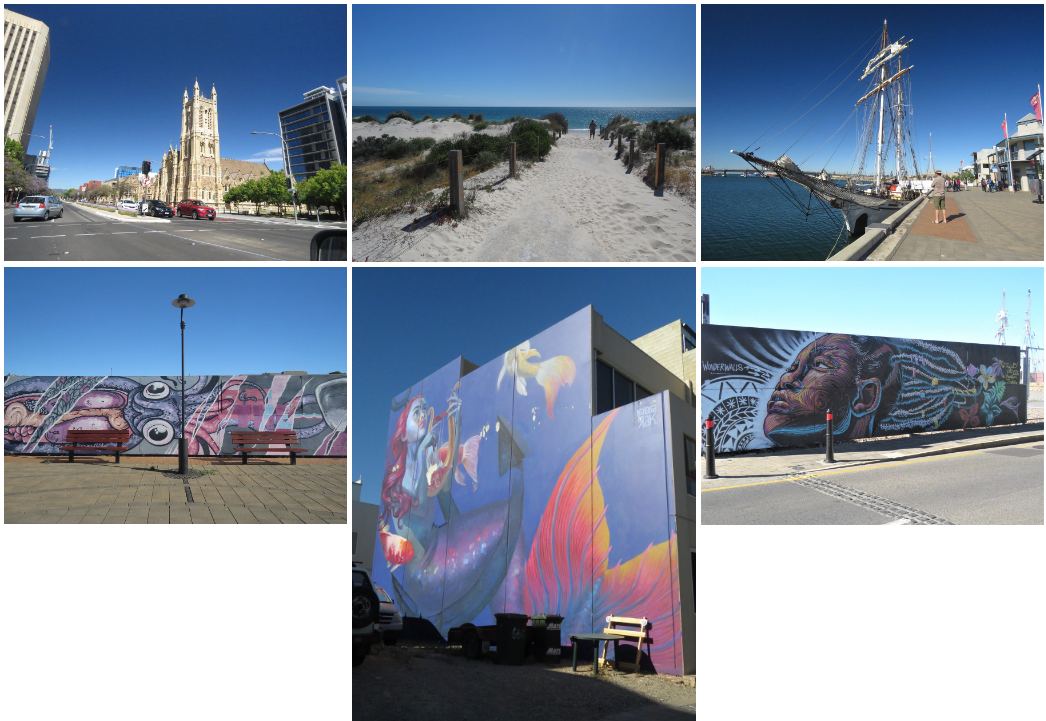
And on we moved. Again … due to time constraints we eventually had a whirlwind drive trough Adelaide with just time to stretch our legs at West Beach and check out the port. At the port we saw a lot of redevelopment and effort to make older parts of town more attractive. Part of this beautifying process is wall art / graffiti. I don’t know who the artists are, but the work is amazing.
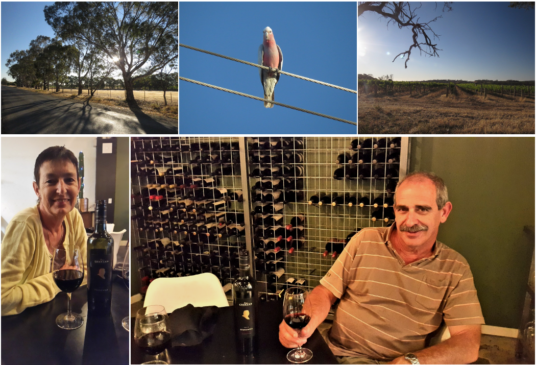
Late afternoon we left Adelaide town and headed for Barossa Valley to find a place to sleep. The sun was setting over the vineyards and the ever present pink and grey Galah parrots were keeping an eye on us. We enjoyed a good bottle of Peter Lehman wine (part of the Casella Family brands where son Peter works) and a wonderful cold platter dinner and called it a day.
Day 8: Pedal to the metal … going home.
Next morning we anticipated a long day ahead: just more than 750 km from Tanunda in Barossa Valley to Griffith. With a tea or lunch break, that would take us more than 8 hours. So that’s what we did … got into the car and drove … till we got home!
For more photos, clips and videos follow us on


Before, during and after our 2019-2020 family holiday, bush fires have been raging in Australia. Thank you to all firefighters and volunteers who worked relentlessly to combat the raging fires.
Outback Uluru Road trip