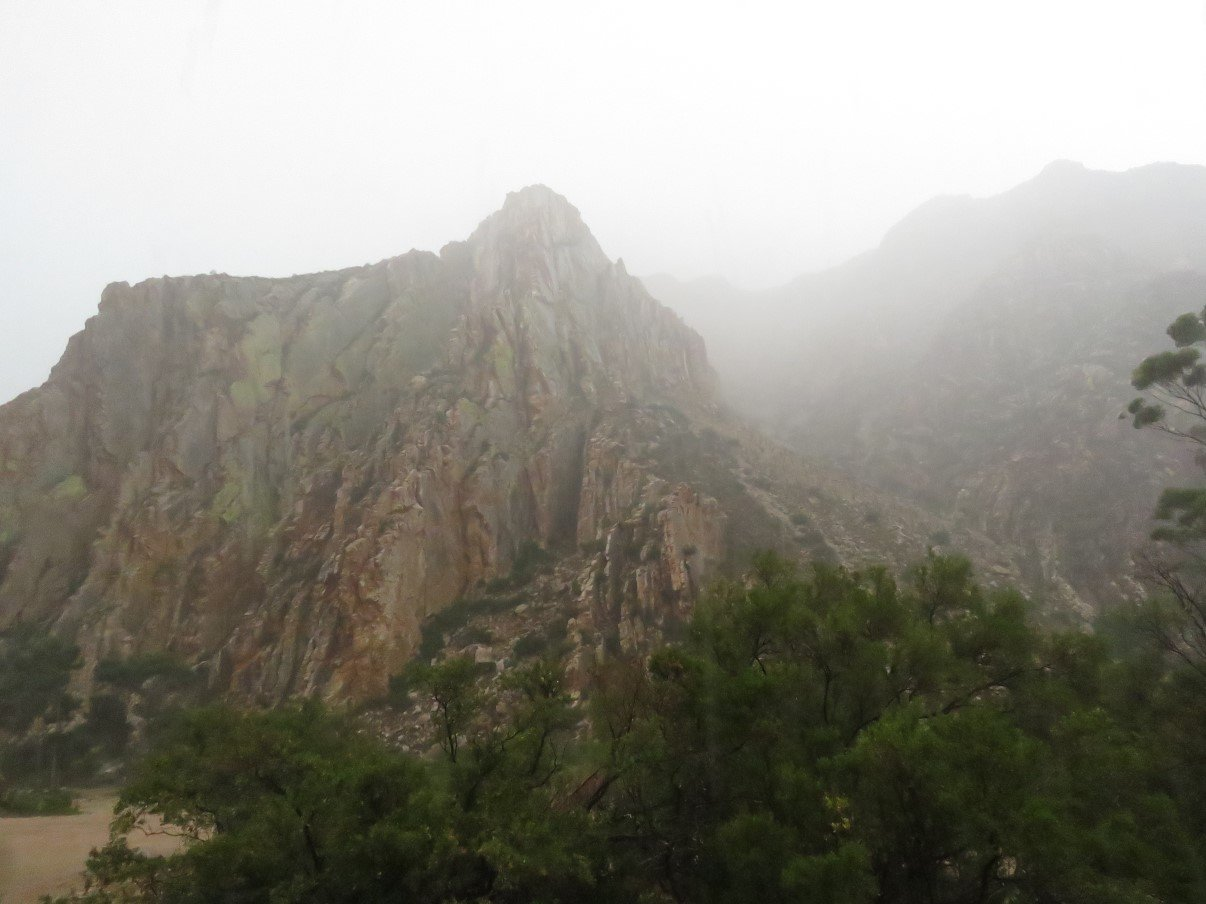
After we had left Route 62 at Calitzdorp and passed through the Nels River valley, we arrived at the foot of the Swartberg Pass. (watch here various videos of the Swartberg pass, courtesy of Mountain Passes of South Africa)
We quickly popped in at Kobus se Gat for a lunch of authentic local fare, but unfortunately they were not open on that day. The owner confirmed however that, although there was a sign that the pass was closed and we could see roadworks further up, the pass was indeed open. (A detour via Seweweeks to Prince Albert to enter the Swartberg Pass from the other side to get to Die Hel, was really NOT an option)
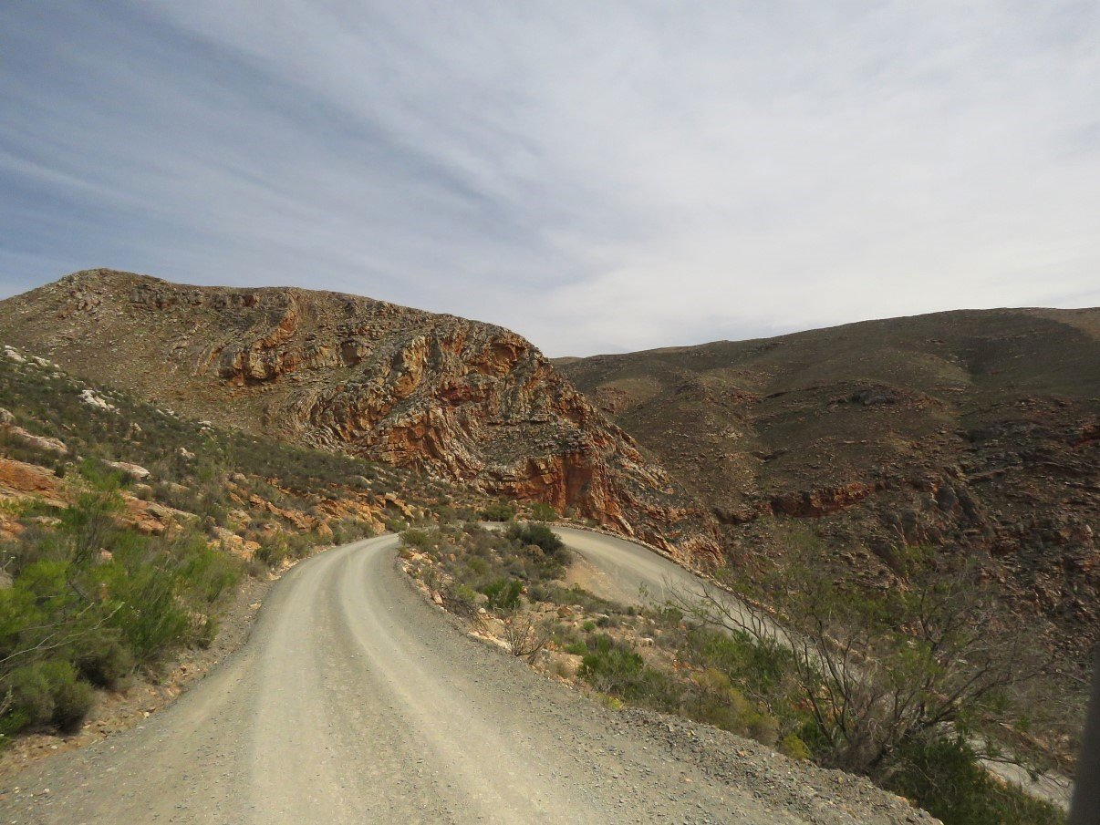
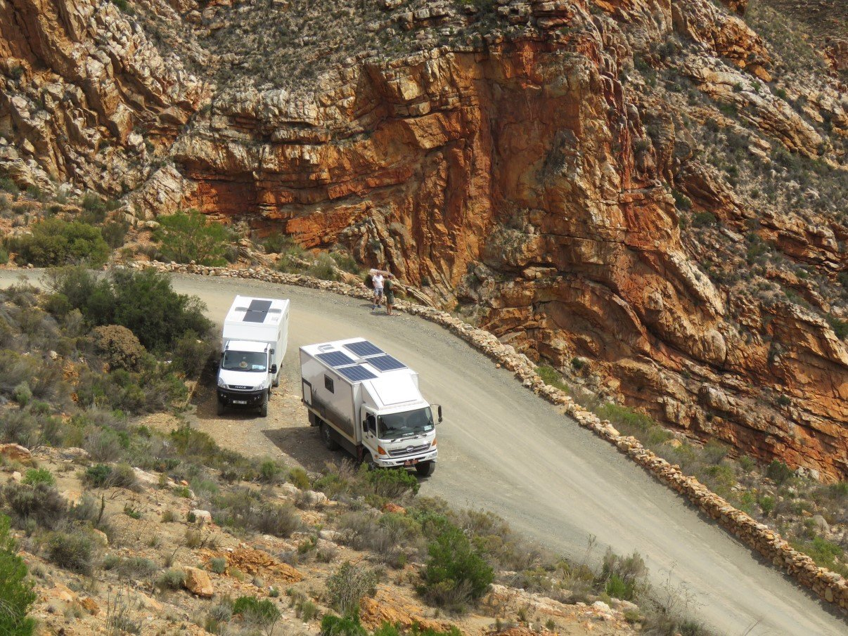
So, after supporting the local economy and buying some biltong, we set off onto the pass: a reasonable wide track… when we were alone on the road. Soon enough however we hit the road works section and it played out like a tetrus game: the different players (grader, truck and us) jostling for a safe passage, without either tumbling down the mountain or scratching any of the other vehicles. On a road that barely fits one truck, even normal SUV’s pull off the road sometimes to let another one pass, so for two trucks or even a truck and an SUV it’s quite a challenge to pass on the same narrow road.
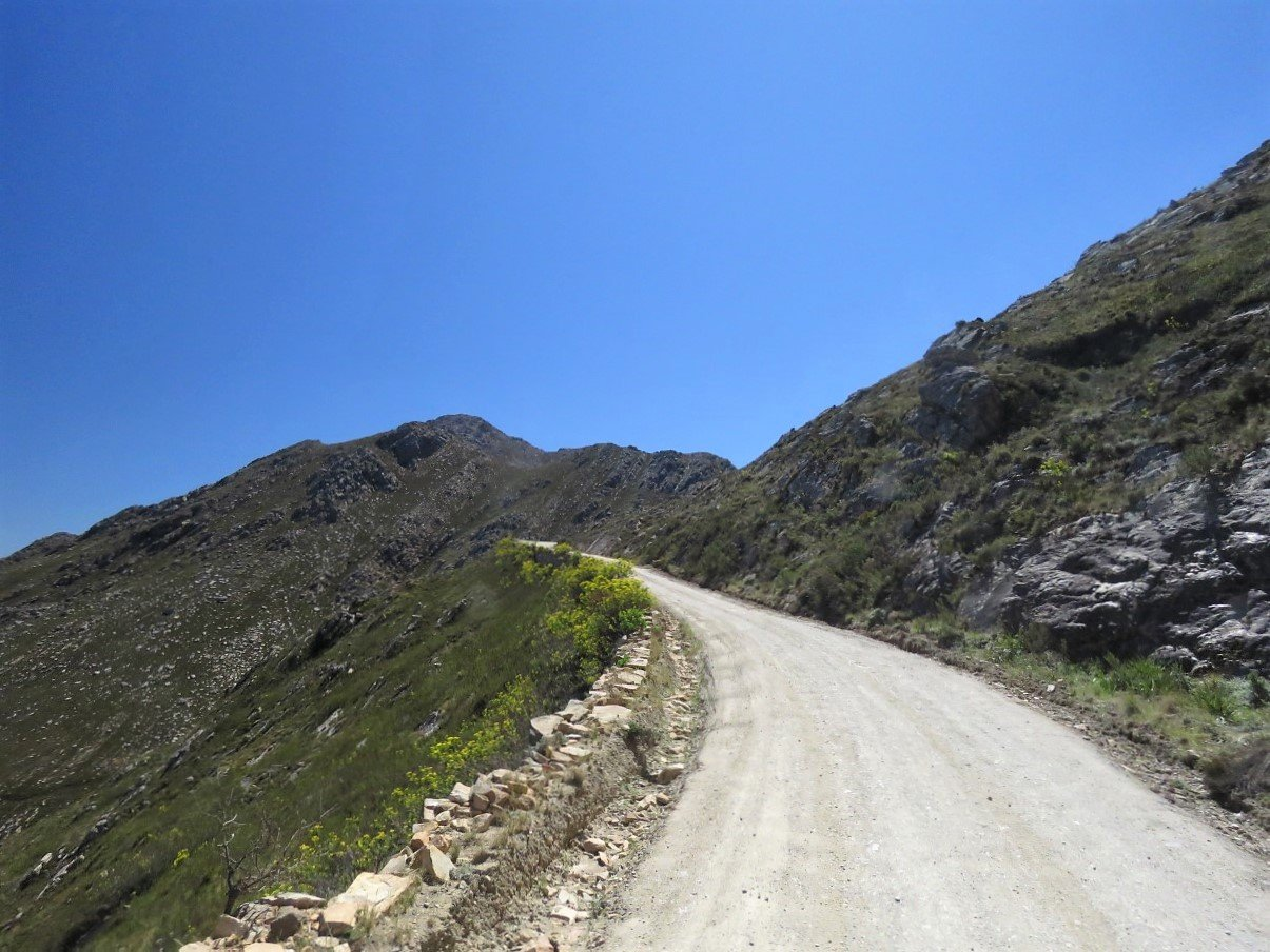
Once past that section it went well enough, although I’m still nervous when we’re negotiating hairpins with 2 or 3 point turns. Especially when I’m sitting on the ravine side!
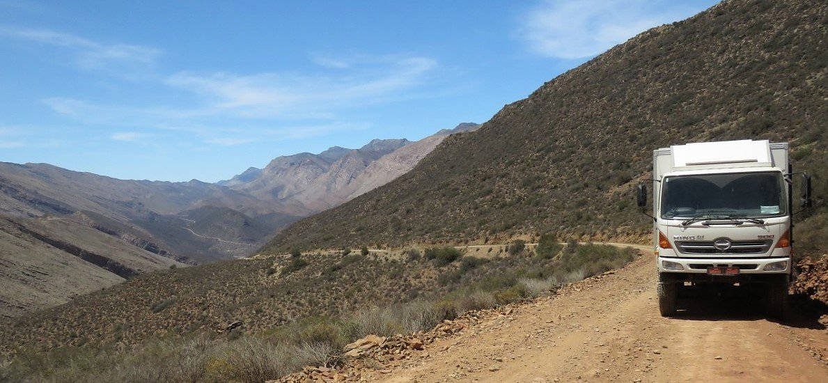
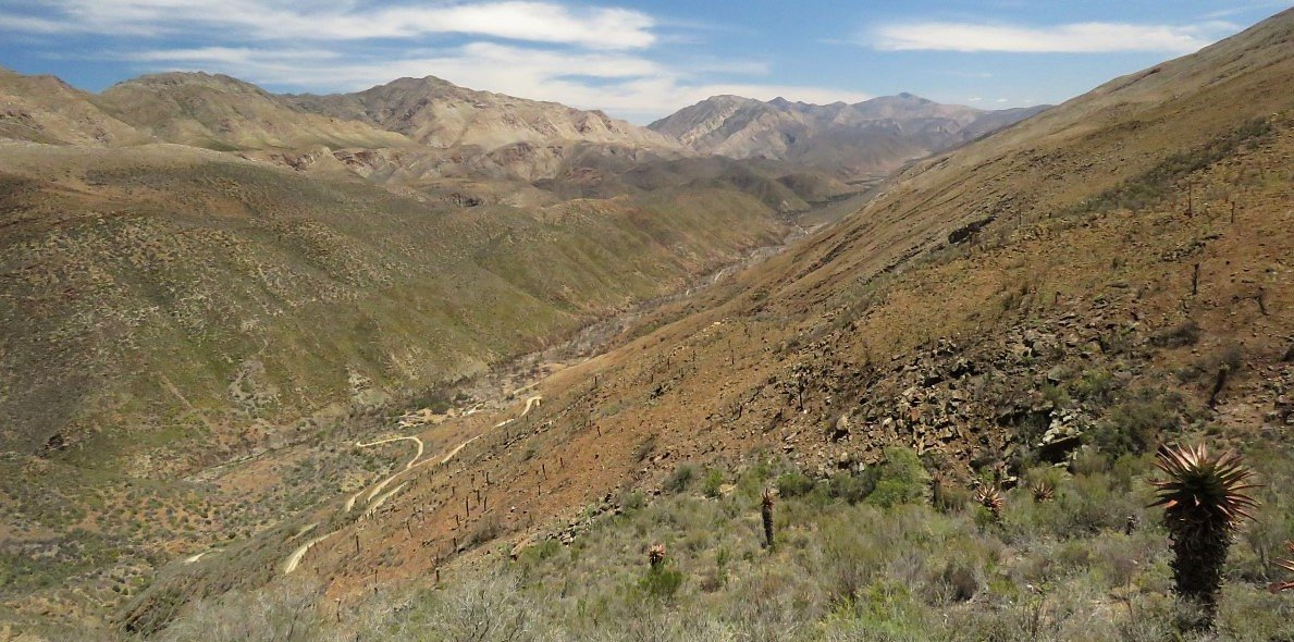
Crawling our way up the mountain we had fantastic views over the Groenkloof valley, which we had passed through that morning.
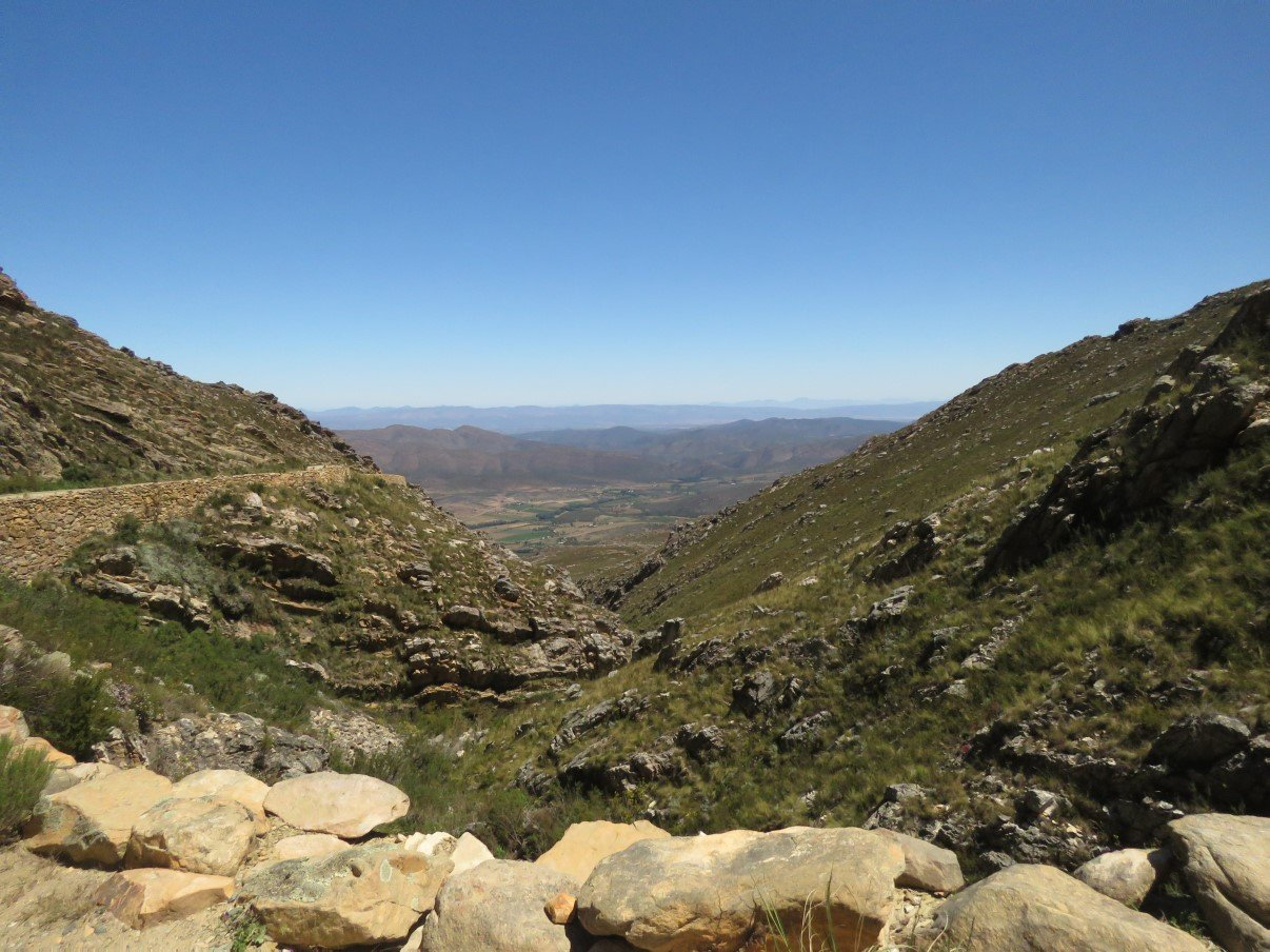
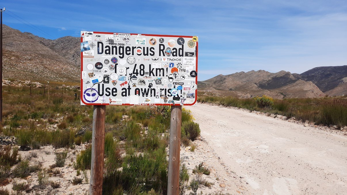
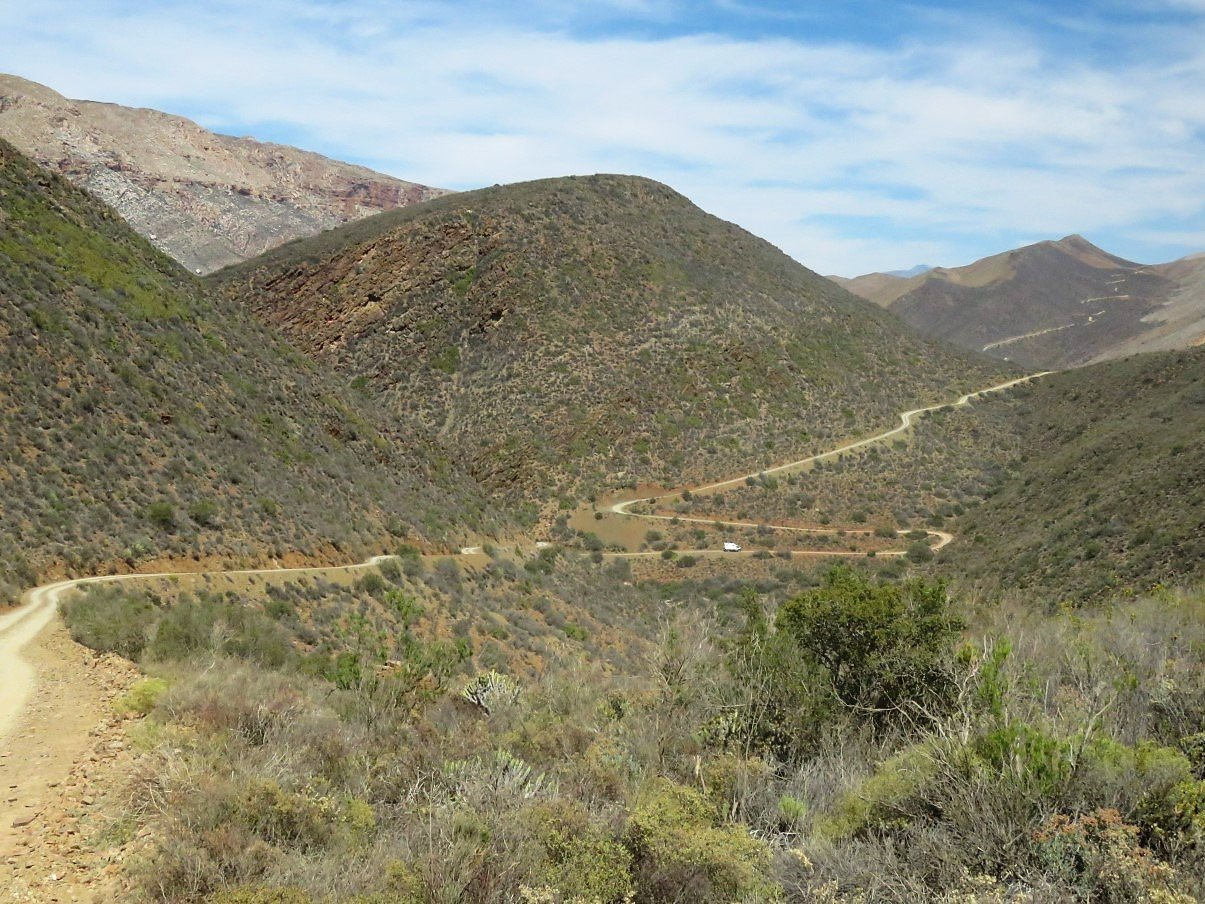
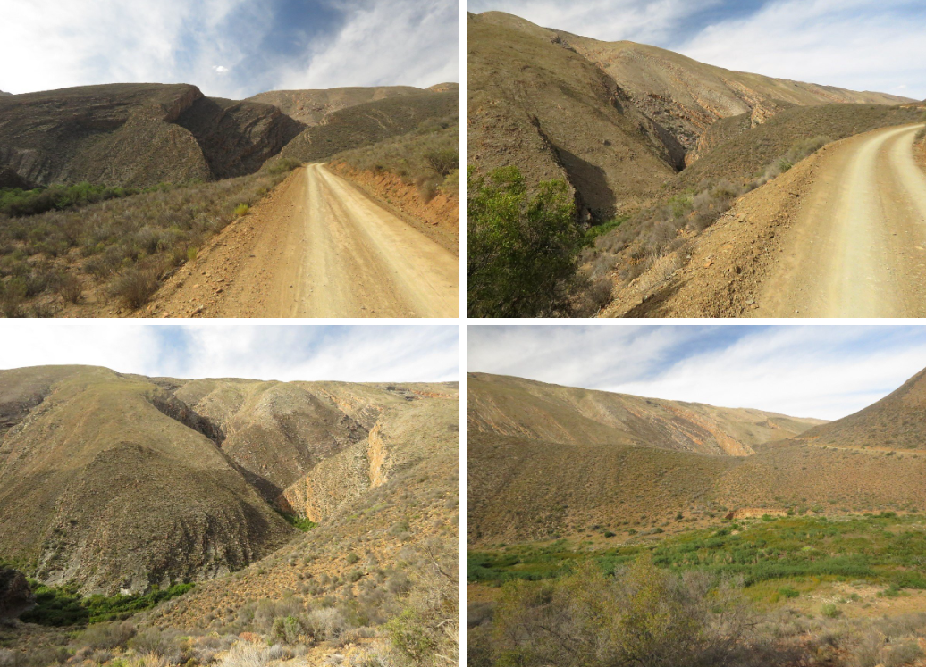
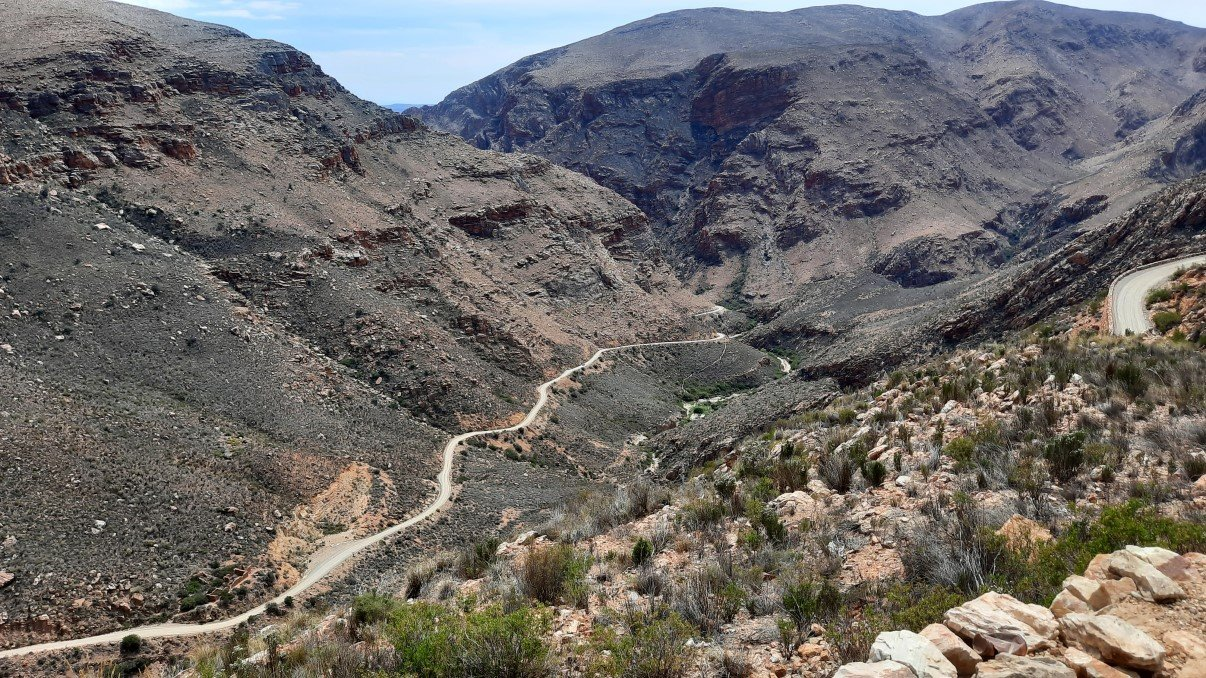
As mentioned before… we had made plans with our friends Gavin and Lee to meet in Die Hel at Gamkaskloof Dam. There is only one way in and same way out: 48 km of gravel road starting on the top of the Swartberg Pass, which is part of the greater Cape Floral Heritage Site. It seems that the official name of this road is the Otto du Plessis Road. We had a good look at the map on the roadsign to make sure this was the right track to take and on we went.
The sign at the start of this track indicates 48 km of dangerous road and the map sign had said something about an average time frame of about two hours to get to our final destination. That would imply we could fly through this pass/road/track at about 24km/hr. That was only a dream.
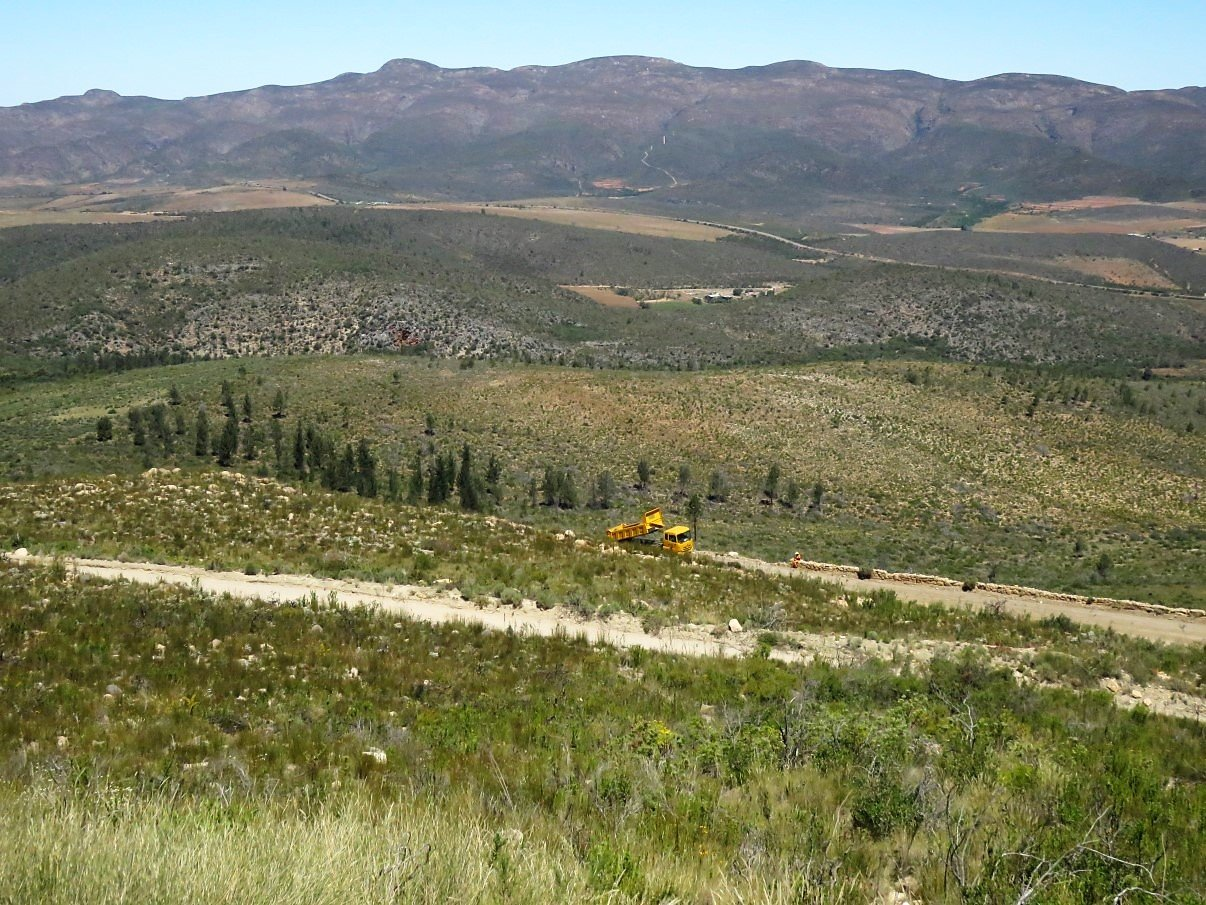
Although Trokkie is a 4×4 vehicle, it is NOT a 4×4 vehicle in the sense of the typical 4×4 SUV. Trokkie is still a 12-ton truck, with not exactly the same “fluidness of movement” as an SUV. Several SUV’s passed us and and left us in their dust and yes… they most probably did the 24km(or more)/hr. With parts of the track being corrugated and rocky, we were averaging closer to only 10km/hr. Which implied an estimated travel time of close to 5 hours. As we had no cell phone reception whatsoever, we didn’t know if Gavin and Lee were before us or after us so we decided to push on. They would be driving faster than us in any case!
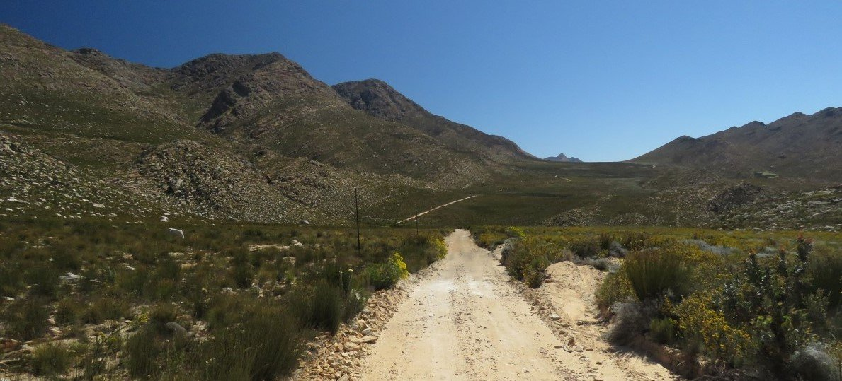
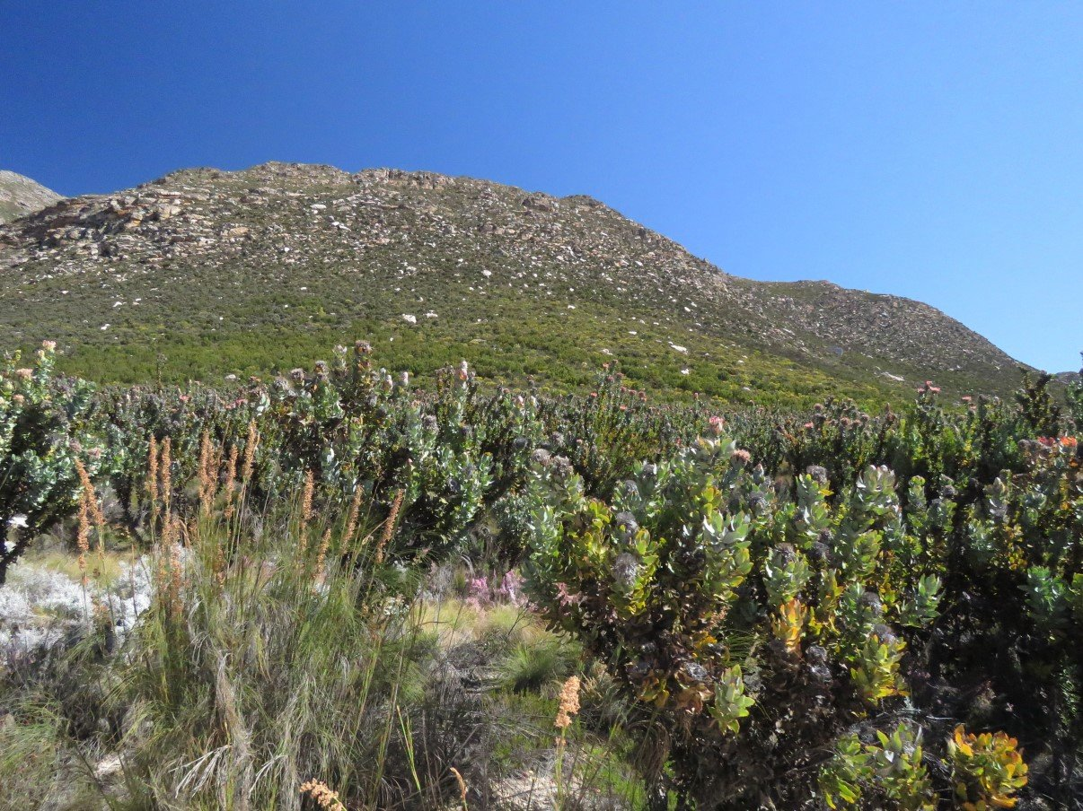
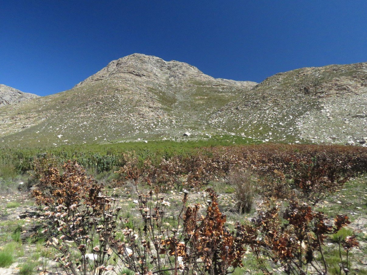
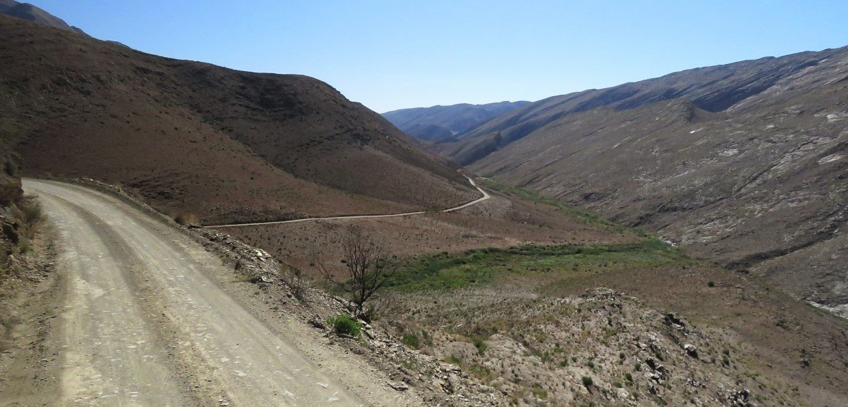
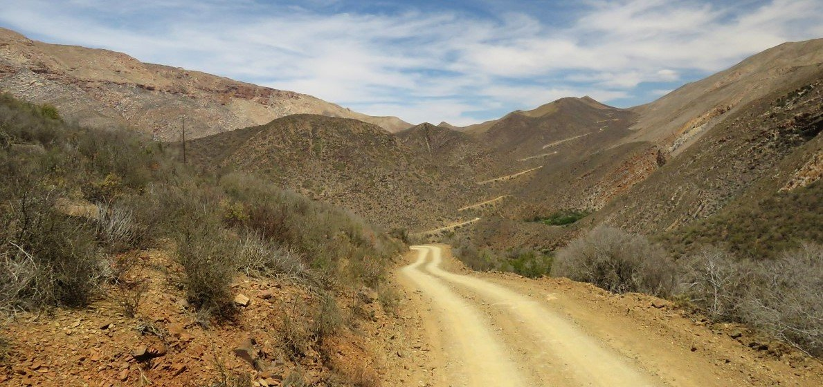
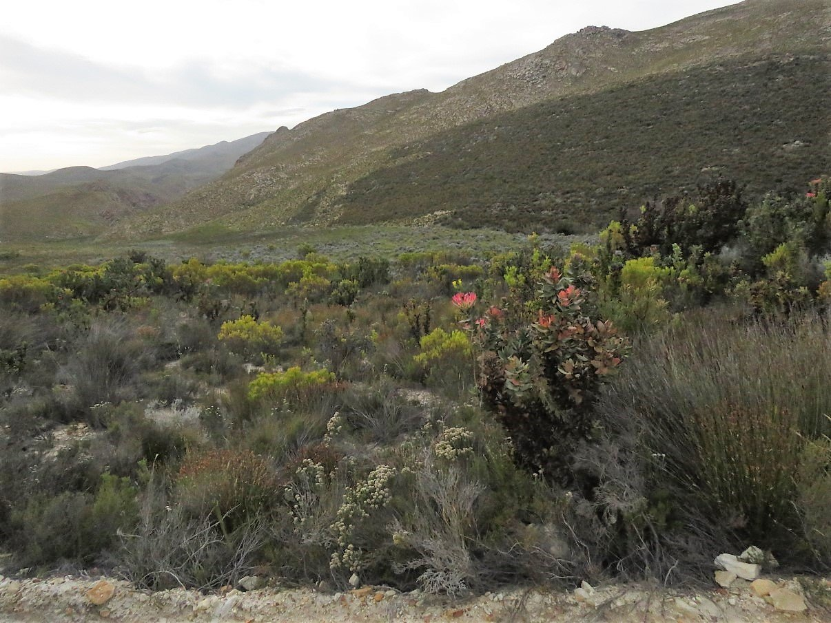
The first part was a fairly flat drive through fynbos and protea covered mountain slopes. We could see some parts where the charred remains of protea bore testimony to serious veld fires. After a while the landscape changed from (reasonably) flat to descending and ascending zig-zags over the mountains. Every time we had descended into a valley and crawled our way up to the highest point again, we could see the next zig-zag far, far away on the next mountain top. Mandela’s quote:” After climbing a great hill, one only finds that there are many more hills to climb.” seemed very appropriate.
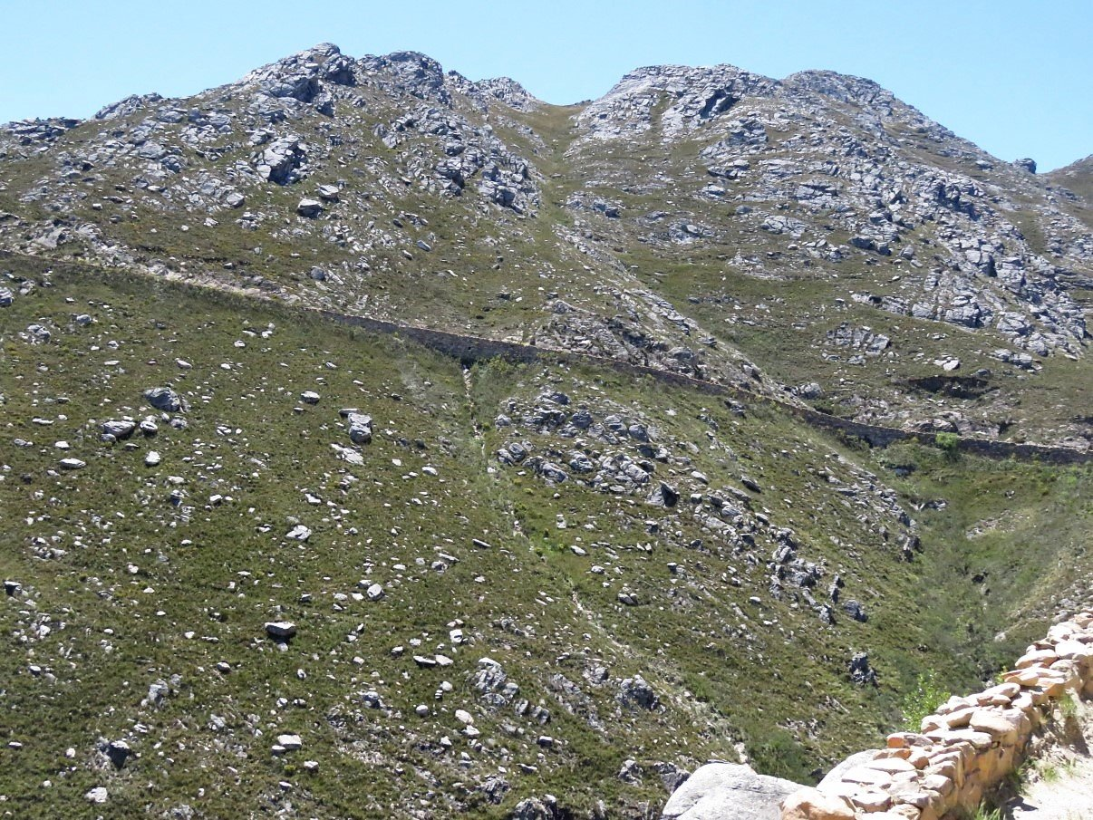
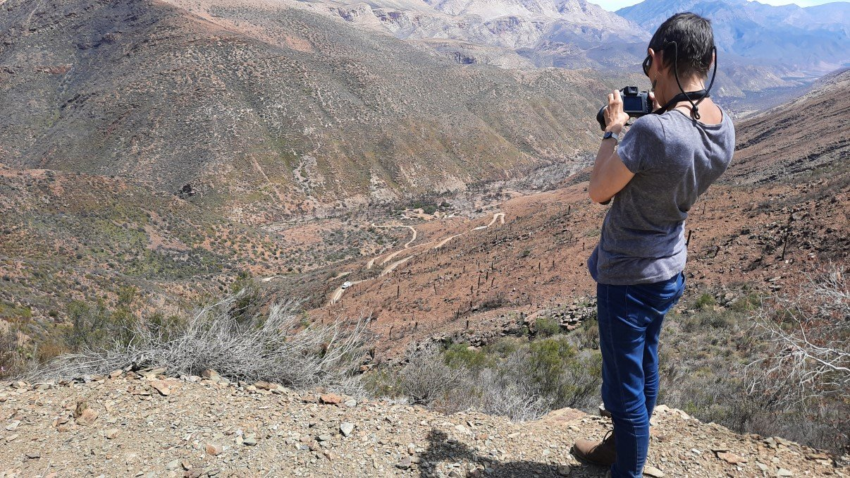
Once again, I was quite stressed with the succession of rugged rock walls and shoulders dropping away from the main track in gullies, steep ravines and hairy hairpin turns. And yes, I got out of the truck regularly when Stefaan had to negotiate these hairpins. I think that- in a way- it helps me when I actually watch the manoeuver. Inside the truck it is impossible to see the wheels and I get very tense when I imagine the wheels getting too close to the edge. If I’m out of Trokkie on solid ground, I can see how far he can go and even though there are still moments where I catch my breath at the tilt of the truck or the closeness of edge, at least I can see exactly where the wheels are.
As mentioned before: luckily Stefaan has way better skills for driving this truck on these narrow and winding roads in the mountains. He always tries to put me at ease (unsuccessfully if I may add) when I grip seat and door handle till my knuckles turn white, and of course it really doesn’t help when he points out crashed cars down the slopes. Not only because of the mere idea of slippery tumble down the mountain, but also… because he should be keeping his eyes on the road and not on crashed cars down below!
Although several SUV’s and motor bikes had passed us already, after about 15 km we saw a bigger vehicle behind us: Gavin and Lee had caught up with us.
Because we realized that there was literally no chance in hell that we would make it to Die Hel before darkness, we pulled over in a lay-by and called it a day.
We didn’t start too late the next day, as we didn’t know how slow or fast our progress would be. Gavin and Lee’s Moglet (an Iveco Daily 4×4) is a bit smaller than us with a different engine so they drive faster than us.
We repeated the same pattern from the previous day: slow up hill crawls, scary turns and steep drops, and me getting in and out of the truck as we progressed.
As Gavin and Lee were by then quite a bit ahead of us, they had covered the last steep zig-zag down into the Gamkaskloof valley, when we were still doing the other ascents and descents. They were rather safe than sorry on our behalf, and sent a message up with one of the bikers, to rather stay put on top: they would be coming back up. They felt that- our Trokkie being longer and wider than their Moglet- our descend might prove too challenging and dangerous on some of the hairpins.
So we followed the advice, parked Trokkie in an out of the way lay-by and walked towards the point where you can see this last serious zig-zag going down and the stretched out and burned Gamkaskloof valley between the mountains.
We could see Moglet parked down below and sent our own message down with another biker that passed us. It seems that messages got mixed up and our signaling was kinda weird. Although we did have 2-way radio’s we weren’t able to get the right channel. (After this exercise, we decided that, maybe, we need to have two flags on board and brush up on our semaphore skills :)
But eventually we saw them getting into their car again and start their drive up. About 20 minutes later they were back on top and listening to their report of the trip down, I could very well imagine how tricky it could have been. My sister had warned us too about Die Hel being a tricky path. And although we had been able to negotiate about 4/5 of the distance, this last descent eluded us. Maybe sometime in the future we might try it again.
(watch here footage of Die Hel courtesy of Mountain Passes of South Africa)
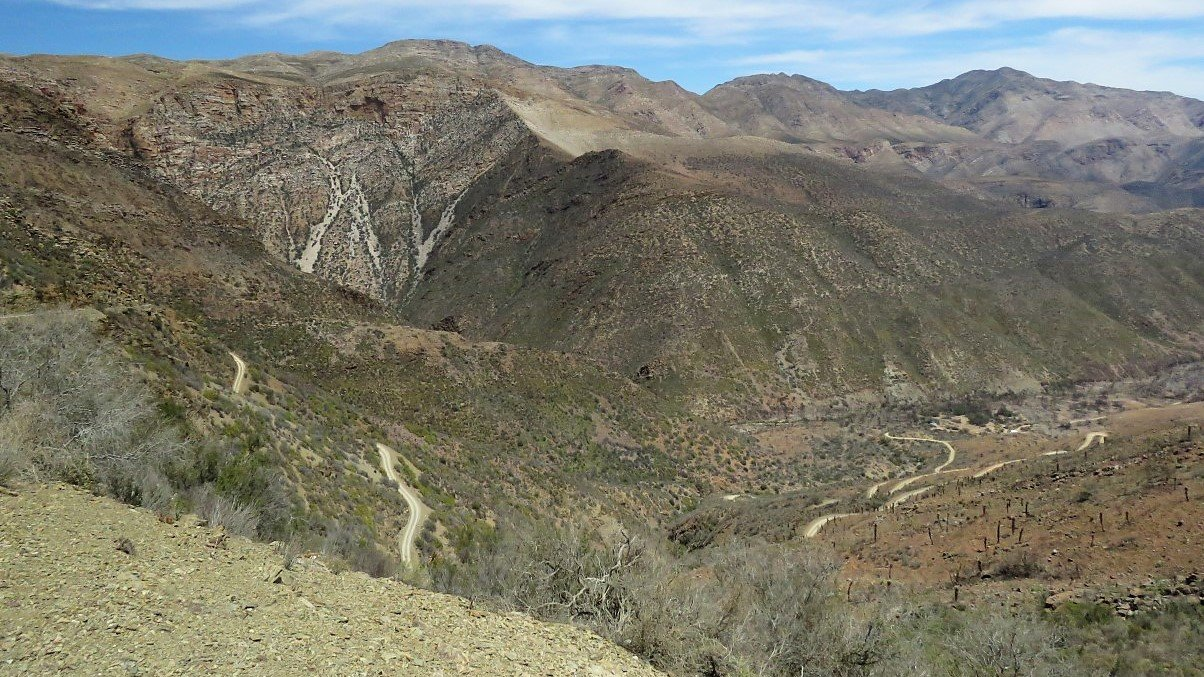
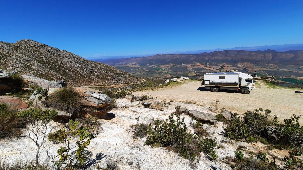
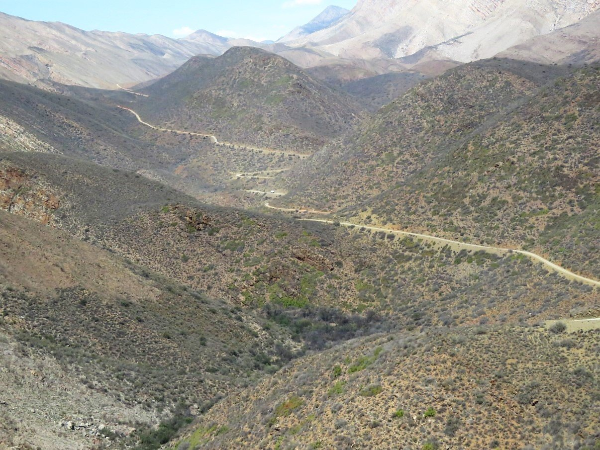
By then it was early afternoon and after a small bite to eat we continued our trip back out of the Gamkaskloof pass. Gavin and Lee went ahead and seeing they go a bit faster, not before long they were way ahead. Just to give you a sense of comparison regarding the magnitude, solitude, desolation and wildness of the mountains: Moglet is the tiny white spot in the centre. This was only one of the never ending ascents and descents covering this 48km road.
Gavin and Lee were quickly far ahead of us and on one of the small bridges they had pulled over to fill up their tanks with fresh water from the stream. As we’ve learned to fill up whenever a clean mountain stream is conveniently accessible, we did the same.
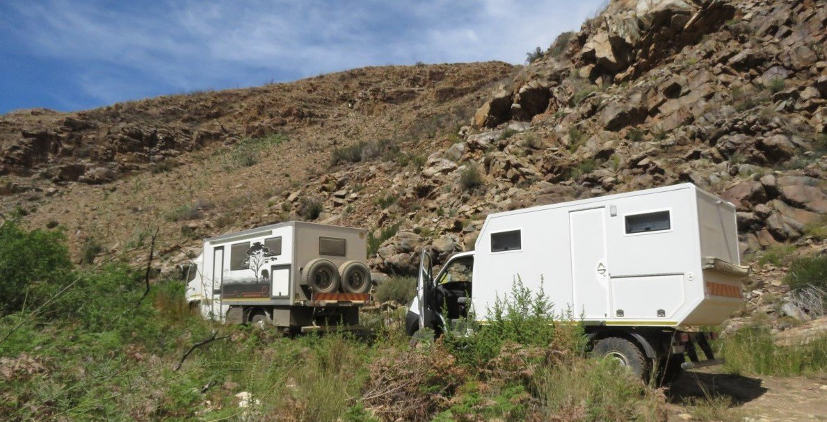
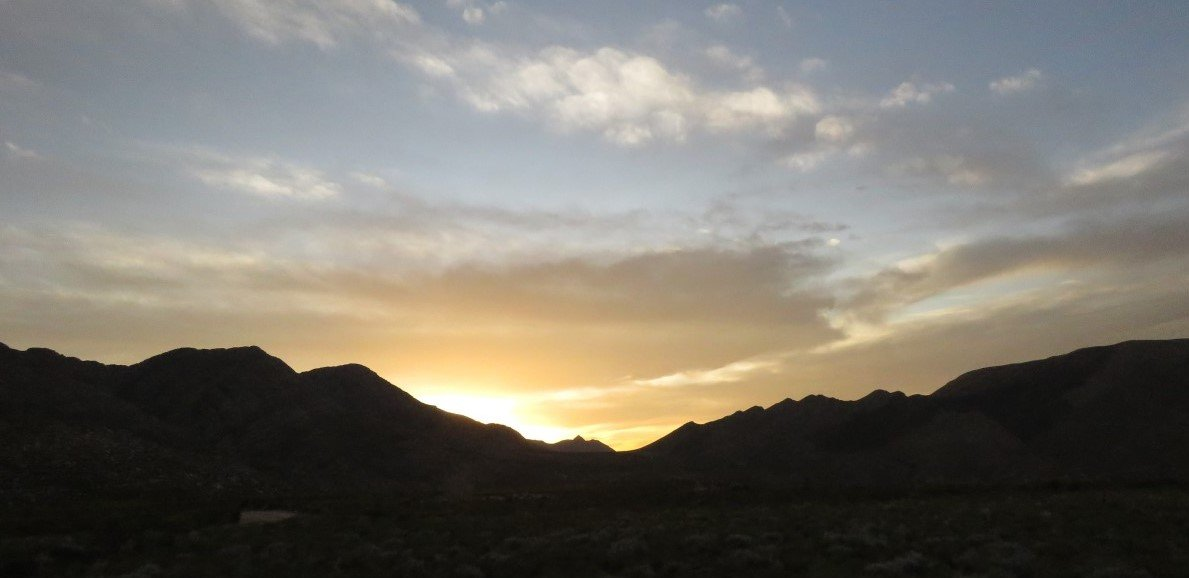
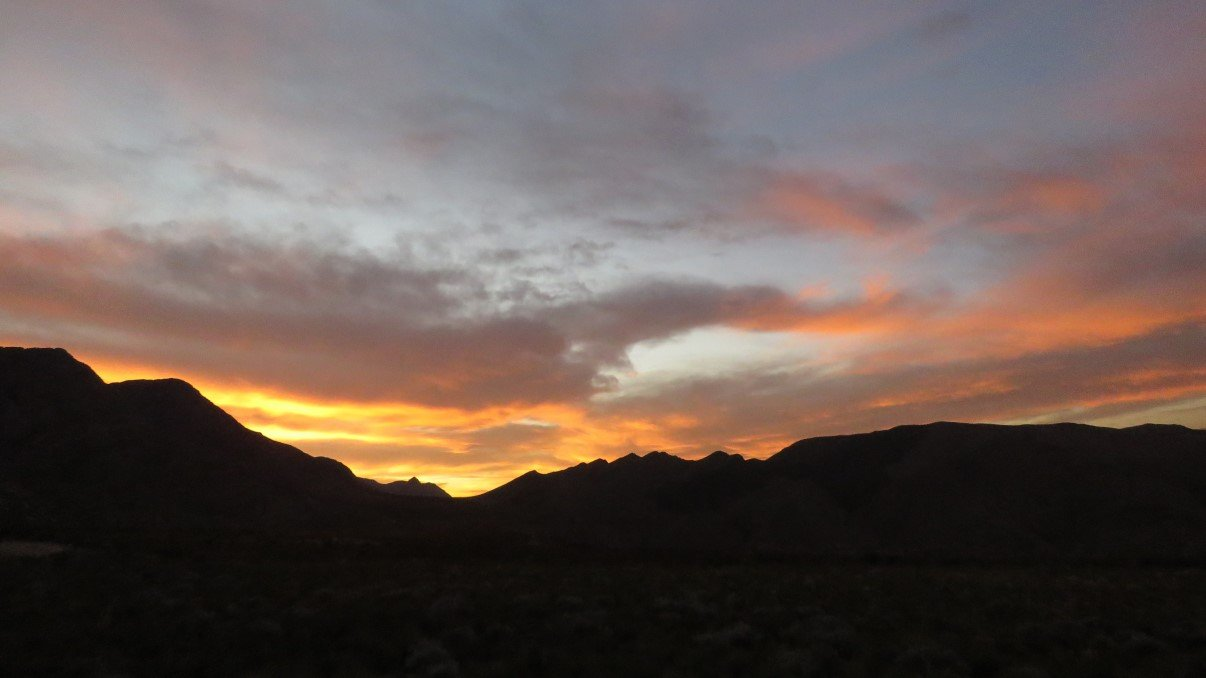
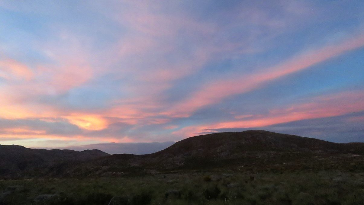
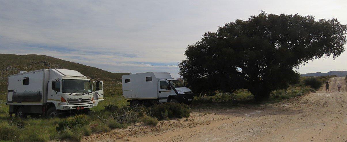
By then it was already afternoon and we decided to drive on till the first good overnight spot we could find… which we found under a big cork tree just before the end of the Gamkaskloof Pass. We shared cooking duties in both trucks while the sun went down in glorious shades of purple pink and orange. We enjoyed a good meal and a good bottle of wine together (of course) and called it a night.
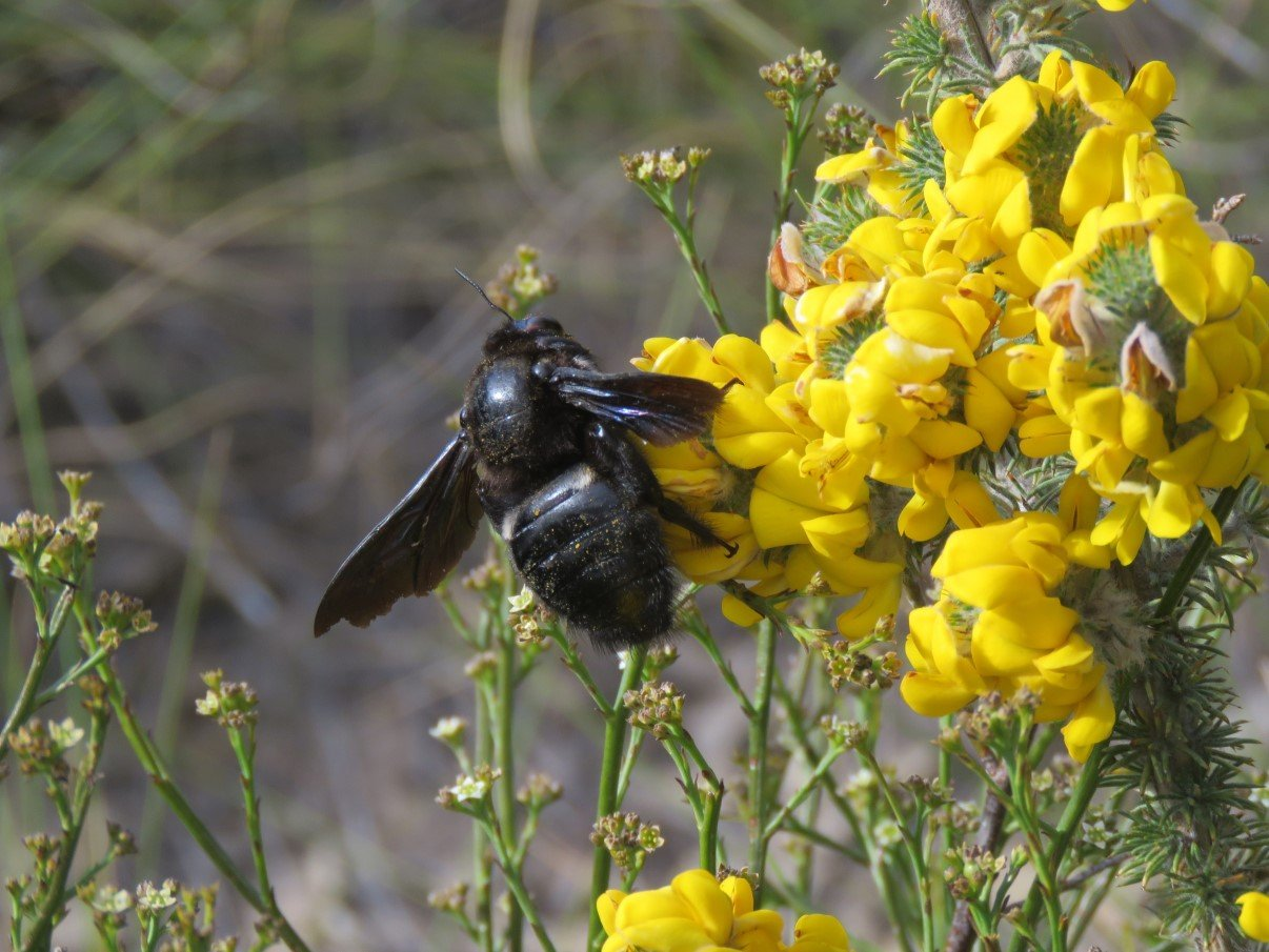
We woke up the the buzzing of bumble bees on the bright yellow flowers in the field.
After our morning coffee under the cork tree, we covered the last few meters of the Gamkaskloof Pass and turned left onto the Swartberg Pass, heading down towards Prince Albert.
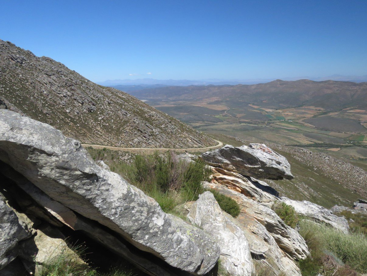
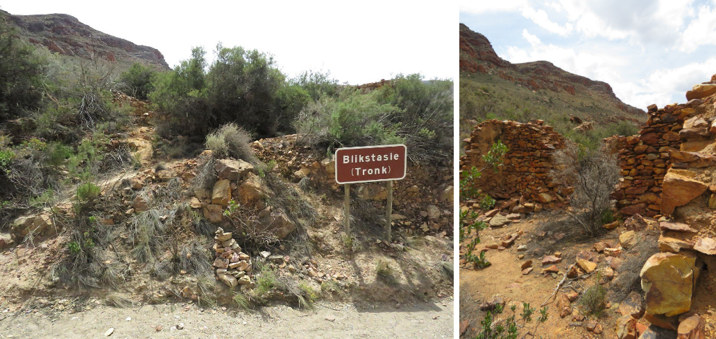
On one of the lookout points we could see an old ruin far below (left bottom of photo below) and we were speculating if it might have been a toll house (as many of the passes have old toll houses). When we stopped there for a lunch break on our way down, we saw it actually had been a prison. It kinda makes sense seeing that many passes in South Africa have been built by prisoners. While having lunch, we were quite amazed how busy this pass was, with bikers and 4×4’s passing every few minutes.
The descending pass eventually changed to an almost flat road that hugged the river flowing in the gorge and after a brief stop we continued to Prince Albert.
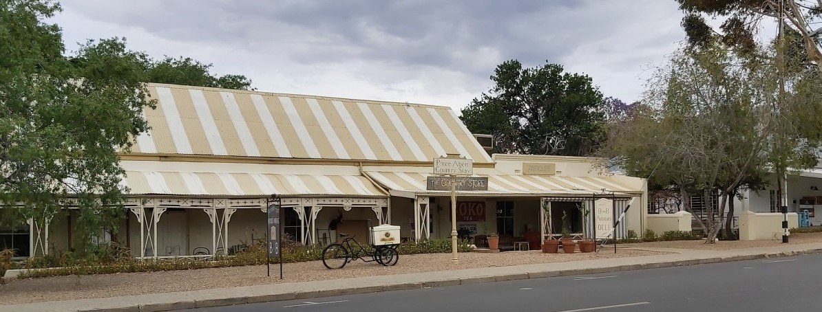
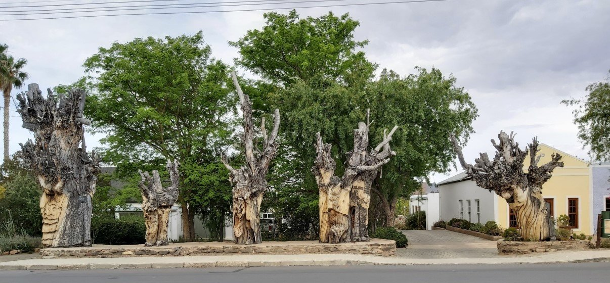
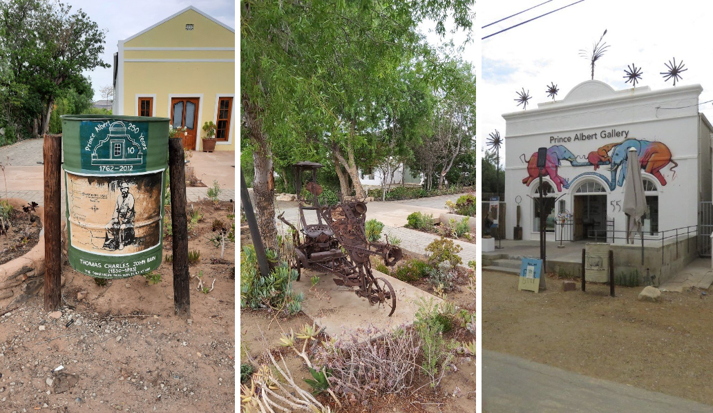
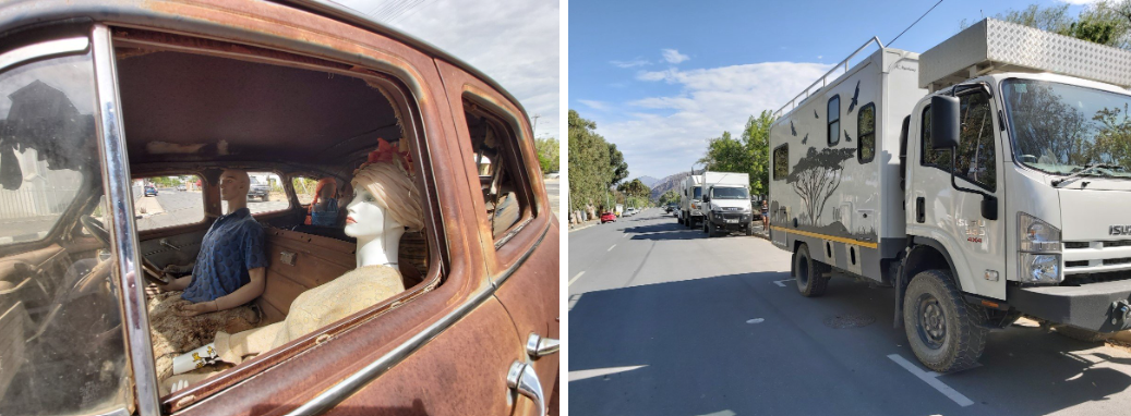
We sauntered up and down the main street, stopping every so often to look at quirky houses, artwork, trees and more and eventually had beer and gin on one of the terraces. We saw another 4×4 expedition vehicle passing in the street and saw him parking just up the street, right in front of our trucks. We couldn’t pass up the opportunity to chat to a like minded person. It seems thorn trees and elephants are a popular decorating subject for vehicles traveling in Africa :)
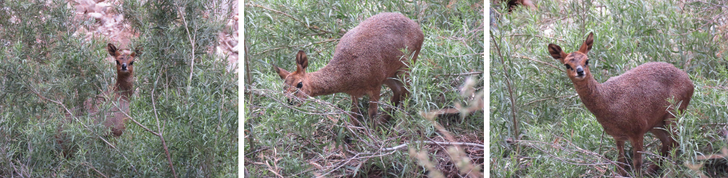
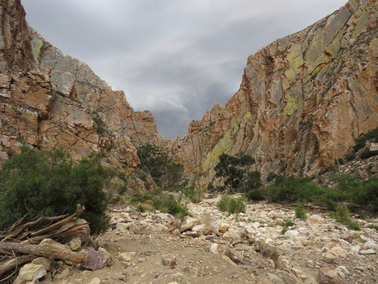
While enjoying our beer and gin, we discussed that one particular spot close to the end of the Swartberg Pass could be a nice spot for a day or two of R&R and that’s exactly what we did. We drove back into the pass, following the riverbed and spotting an elusive duikertjie hiding in the under brush.
When we got there and set up for the night and started supper, the heavens opened: thunder and lighting and a serious downpour, that made the river swell quite quickly.
But by the next morning, when it had stopped raining, it was quite amazing how fast the water levels had dropped again to what we had seen it the previous day, before the deluge.
As said… a day of R&R was on the books and we spent time washing, cleaning, working on the website and more. Some daily grind things need to be done every so often! The weather was kinda wishy washy with the sky remaining overcast and spitting out some rain once in a while. Our braai plans rained out eventually!
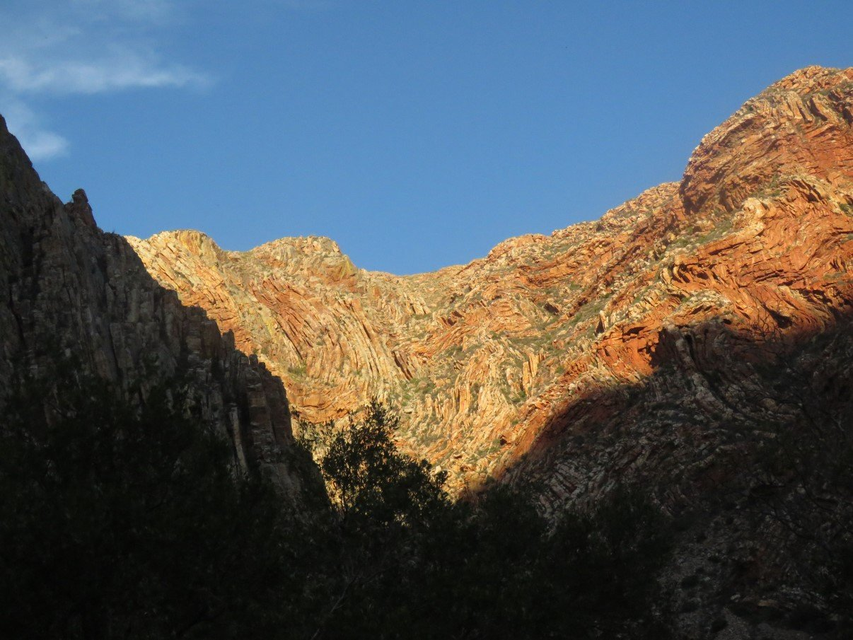
Next morning however, the weather had totally cleared and the sun coloured the rockface a brilliant orange against the bright blue sky.
After a breakfast of wholesome oats and some leisure time spent looking at the eagles soaring in the sky and the cliffs way up high, we cleaned up, packed up and headed out of the Pass.
There we split ways: we went back to Cape Town and Gavin and Lee went to Port Elizabeth. One day we’ll make another trip together!
For more photos, clips and videos follow us on


Swartberg Pass and Die Hel