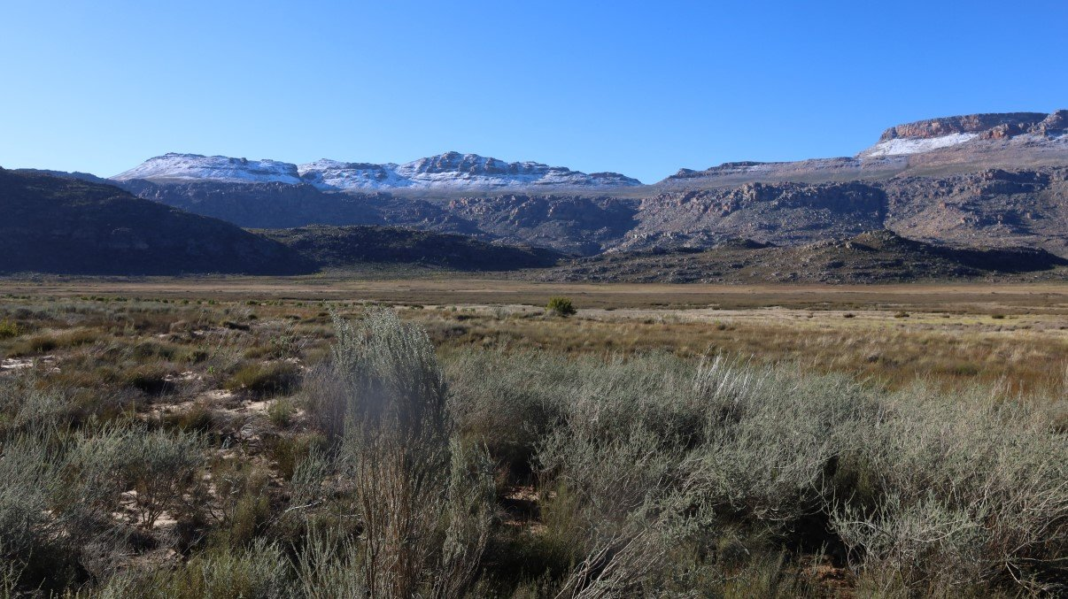
After our few days of R&R at St Helena Bay, we headed for the mountains. As we came closer to the Cederberg mountain range, part of the greater Cape Floral World Heritage Site, we could see snow on the top of certain mountains and got excited like little kids. Although we grew up in Europe and know proper snow, we’ve seen very little snow in our almost 40 years in South Africa and have as such adopted the South African way: every little bit of snow is exciting!
We filled up with diesel in Piketberg and at the spur of the moment decided to buy roosterkoek for lunch at the Winkelshoek Padstal. It was our lucky day, because the staff was testing out a new coffee machine and they offered us a free coffee. And of course, we never say no to a good- and free- cup of coffee!
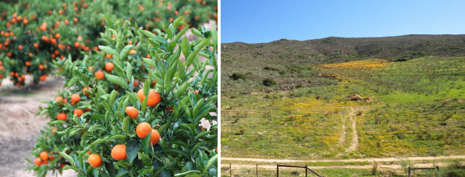
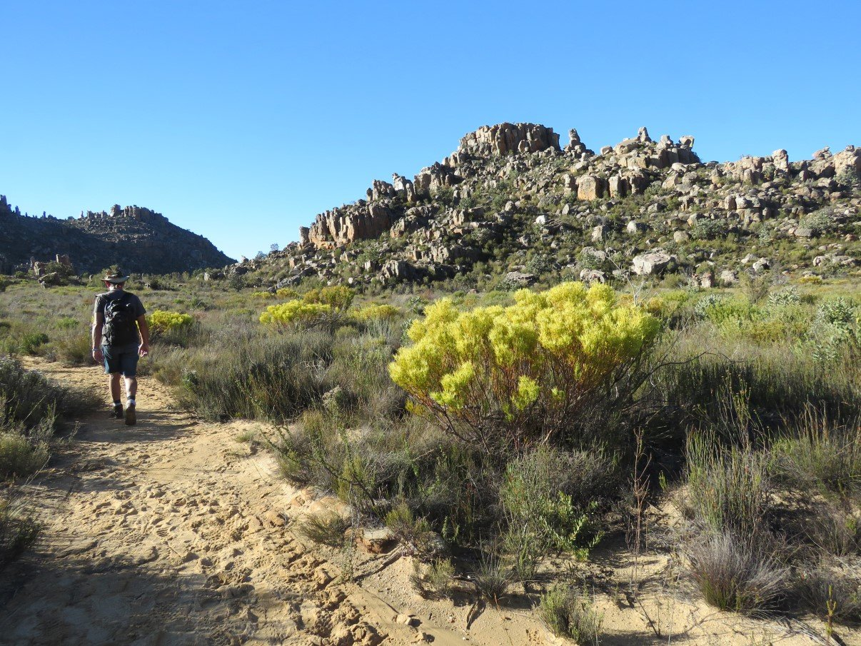
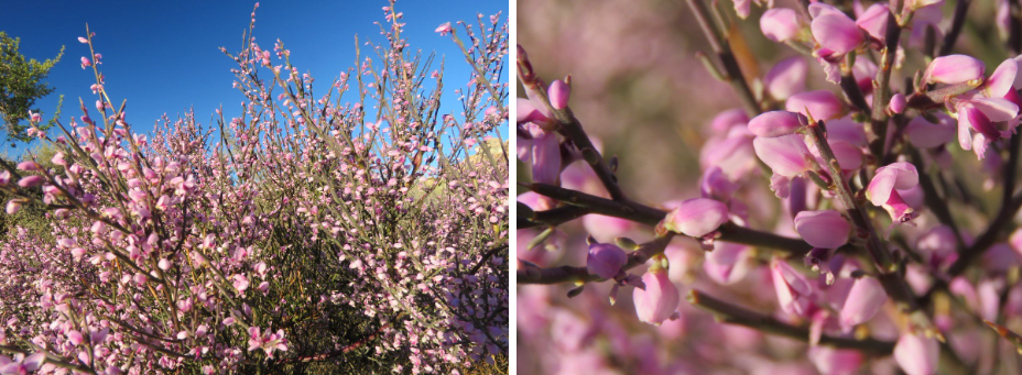
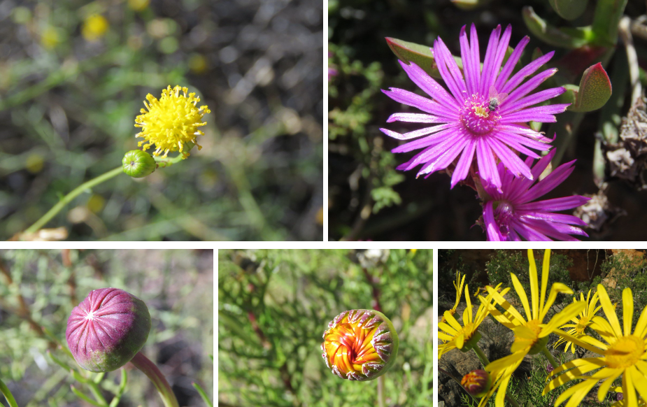
From Piketberg we continued into the direction of Clanwilliam, passing groves of summery Christmas trees: little green naartjie trees decked with heaps of bright orange baubles! Bypassing Citrusdal we kept the Olifants River on our right and- about 30km before reaching Clanwilliam- when we turned right towards Algeria, we saw the first dazzling patches of yellow flowers, like we had seen them on last year’s trip in Namaqualand.
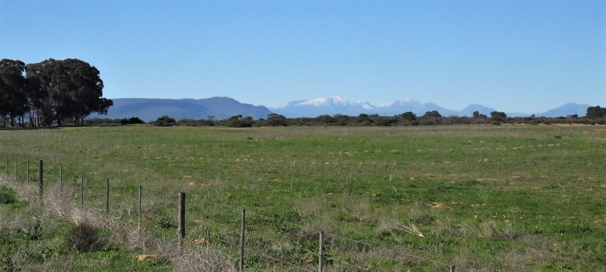
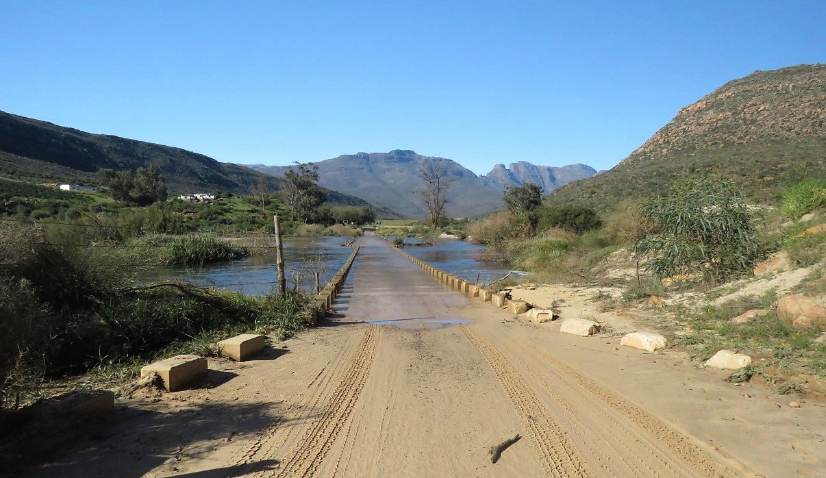
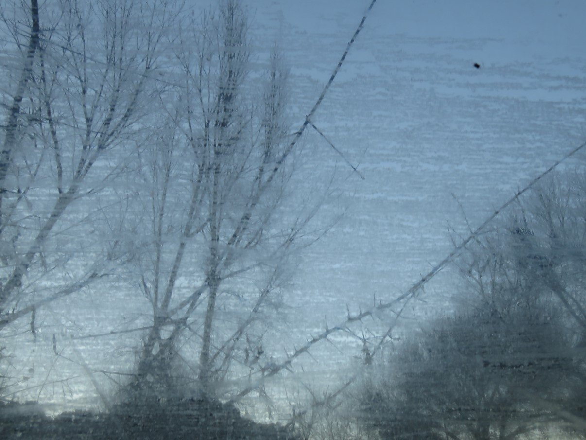
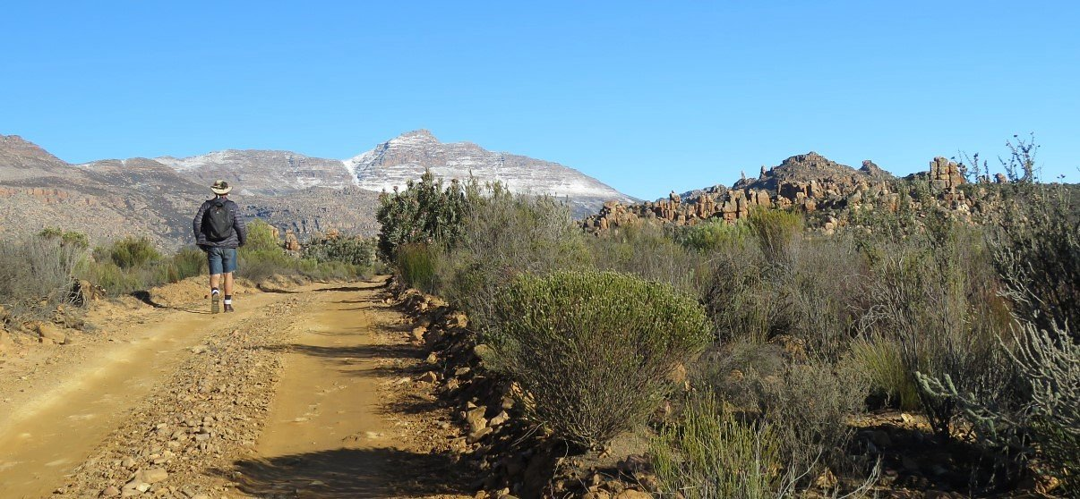
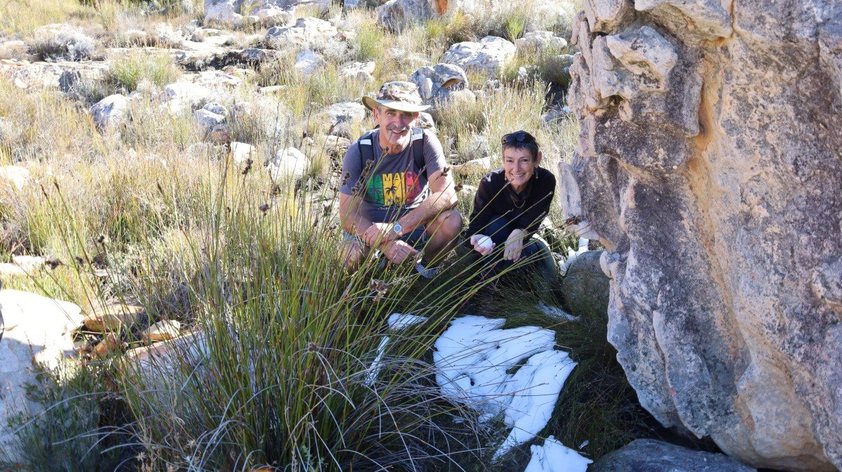
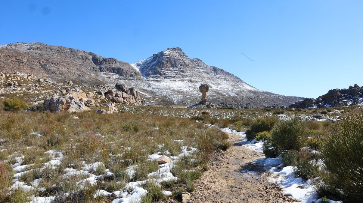
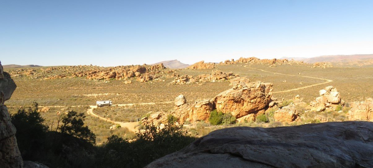
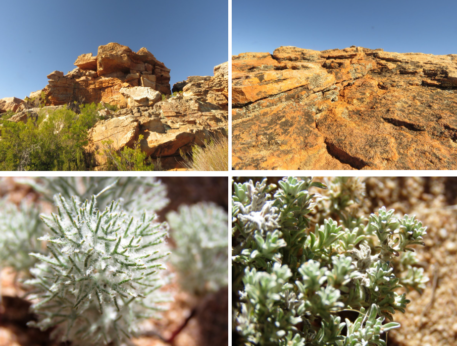
Then we were on the gravel road leading to Algeria, where we had to get our permits for the various hikes we wanted to do. When we crossed the Olifants River, we could see that the valley must have had good rains recently because the water flowed over the bridge. The roads in the valley are pretty good maintained with paved sections leading to and from Algeria and good gravel roads further down the valley. We traveled over a pass or two, got right there where the snow was and stopped a few times to take photos of the snow on the mountains.
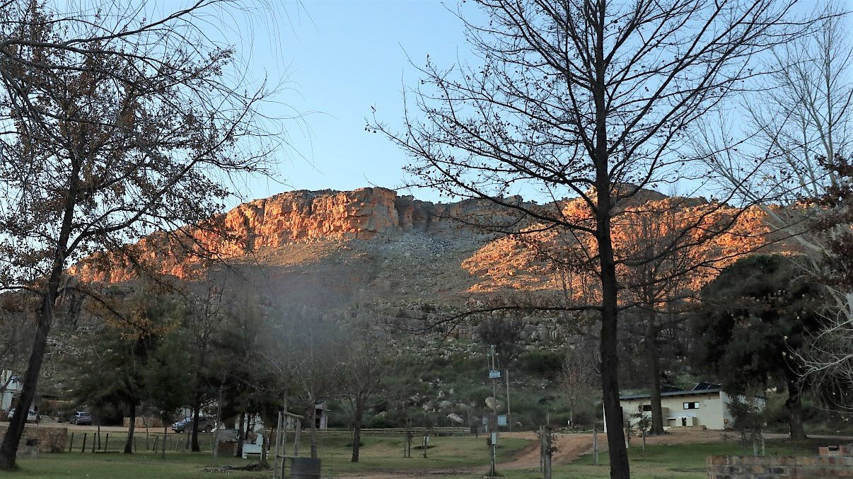
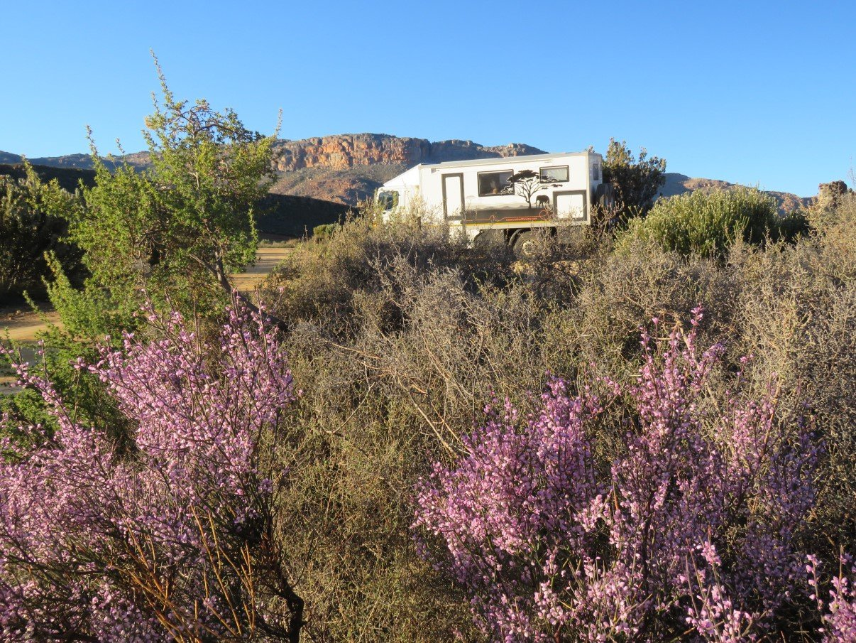
We got our second permit and camp booking at the Dwarsrivier office at the Cederberg winery. We camped at the Sanddrif camp site with views of the Wolfberg Cracks (the hike we did with Lut and Gerhard the year before) and prepped for the hike to Maltese Cross the following day.
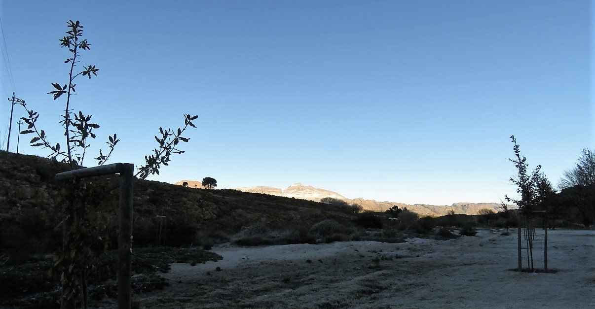
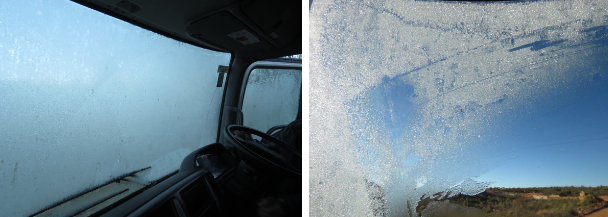
We got up to a freezing morning and, looking at the sprinkling of crispy little tents around us, were eternally grateful to have our warm house-on-wheels to sleep in. We had to defrost windscreen, windows and mirror before getting underway but soon enough we left and parked a few minutes later at the Dwarsrivier Observatory.
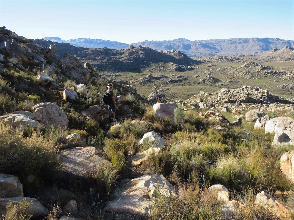
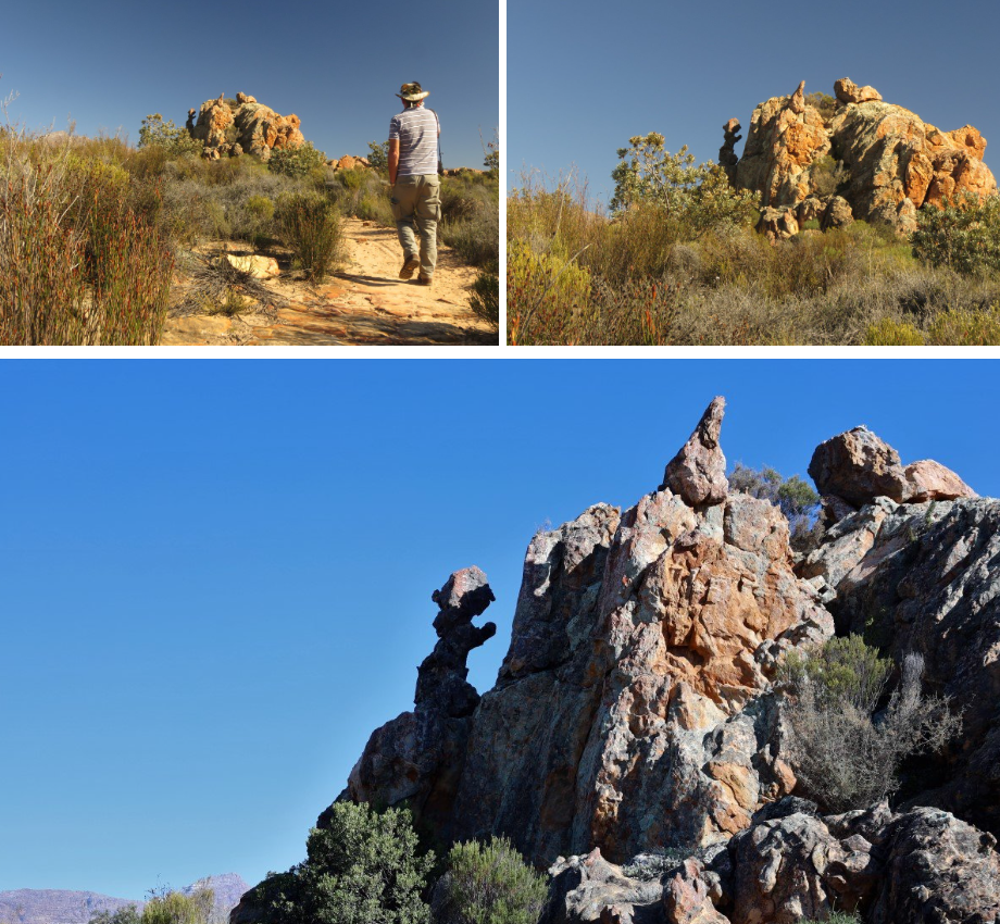
There was a locked gate, so we parked and started walking. While walking this road we commented that this kinda looked like a proper vehicular road and true as bob… a few cars passed us. We initially thought that they might have been local farmers. Till we arrived at the far end parking lot and realised that the portion of the road we had walked for the past 1hour and 50 minutes was not really the hike to the Cross, but just the entry road into the reserve. Later on the hike we met people who said that we were supposed the have gotten a code to unlock the gate and DRIVE all the way to the parking. (when we got back at the end of the day we checked the form and indeed saw the code of the lock – another lesson learned: READ all forms!). Eventually this oversight turned our hike from a 6km to a 16km hike! Good exercise!
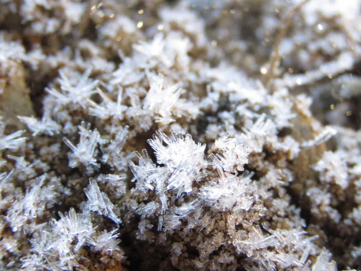
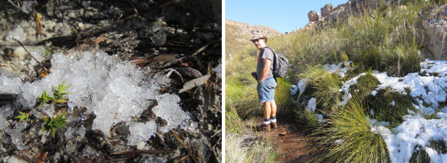
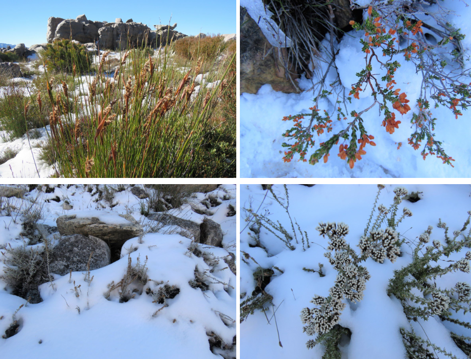
We started fairly early in the morning and patches of soil were crisp with crystals like little stars frozen in time.
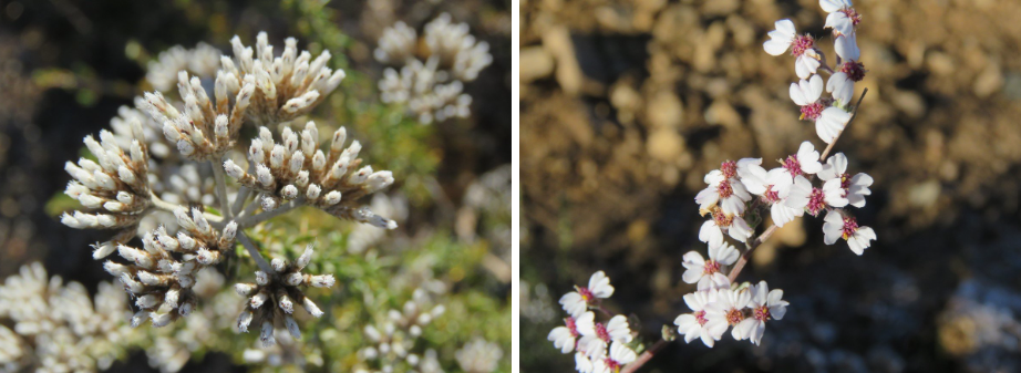
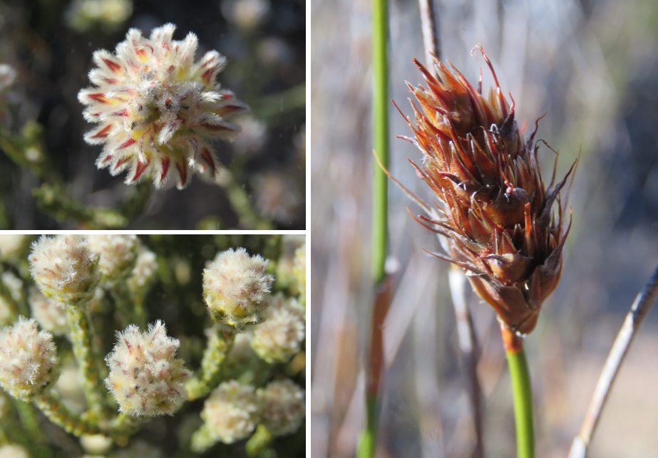
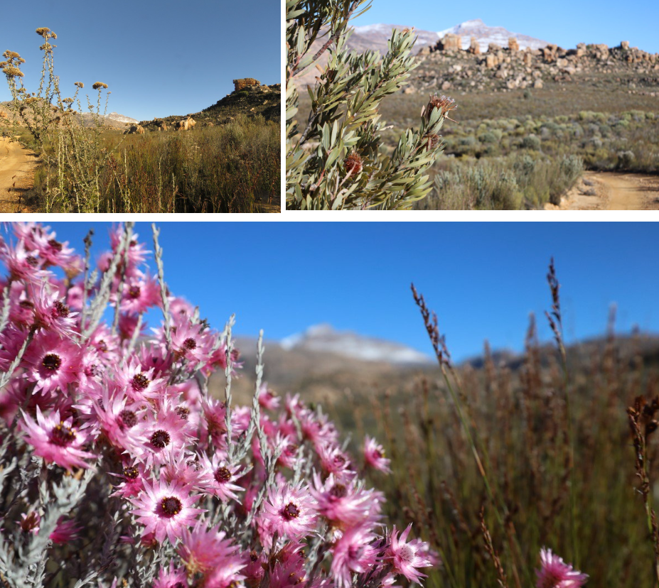
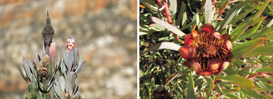
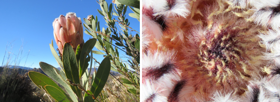
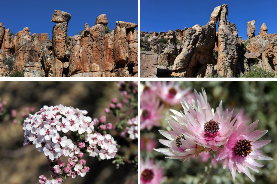
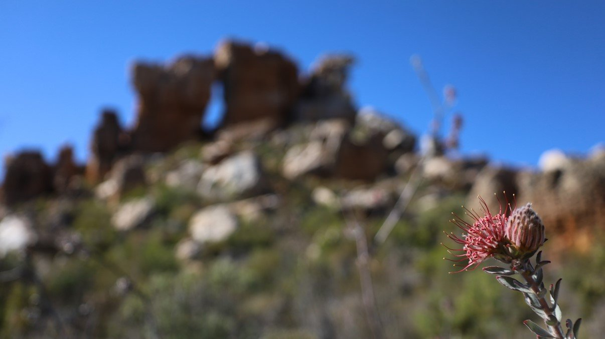
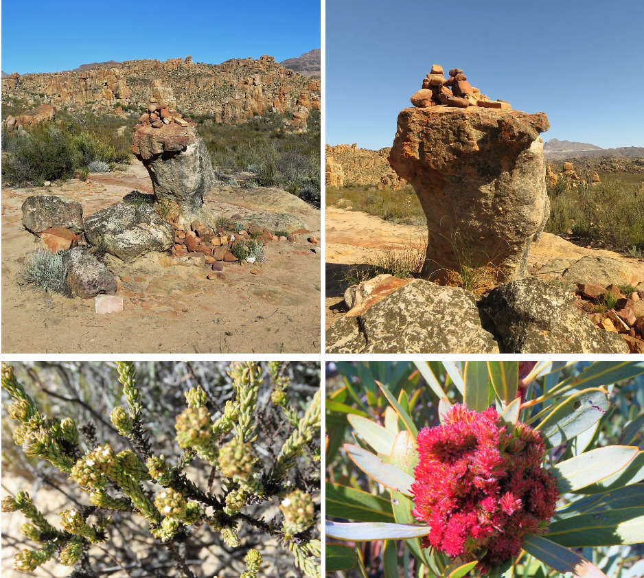
This is fynbos world and the fields were decked with a plethora of grasses and proteas, erica’s and other fynbos vegetation.
It was a brilliant day and the walk was beautiful! Utterly quiet and peaceful! Two parties had started the walk before us and we could see one of them halfway up the mountain. When we had crossed the valley and started on the uphill, we heard other voices and soon enough we were overtaken by two families with young children.
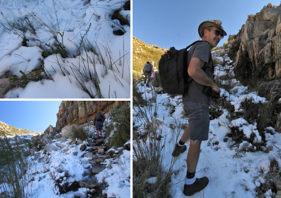
We were as excited as the young children when we hit the section where the snow had still remained. We took photos of the smallest patches of snow as we’ve learned the hard way: you take photos (or buy souvenirs for that matter) when you see it because sometimes things happen and you don’t come back the same route or see the same item. So yes, we took photos of small snow patches dotted along the path.
The higher we got however the more muddy the path became (little streams of melting snow flowing over the path). The path curved around the mountain and all of a sudden the snow and ice were abundant and treacherous. That part of the mountain obviously didn’t get as much sun and the snow hadn’t disappeared to the same degree. That section turned out to be a more tricky boulder and rock path to negotiate with the added difficulty of snow covering the visible path and ice making some spots extremely slippery.
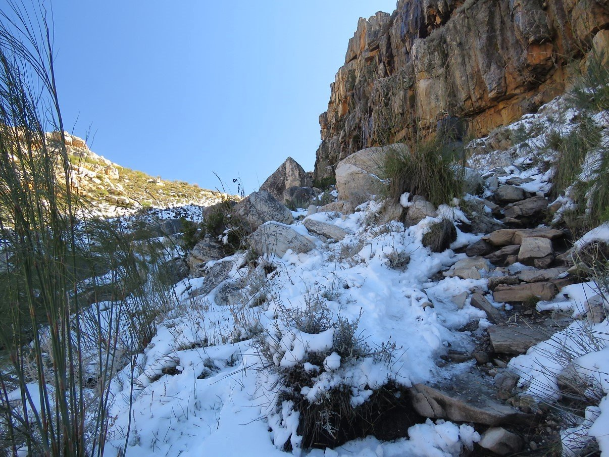
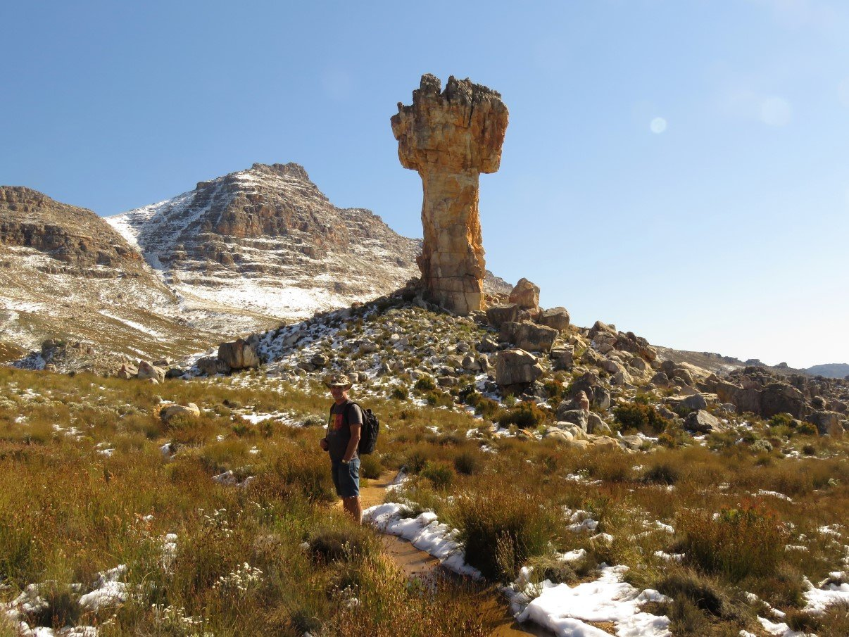
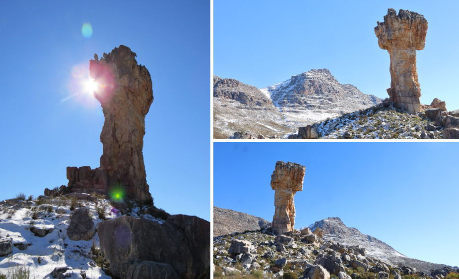
But we made it to the top! And the Maltese Cross was just magnificent in its imposing grandeur standing solitary, etched out against the snow decked slopes of Sneeuberg. We took a mini lunch break, walked around and headed back down the mountain again.

As we had realised that we had parked about 5km away from the actual parking area at the start of the hiking trail, we knew that we had to add another hour to our walk when we would reach the bottom of the mountain. Luckily the walk down went much easier and we made good time. We passed the second party that had preceded us, reached the parking lot and started our walk back to the observatory. Hitting the last quarter of that road, they passed us and offered a lift. It seemed they were respectively 70 and 73 years old and proud to have done the hike but admitted that the extra 5km we were walking would have been too much! Kudos to them in any case. Hopefully we can still do these kind of hikes at that age!
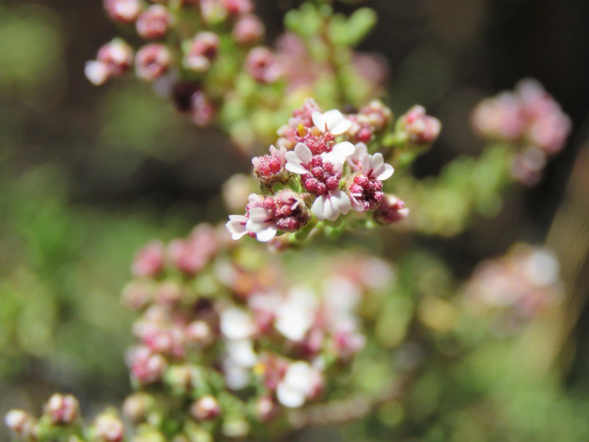
The last family on the mountain passed us a while later so now we were the last ones to leave the trail. We eventually reached Trokkie where we had left her on the Observatory parking, framed by pretty purple Erica bushes, our daughter’s namesake. We got in and drove back to Sanddrif.
At the campsite, Stefaan got chatting with fellow camper Jaco and his family about the truck, while I started to sort out the cameras to recharge the batteries. Stefaan had emptied the backpack on the bed when we had arrived at the Observatory parking area and I was now looking for his camera between the stuff… and couldn’t find it. When he climbed into the truck after Jaco and his family had walked back to their chalet, I asked him where he had put the camera. Long story short: within minutes we realised that he must have lost the camera on the mountain. My ears tingled a bit with his vocabulary that expressed his utter frustration! He was so angry with himself. On the slippery ice slope he had put the camera in the backpack out of fear of slipping and banging it against the rocks. Somewhere along the way, the zip must have slipped open and the camera must have fallen out. (To today, we can still not figure out how it could have fallen out without us noticing it – unbelievable!)
He ran over to Jaco and asked him pretty, pretty, pretty please, if he would mind driving him back onto the trail to the far parking area to see if we might have lost the camera along that part of the road. Unfortunately… no luck.
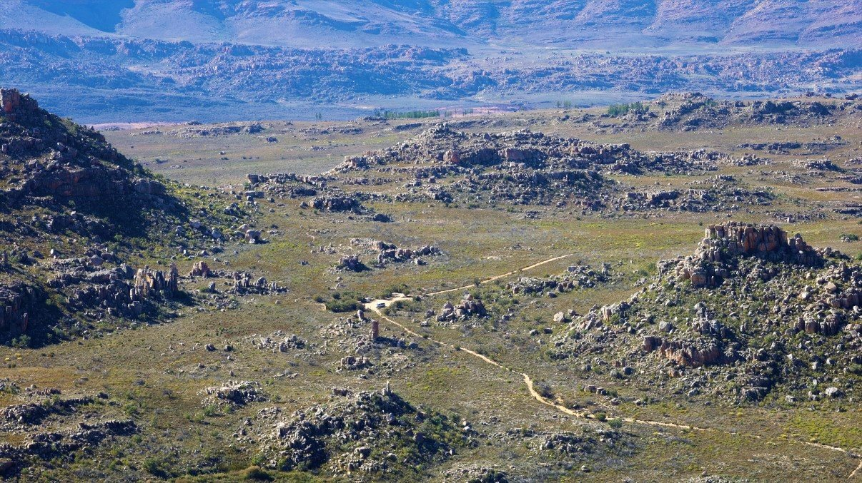
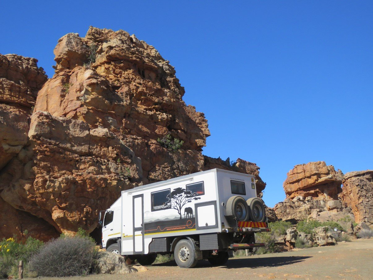
He spent quite an uncomfortable, frustrating and sleepless night and by first light the next morning we drove back to the trail (opening the gate and driving to the far parking area this time around which saved us an hour or so). He decided to do the climb alone as I would only hold him back, so I held the fort in Trokkie. Cleaning up in a closed truck, I missed two parties who went up shortly after him, but I opened the doors in time to see a third party getting ready for the hike. I explained why I was there while my husband was on the mountain looking for a camera and they promised to be on the lookout too. Photo below was taken when Stefaan came down the mountain of the Maltese Cross hike trail, when he went looking for the camera. We think Trokkie is pretty big, but she gets totally lost in this rugged landscape.
After a surprising two hours Stefaan got back and because it felt like so quick (when I walked with him the walk had taken about 3hrs up and another 2hrs down) I was sure he had found the camera. Unfortunately not. He was very despondent, frustrated and angry with himself. We ran a whole heap of scenarios of what could have happened, could someone have found it, what would someone do if they found it etc, etc. The most logical thing seemed to go ask at the Dwarsfontein office, where everyone gets their hiking permit, and see if someone brought in a camera. But no. No luck… nobody had brought anything in. We left contact details, but were quite convinced this would be the last we would hear about it.
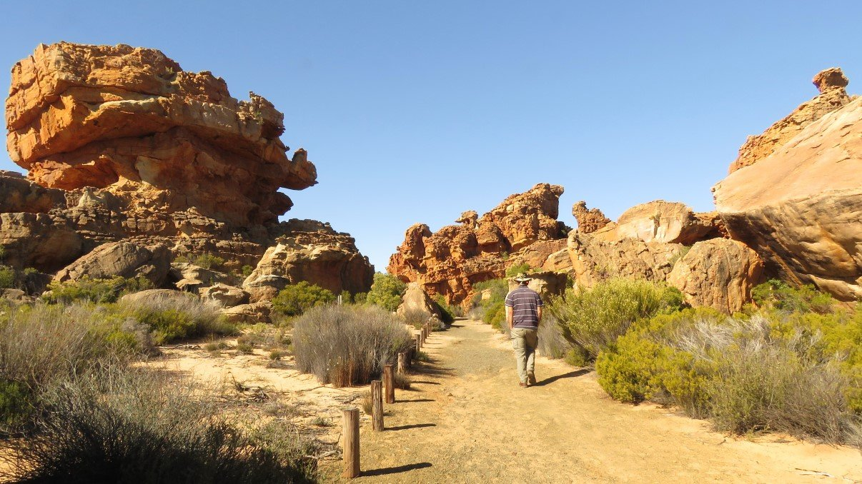
As it was early afternoon, we drove a few kilometers down the road to visit the Rock Art site and the Stadsaal caves. Just at the entrance we met up with one of the families we had met on the Maltese Cross hike and when they heard we had lost a camera they felt very sorry, because they unfortunately had not seen anything on their way down.
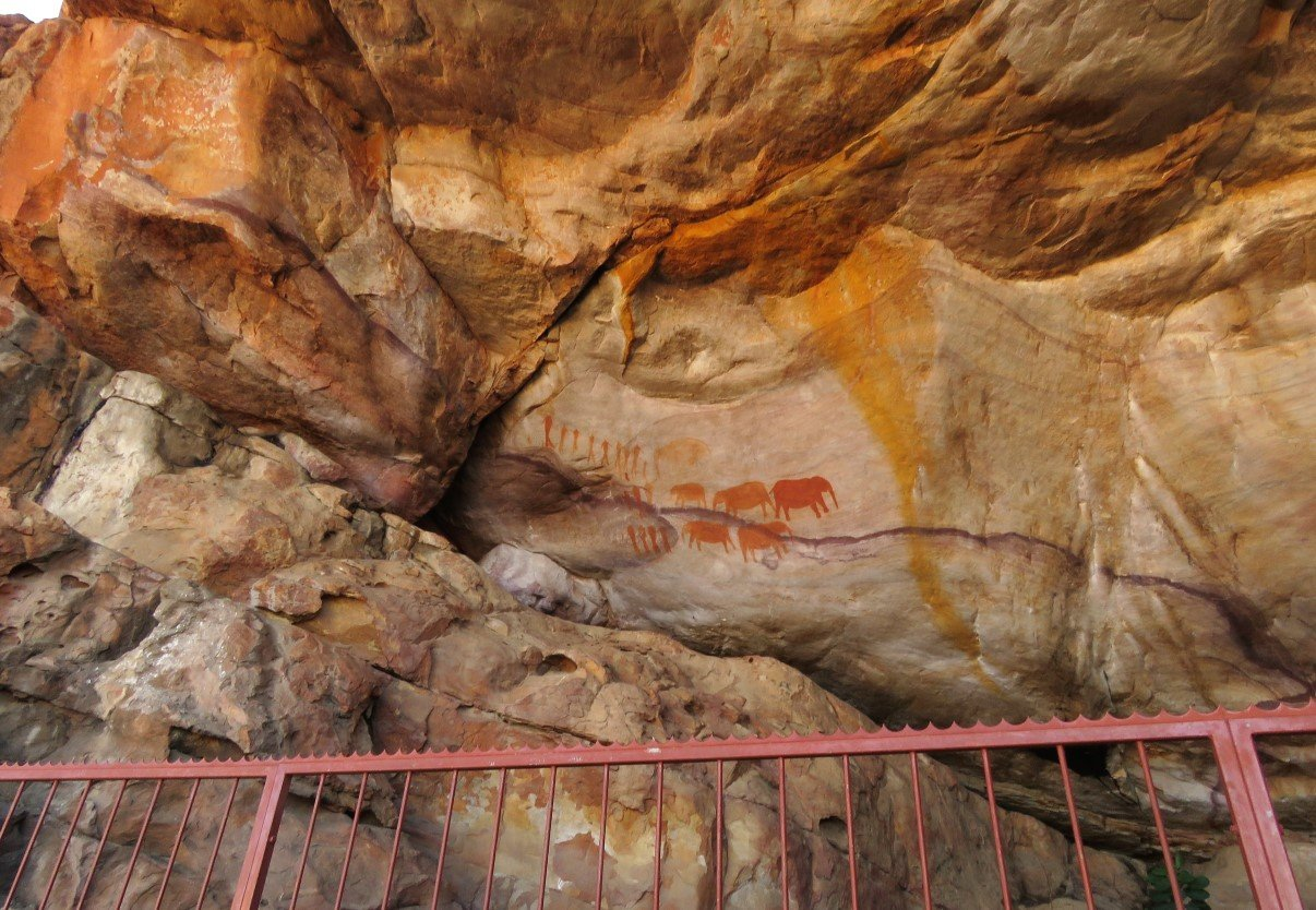
We parked at the Rock Art site which is nice, but very small: only the one painting with elephants and people. There seem to be a handful of other rock paintings in the vicinity, but it doesn’t seem clear where exactly they are. Maybe it’s something one can do with a local guide, who knows the different sites and locations.
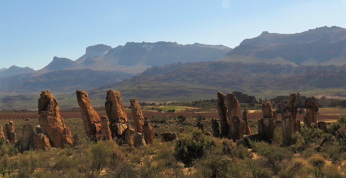
From the rock art site we had views over the road leading to the Stadsaal Caves. Trokkie looks quite dwarfed in the rocky landscape.
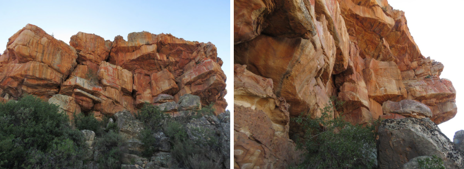
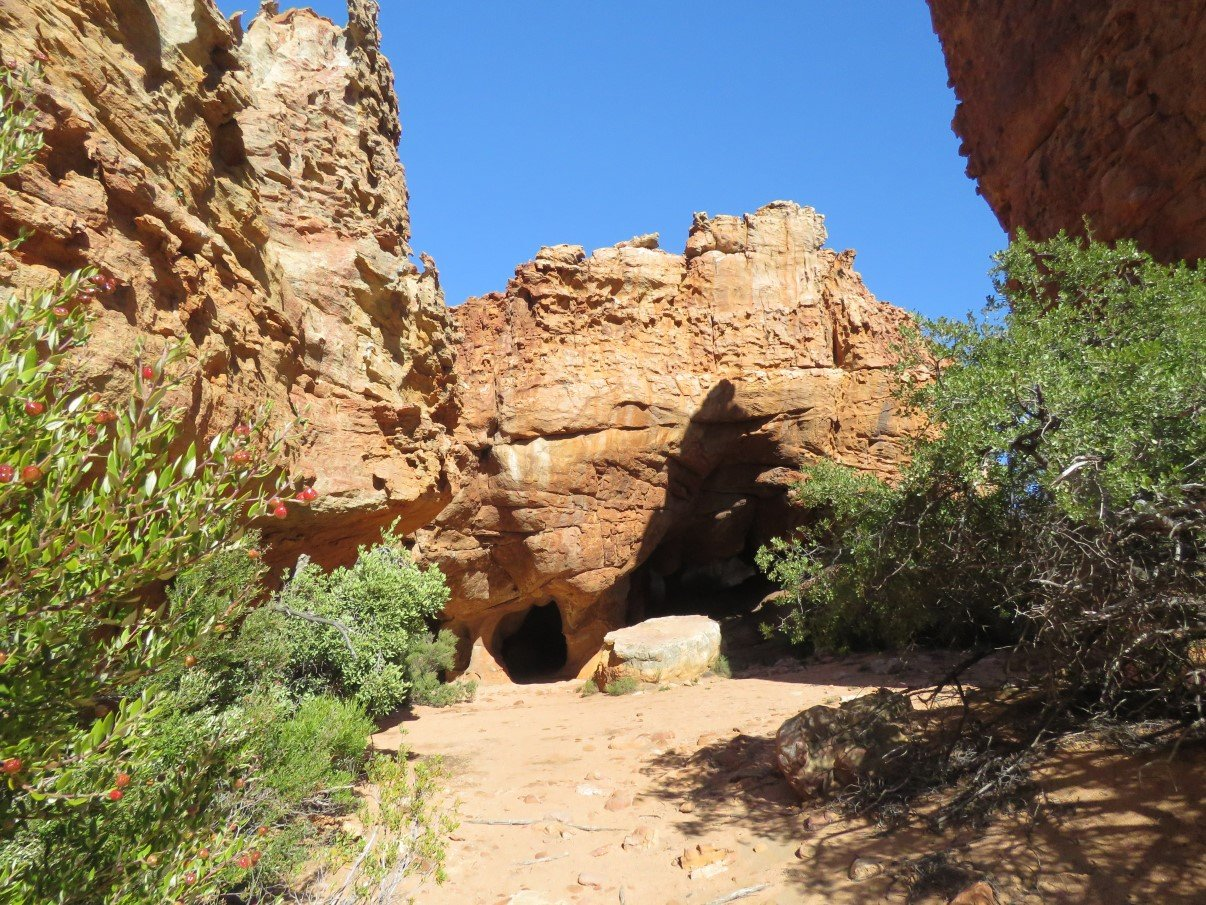
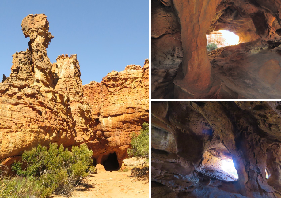
We continued to the Stadsaal caves, just a bit further up the road and had a nice walk around. We were, yet again, amazed at how the forces of nature have carved these rock formations into the most fascinating shapes. Various formations looked as if they could collapse at any moment!
As we had parked a young couple had greeted us and were very curious to see Trokkie inside. And we’re always happy to show! They in turn showed us a booklet which seemed to indicate that there were more cave paintings in this area, than the one we had seen just now. When they left and we walked around, we tried to figure out where more rock art could be but couldn’t find anything. We figured that perhaps you could go look for them if you would have a guide.
After our walk we decided to have a cup of coffee… we’re in no rush to get from A to B. Just as we had finished our cup of coffee, a familiar car parked and we met up with Jaco and his family again. Stefaan promised to wait around (with another cup of coffee of course) so that dad Jaco and the two boys could hitch a ride in the truck, back to the campsite. The boys just loved it!
When we arrived back in camp, Stefaan started a fire and we had a glass of wine… to drown our lost-camera-sorrows! And while the braai was cooking we made nice winter butternut soup inside the truck. Supper done and dusted we closed up to keep the cold outside.
With all the frustration, we decided to call it an early night and just as we were preparing, there was a knock on the door: it was the third group that hiked that morning and with whom I had had a short chat in the parking lot. The dad had his two hands behind his back, smiled and said: pick a hand. I obviously picked the wrong hand because he showed an empty hand. But then he probably didn’t want to keep us in unnecessary suspense and brought his other hand forward and lo and behold… there was our camera! I was ecstatic and Stefaan nearly jumped out of his skin of pure relief!
Stefaan had met them on the mountain that morning and they had chatted about the lost camera. Talking now about the when, where and how, it seemed that they eventually found the camera, on their way back down, only a few meters from where they had met Stefaan that morning. These people were our saving angels that day! A gazillion thanks to Barend. Louise and Andre! We shared a good glass of wine to say thank you and slept a peaceful and dreamless night.
The following day was Sunday and our last visit in the valley was the Lot’s Wife rock formation, which is just about 200meters from the road. Although Lot’s wife is close to the road, there are hiking and mountain bike trails further in and we went for a walk.
At one stage Stefaan must have stepped of the path for taking photos and I must have passed him without him hearing me and me not noticing him. Result: at a certain moment I realised I didn’t see him no more and started walking faster, but was not able to catch up. I got a bit nervous as I could not imagine me being that far behind. And I walked even faster. No Stefaan to be seen. I yelled a few times with the echo’s answering me, but no Stefaan.
At a certain point I wasn’t sure what to do now: continue further, risking he’s behind me and he returns when he can’t find me and is waiting for me at the truck or turn back, risking he is indeed before me and will return when I eventually don’t reach him. In the end I opted for option 2: turn back. I hadn’t walked 5 meters when he popped up out of the blue. Relief and anxiety flooded through me and we played the different scenarios where we might have missed each other. My main concern was that he hadn’t heard me yelling. We need whistles!!!
Paths in the Cederberg are marked with little piles of rock. On the hiking trail beyond Lot’s Wife we passed a big pile of rock and it seems that all passersby add their little contribution. So did we: we are the top rock on the right!
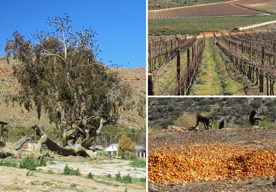
We walked back to Trokkie, had a small photo-op with a Caterpillar bulldozer to “test” the recently installed winch and had lunch, before making our way back out of the valley to Cape Town, via vineyards acting as horse paddocks, trees decorated with flocks of birds and baboons having an citrus party along the road.
Enjoy the video.
For more photos, clips and videos follow us on


Cederberg